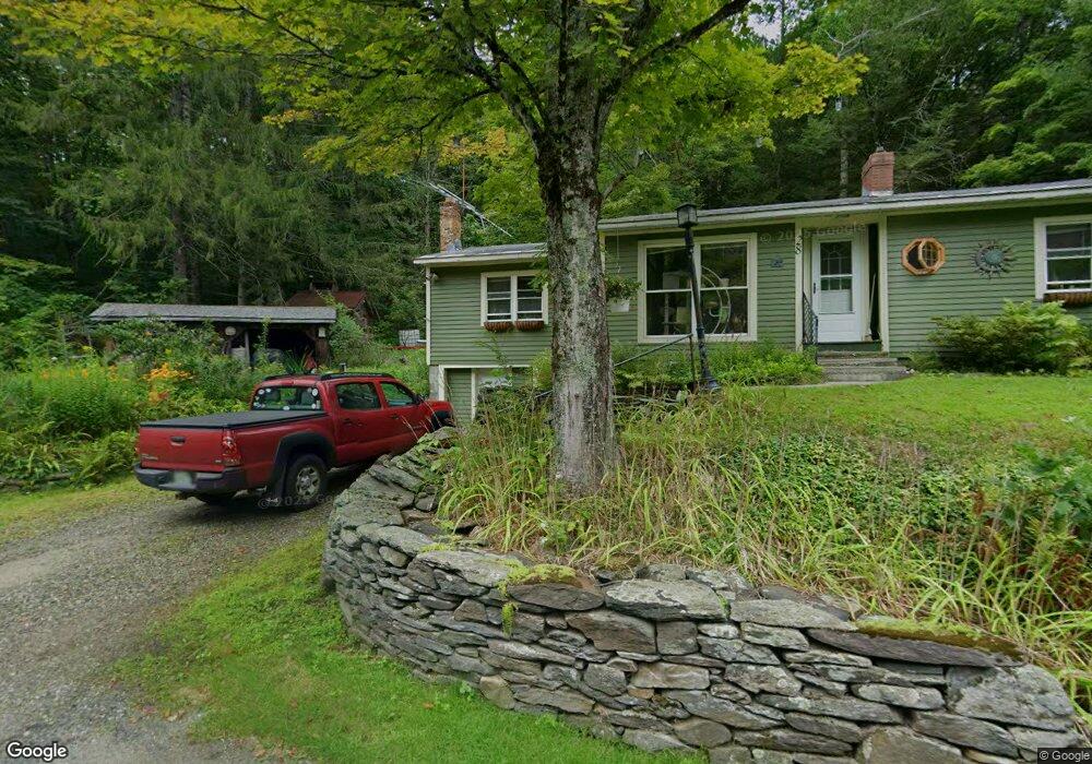
28 Shephard Rd Charlemont, MA 01339
Buckland NeighborhoodEstimated Value: $296,210 - $403,000
3
Beds
1
Bath
1,148
Sq Ft
$302/Sq Ft
Est. Value
About This Home
This home is located at 28 Shephard Rd, Charlemont, MA 01339 and is currently estimated at $346,553, approximately $301 per square foot. 28 Shephard Rd is a home with nearby schools including Mohawk Trail Regional High School.
Ownership History
Date
Name
Owned For
Owner Type
Purchase Details
Closed on
Feb 25, 2013
Sold by
Harris-Fried David and Harris-Fried Barbara
Bought by
Harris Barbara J
Current Estimated Value
Purchase Details
Closed on
Oct 25, 1994
Sold by
Allen Faith G
Bought by
Fried David W and Harris Barbara J
Home Financials for this Owner
Home Financials are based on the most recent Mortgage that was taken out on this home.
Original Mortgage
$77,900
Interest Rate
8.49%
Mortgage Type
Purchase Money Mortgage
Create a Home Valuation Report for This Property
The Home Valuation Report is an in-depth analysis detailing your home's value as well as a comparison with similar homes in the area
Home Values in the Area
Average Home Value in this Area
Purchase History
| Date | Buyer | Sale Price | Title Company |
|---|---|---|---|
| Harris Barbara J | $22,000 | -- | |
| Fried David W | $82,000 | -- |
Source: Public Records
Mortgage History
| Date | Status | Borrower | Loan Amount |
|---|---|---|---|
| Previous Owner | Fried David W | $120,000 | |
| Previous Owner | Fried David W | $118,400 | |
| Previous Owner | Fried David W | $77,900 |
Source: Public Records
Tax History
| Year | Tax Paid | Tax Assessment Tax Assessment Total Assessment is a certain percentage of the fair market value that is determined by local assessors to be the total taxable value of land and additions on the property. | Land | Improvement |
|---|---|---|---|---|
| 2025 | $3,891 | $229,700 | $47,400 | $182,300 |
| 2024 | $3,837 | $218,500 | $47,400 | $171,100 |
| 2023 | $3,332 | $196,700 | $47,400 | $149,300 |
| 2022 | $3,301 | $196,700 | $47,400 | $149,300 |
| 2021 | $3,111 | $174,400 | $47,400 | $127,000 |
| 2020 | $2,991 | $161,500 | $47,400 | $114,100 |
| 2019 | $2,824 | $151,600 | $47,400 | $104,200 |
| 2018 | $2,765 | $146,700 | $47,400 | $99,300 |
| 2017 | $2,648 | $146,700 | $47,400 | $99,300 |
| 2016 | $2,500 | $147,900 | $47,400 | $100,500 |
| 2015 | $2,485 | $147,900 | $47,400 | $100,500 |
Source: Public Records
Map
Nearby Homes
- 0 Upper St
- 5 Clesson Brook Rd
- 7 Hog Hollow Rd
- 1451 Route 2 E
- 1451 Massachusetts 2
- 143 E Buckland Rd
- 31 W Oxbow Rd
- 0, Lot 7 East Rd
- Lot 3.2 East Rd
- 24 W Oxbow Rd
- 0 W Oxbow Rd Unit 73453651
- 0 W Oxbow Rd Unit 248444
- 292 E Hawley Rd
- 49 East Rd
- 220 Hawley Rd
- 13 Bray Rd
- 168 Main St
- 2151 Route 2
- 2155 Massachusetts 2
- 102 Elm St
- 30 Shephard Rd
- 38 Shephard Rd
- 78 Clesson Brook Rd
- 0 Avery Rd L:60
- 73 Avery Rd
- 0 Street Unit 73373547
- 1 Shephard Rd
- 65 Avery Rd
- 65 Avery Rd
- 55 Orcutt Hill Rd
- Lot 1 Orcutt Hill Rd L:1
- 72 Clesson Brook Rd
- 51 Orcutt Hill Rd
- 68 Avery Rd
- 49 Avery Rd
- 96 Clesson Brook Rd
- 27 Orcutt Hill Rd
- 63 Shephard Rd
- 100 Clesson Brook Rd
- 66 Clesson Brook Rd
Your Personal Tour Guide
Ask me questions while you tour the home.