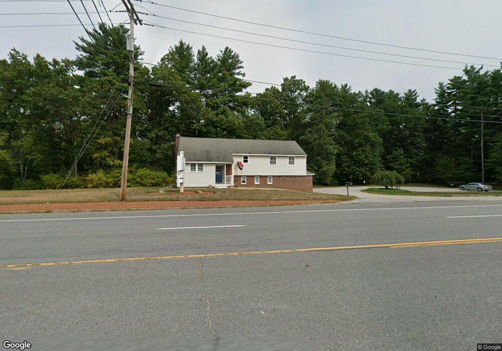
28 State Route 101a Amherst, NH 03031
Estimated Value: $543,573
3
Beds
1
Bath
2,029
Sq Ft
$268/Sq Ft
Est. Value
About This Home
This home is located at 28 State Route 101a, Amherst, NH 03031 and is currently estimated at $543,573, approximately $267 per square foot. 28 State Route 101a is a home located in Hillsborough County with nearby schools including Wilkins Elementary School, Amherst Middle School, and Souhegan Cooperative High School.
Ownership History
Date
Name
Owned For
Owner Type
Purchase Details
Closed on
May 11, 2017
Sold by
Kalhori Elaine L
Bought by
Elaine L Klahori Ret and Klahori
Current Estimated Value
Purchase Details
Closed on
Oct 7, 2002
Sold by
Thunell Ft William L
Bought by
Kalhori Albert A and Kalhori Elaine L
Home Financials for this Owner
Home Financials are based on the most recent Mortgage that was taken out on this home.
Original Mortgage
$150,000
Interest Rate
6.27%
Mortgage Type
Commercial
Purchase Details
Closed on
Nov 2, 1999
Sold by
Hineman Earl R
Bought by
Fam William L Thunell
Home Financials for this Owner
Home Financials are based on the most recent Mortgage that was taken out on this home.
Original Mortgage
$130,000
Interest Rate
7.78%
Mortgage Type
Commercial
Create a Home Valuation Report for This Property
The Home Valuation Report is an in-depth analysis detailing your home's value as well as a comparison with similar homes in the area
Home Values in the Area
Average Home Value in this Area
Purchase History
| Date | Buyer | Sale Price | Title Company |
|---|---|---|---|
| Elaine L Klahori Ret | -- | -- | |
| Elaine L Klahori Ret | -- | -- | |
| Kalhori Albert A | $209,000 | -- | |
| Kalhori Albert A | $209,000 | -- | |
| Fam William L Thunell | $190,000 | -- | |
| William L Thunell Fam | $190,000 | -- |
Source: Public Records
Mortgage History
| Date | Status | Borrower | Loan Amount |
|---|---|---|---|
| Previous Owner | William L Thunell Fam | $150,000 | |
| Previous Owner | William L Thunell Fam | $130,000 |
Source: Public Records
Tax History Compared to Growth
Tax History
| Year | Tax Paid | Tax Assessment Tax Assessment Total Assessment is a certain percentage of the fair market value that is determined by local assessors to be the total taxable value of land and additions on the property. | Land | Improvement |
|---|---|---|---|---|
| 2024 | $10,651 | $464,500 | $332,600 | $131,900 |
| 2023 | $10,163 | $464,500 | $332,600 | $131,900 |
| 2022 | $9,779 | $462,800 | $332,600 | $130,200 |
| 2021 | $9,862 | $462,800 | $332,600 | $130,200 |
| 2020 | $12,477 | $438,100 | $317,200 | $120,900 |
| 2019 | $11,811 | $438,100 | $317,200 | $120,900 |
| 2018 | $11,660 | $428,200 | $317,200 | $111,000 |
| 2017 | $11,137 | $428,200 | $317,200 | $111,000 |
| 2016 | $10,748 | $428,200 | $317,200 | $111,000 |
| 2015 | $11,230 | $424,100 | $323,500 | $100,600 |
| 2014 | $11,307 | $424,100 | $323,500 | $100,600 |
| 2013 | $11,217 | $424,100 | $323,500 | $100,600 |
Source: Public Records
Map
Nearby Homes
- 6 Veterans Rd Unit 15
- 16 Captain Danforth Ln
- 8 Carriage Ln
- 12 Fairway Dr
- 2 Benning St
- 24 Deerwood Dr
- 148 County Rd
- 150 County Rd Unit 4-142-8
- 150 County Rd
- 77 Mooar Hill Rd
- 377 Nashua St
- 0 Claude Rd
- 2 County Rd
- 9 Northfield Rd
- 101-2 Seaverns Bridge Rd
- 1 County Rd
- 103 Seaverns Bridge Rd
- 105 Seaverns Bridge Rd
- 1A Debbie Ln
- 11 Souhegan St
- 28 New Hampshire 101a
- 31 State Route 101a
- 32A State Route 101a
- 32 State Route 101a
- 32 Route 101a
- 32 Nh 101a
- 32 Nh 101a
- 33 State Route 101a
- 30 Route 101a
- 36 New Hampshire 101a
- 4 Old Nashua Rd
- 5 Old Nashua Rd
- 3 Old Nashua Rd
- 4 Captain Danforth Ln
- 4 Veterans Rd
- 9 Old Nashua Rd Unit 3A
- 9 Old Nashua Rd Unit 4A
- 9 Old Nashua Rd Unit B-2
- 9 Old Nashua Rd Unit A-1
- 6 Captain Danforth Ln