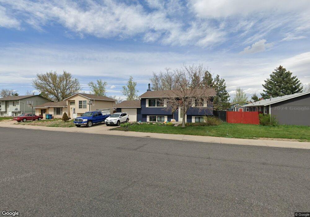
2804 Double Tree Dr Fort Collins, CO 80521
Estimated Value: $470,858 - $483,000
3
Beds
2
Baths
1,587
Sq Ft
$301/Sq Ft
Est. Value
About This Home
This home is located at 2804 Double Tree Dr, Fort Collins, CO 80521 and is currently estimated at $478,215, approximately $301 per square foot. 2804 Double Tree Dr is a home located in Larimer County with nearby schools including Irish Elementary School, Cache La Poudre Middle School, and Poudre High School.
Ownership History
Date
Name
Owned For
Owner Type
Purchase Details
Closed on
Jan 10, 2003
Sold by
Cendant Mobility Government Financial Se
Bought by
Kolb Wing Michael F and Kolb Wing Lori Ann
Current Estimated Value
Home Financials for this Owner
Home Financials are based on the most recent Mortgage that was taken out on this home.
Original Mortgage
$169,400
Outstanding Balance
$70,351
Interest Rate
6.16%
Estimated Equity
$407,864
Purchase Details
Closed on
May 1, 1984
Bought by
Bardsley Dana R
Create a Home Valuation Report for This Property
The Home Valuation Report is an in-depth analysis detailing your home's value as well as a comparison with similar homes in the area
Purchase History
| Date | Buyer | Sale Price | Title Company |
|---|---|---|---|
| Kolb Wing Michael F | $172,500 | -- | |
| Cendant Mobility Government Financial Se | -- | -- | |
| Bardsley Dana R | $60,000 | -- |
Source: Public Records
Mortgage History
| Date | Status | Borrower | Loan Amount |
|---|---|---|---|
| Open | Kolb Wing Michael F | $169,400 |
Source: Public Records
Tax History
| Year | Tax Paid | Tax Assessment Tax Assessment Total Assessment is a certain percentage of the fair market value that is determined by local assessors to be the total taxable value of land and additions on the property. | Land | Improvement |
|---|---|---|---|---|
| 2025 | $2,732 | $29,251 | $2,188 | $27,063 |
| 2024 | $2,601 | $31,792 | $2,345 | $29,447 |
| 2022 | $2,216 | $23,220 | $2,433 | $20,787 |
| 2021 | $2,236 | $23,889 | $2,503 | $21,386 |
| 2020 | $1,958 | $20,736 | $2,503 | $18,233 |
| 2019 | $1,967 | $20,736 | $2,503 | $18,233 |
| 2018 | $1,640 | $17,842 | $2,520 | $15,322 |
| 2017 | $1,635 | $17,842 | $2,520 | $15,322 |
| 2016 | $1,528 | $16,589 | $2,786 | $13,803 |
| 2015 | $1,517 | $16,590 | $2,790 | $13,800 |
| 2014 | $1,259 | $13,680 | $2,790 | $10,890 |
Source: Public Records
Map
Nearby Homes
- 3000 Marion St
- 2205 Stonecrest Dr
- 1340 N Taft Hill Rd
- 518 N Overland Trail
- 329 N Sunset St
- 2708 Laporte Ave
- 2704 Laporte Ave
- 2801 Farview Dr
- 0 Laporte Ave
- 4516 Bingham Hill Rd
- 437 Clover Ln
- 1153 Casa Ln
- 722 Cherry St
- 1700 Laporte Ave Unit 4
- 400 S Overland Trail Unit 6
- 100 Grandview Ave
- 1225 Alameda St
- 3328 Mcconnell Dr
- 1204 Pomona St Unit S & T
- 1200 Pomona St Unit Q & R
- 2805 Swing Station Way
- 2808 Double Tree Dr
- 2805 Buckboard Ct
- 2812 Double Tree Dr
- 2809 Buckboard Ct
- 2801 Buckboard Ct
- 2813 Buckboard Ct
- 2901 Double Tree Dr
- 2905 Double Tree Dr
- 2804 Swing Station Way
- 2816 Double Tree Dr
- 2735 Spoke Ct
- 2817 Buckboard Ct
- 2904 Swing Station Way
- 2740 Double Tree Dr
- 2909 Double Tree Dr
- 2821 Buckboard Ct
- 2901 Swing Station Way
- 2733 Spoke Ct
- 2900 Double Tree Dr
Your Personal Tour Guide
Ask me questions while you tour the home.