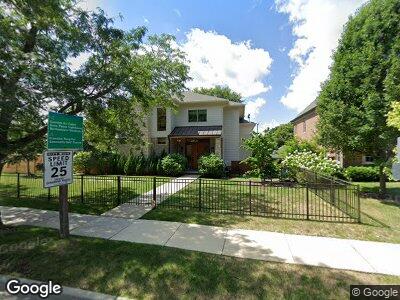
2806 Sheridan Rd Evanston, IL 60201
Estimated Value: $1,019,000 - $1,733,996
4
Beds
4
Baths
3,000
Sq Ft
$488/Sq Ft
Est. Value
About This Home
This home is located at 2806 Sheridan Rd, Evanston, IL 60201 and is currently estimated at $1,463,749, approximately $487 per square foot. 2806 Sheridan Rd is a home located in Cook County with nearby schools including Orrington Elementary School, Haven Middle School, and Evanston Township High School.
Ownership History
Date
Name
Owned For
Owner Type
Purchase Details
Closed on
Sep 24, 2013
Sold by
Sheridan Point Investors Llc
Bought by
Emerson John and Viltz Emerson Malika
Current Estimated Value
Home Financials for this Owner
Home Financials are based on the most recent Mortgage that was taken out on this home.
Original Mortgage
$1,261,560
Interest Rate
4.24%
Mortgage Type
Adjustable Rate Mortgage/ARM
Purchase Details
Closed on
Oct 8, 2010
Sold by
Rsd Sheridan Pointe Llc
Bought by
Sheridan Point Investors Llc
Create a Home Valuation Report for This Property
The Home Valuation Report is an in-depth analysis detailing your home's value as well as a comparison with similar homes in the area
Home Values in the Area
Average Home Value in this Area
Purchase History
| Date | Buyer | Sale Price | Title Company |
|---|---|---|---|
| Emerson John | $620,000 | Cti | |
| Sheridan Point Investors Llc | $396,000 | None Available |
Source: Public Records
Mortgage History
| Date | Status | Borrower | Loan Amount |
|---|---|---|---|
| Open | Emerson John | $1,200,000 | |
| Previous Owner | Emerson John | $1,261,560 |
Source: Public Records
Tax History Compared to Growth
Tax History
| Year | Tax Paid | Tax Assessment Tax Assessment Total Assessment is a certain percentage of the fair market value that is determined by local assessors to be the total taxable value of land and additions on the property. | Land | Improvement |
|---|---|---|---|---|
| 2024 | $30,826 | $135,000 | $21,002 | $113,998 |
| 2023 | $30,826 | $135,000 | $21,002 | $113,998 |
| 2022 | $30,826 | $135,000 | $21,002 | $113,998 |
| 2021 | $34,444 | $131,959 | $13,746 | $118,213 |
| 2020 | $34,039 | $131,959 | $13,746 | $118,213 |
| 2019 | $33,349 | $144,534 | $13,746 | $130,788 |
| 2018 | $31,516 | $117,500 | $11,455 | $106,045 |
| 2017 | $30,701 | $117,500 | $11,455 | $106,045 |
| 2016 | $29,336 | $117,500 | $11,455 | $106,045 |
| 2015 | $33,520 | $123,940 | $9,737 | $114,203 |
| 2014 | $2,606 | $9,737 | $9,737 | $0 |
| 2013 | $2,545 | $9,737 | $9,737 | $0 |
Source: Public Records
Map
Nearby Homes
- 824 Ingleside Place
- 250 3rd St
- 721 Central St
- 736 Central St
- 221 Greenleaf Ave
- 1210 Central St Unit 2
- 1214 Central St Unit 2N
- 320 Linden Ave
- 810 Lincoln St
- 728 Lincoln St
- 708 Lincoln St
- 203 5th St
- 1319 Lincoln St
- 511 Linden Ave
- 515 Linden Ave
- 404 Greenleaf Ave
- 1404 Lincoln St
- 2256 Sherman Ave Unit 1
- 2252 Orrington Ave
- 2233 Sherman Ave
- 2806 Sheridan Rd
- 2810 Sheridan Rd
- 2808 Sheridan Place
- 2802 Sheridan Rd
- 2812 Sheridan Rd
- 2809 Garrison Ave
- 2805 Garrison Ave
- 2811 Garrison Ave
- 915 Isabella St
- 2801 Sheridan Rd
- 2815 Garrison Ave
- 119 Sheridan Rd
- 2819 Garrison Ave
- 100 Garrison Ave
- 2815 Sheridan Rd
- 2766 Ridge Ave
- 2823 Sheridan Rd
- 2773 Garrison Ave
- 123 Sheridan Rd
- 2783 Sheridan Rd