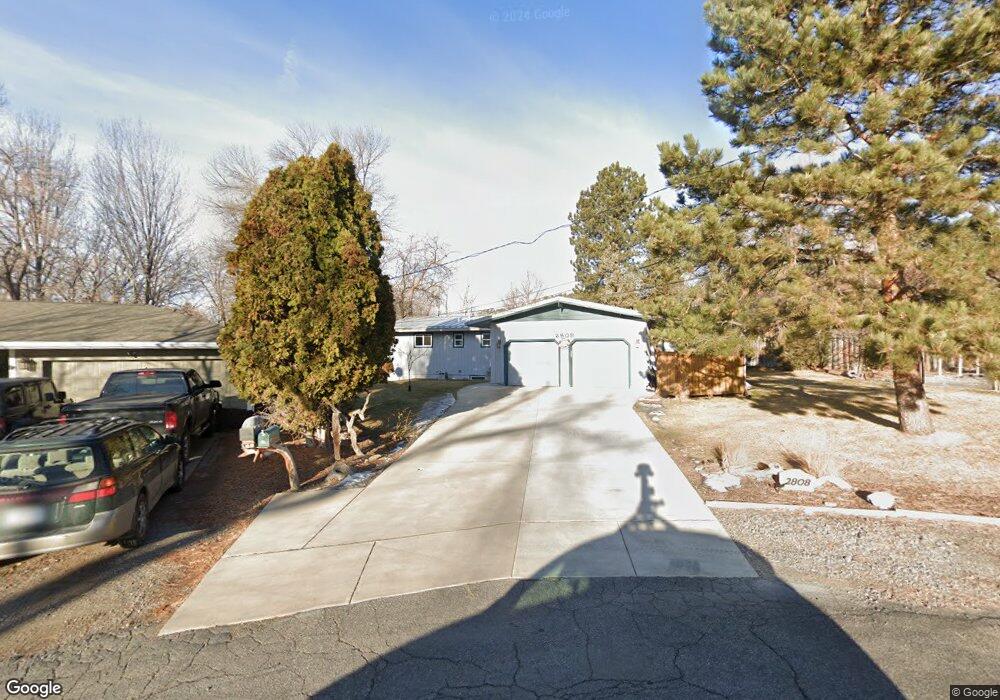
2808 Louise Ln Billings, MT 59102
North Central Billings NeighborhoodEstimated Value: $376,000 - $402,630
5
Beds
3
Baths
1,281
Sq Ft
$302/Sq Ft
Est. Value
About This Home
This home is located at 2808 Louise Ln, Billings, MT 59102 and is currently estimated at $386,908, approximately $302 per square foot. 2808 Louise Ln is a home located in Yellowstone County with nearby schools including Poly Drive School, Will James Junior High School, and Billings Senior High School.
Ownership History
Date
Name
Owned For
Owner Type
Purchase Details
Closed on
Aug 14, 2019
Sold by
T Wilson Ft
Bought by
Serry Scott E
Current Estimated Value
Purchase Details
Closed on
Apr 19, 2006
Sold by
Naumann John F
Bought by
Sery John G
Purchase Details
Closed on
Oct 6, 2005
Sold by
Naumann John F
Bought by
Sery John G
Home Financials for this Owner
Home Financials are based on the most recent Mortgage that was taken out on this home.
Original Mortgage
$52,000
Interest Rate
5.7%
Mortgage Type
New Conventional
Create a Home Valuation Report for This Property
The Home Valuation Report is an in-depth analysis detailing your home's value as well as a comparison with similar homes in the area
Home Values in the Area
Average Home Value in this Area
Purchase History
| Date | Buyer | Sale Price | Title Company |
|---|---|---|---|
| Serry Scott E | -- | -- | |
| Sery John G | -- | St | |
| Sery John G | -- | None Available |
Source: Public Records
Mortgage History
| Date | Status | Borrower | Loan Amount |
|---|---|---|---|
| Previous Owner | Sery John G | $52,000 |
Source: Public Records
Tax History Compared to Growth
Tax History
| Year | Tax Paid | Tax Assessment Tax Assessment Total Assessment is a certain percentage of the fair market value that is determined by local assessors to be the total taxable value of land and additions on the property. | Land | Improvement |
|---|---|---|---|---|
| 2025 | $3,439 | $421,800 | $63,890 | $357,910 |
| 2024 | $3,439 | $350,300 | $60,520 | $289,780 |
| 2023 | $3,453 | $350,300 | $60,520 | $289,780 |
| 2022 | $2,965 | $262,100 | $0 | $0 |
| 2021 | $2,810 | $262,100 | $0 | $0 |
| 2020 | $2,839 | $254,600 | $0 | $0 |
| 2019 | $2,711 | $254,600 | $0 | $0 |
| 2018 | $2,562 | $235,300 | $0 | $0 |
| 2017 | $2,178 | $235,300 | $0 | $0 |
| 2016 | $2,344 | $224,200 | $0 | $0 |
| 2015 | $2,291 | $224,200 | $0 | $0 |
| 2014 | $2,215 | $115,487 | $0 | $0 |
Source: Public Records
Map
Nearby Homes
- 2730 Gregory Dr S
- 2717 Patricia Ln
- 2748 Palm Dr
- 2736 Palm Dr
- 2646 Rimrock Rd
- 2644 Rimrock Rd
- 2815 Palm Dr
- 2912 Stinson Ave
- 2516 Lyndale Ln
- 3135 Sycamore Ln
- 3065 Gregory Dr W
- 2737 Gregory Dr N
- 2911 E Macdonald Dr
- 3106 Forsythia Blvd
- 2422 Brentwood Ln
- 3311 Harlou Dr
- 3540 Masterson Cir
- 3580 Masterson Cir
- 2411 Granite Ave
- 3107 Poly Dr
- 2804 Louise Ln
- 2811 Lyndale Ln
- 2811 Louise Ln
- 2746 Rimrock Rd
- 2805 Louise Ln
- 2819 Lyndale Ln
- 2732 Louise Ln
- 2827 Lyndale Ln
- 2735 Louise Ln
- 2728 Rimrock Rd
- 2710 Rimrock Rd
- 2728 Louise Ln
- 2807 Lyndale Ln
- 2727 Louise Ln
- 2812 Rimrock Rd
- 2723 Lyndale Ln
- 2724 W Bridger Dr
- 2720 Gregory Dr S
- 2720 Louise Ln
- 2812 Lyndale Ln