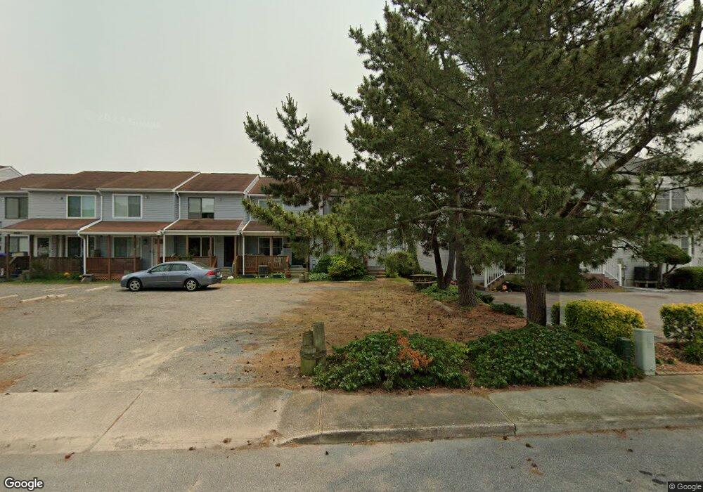
2808 Plover Dr Unit B Ocean City, MD 21842
Estimated Value: $390,000 - $475,000
--
Bed
1
Bath
960
Sq Ft
$450/Sq Ft
Est. Value
About This Home
This home is located at 2808 Plover Dr Unit B, Ocean City, MD 21842 and is currently estimated at $432,041, approximately $450 per square foot. 2808 Plover Dr Unit B is a home located in Worcester County with nearby schools including Ocean City Elementary School, Stephen Decatur Middle School, and Berlin Intermediate School.
Ownership History
Date
Name
Owned For
Owner Type
Purchase Details
Closed on
Oct 5, 2001
Sold by
Bathurst Richard F and Bathurst Frances A
Bought by
Bathurst Richard F
Current Estimated Value
Purchase Details
Closed on
May 16, 1988
Sold by
Aefsky Gene Allan and Catherine Lynn
Bought by
Bathurst Richard F and Bathurst Frances A
Home Financials for this Owner
Home Financials are based on the most recent Mortgage that was taken out on this home.
Original Mortgage
$59,600
Interest Rate
10.4%
Create a Home Valuation Report for This Property
The Home Valuation Report is an in-depth analysis detailing your home's value as well as a comparison with similar homes in the area
Home Values in the Area
Average Home Value in this Area
Purchase History
| Date | Buyer | Sale Price | Title Company |
|---|---|---|---|
| Bathurst Richard F | -- | -- | |
| Bathurst Richard F | $74,500 | -- |
Source: Public Records
Mortgage History
| Date | Status | Borrower | Loan Amount |
|---|---|---|---|
| Previous Owner | Bathurst Richard F | $59,600 |
Source: Public Records
Tax History Compared to Growth
Tax History
| Year | Tax Paid | Tax Assessment Tax Assessment Total Assessment is a certain percentage of the fair market value that is determined by local assessors to be the total taxable value of land and additions on the property. | Land | Improvement |
|---|---|---|---|---|
| 2025 | $3,881 | $284,200 | $0 | $0 |
| 2024 | $3,601 | $258,100 | $0 | $0 |
| 2023 | $3,260 | $232,000 | $155,000 | $77,000 |
| 2022 | $3,194 | $227,267 | $0 | $0 |
| 2021 | $3,145 | $222,533 | $0 | $0 |
| 2020 | $3,077 | $217,800 | $155,000 | $62,800 |
| 2019 | $2,946 | $207,067 | $0 | $0 |
| 2018 | $2,765 | $196,333 | $0 | $0 |
| 2017 | $2,622 | $185,600 | $0 | $0 |
| 2016 | -- | $174,767 | $0 | $0 |
| 2015 | $3,450 | $163,933 | $0 | $0 |
| 2014 | $3,450 | $153,100 | $0 | $0 |
Source: Public Records
Map
Nearby Homes
- 2807D Plover Dr Unit 4
- 2813 Tern Dr Unit 208
- 424 Lark Ln
- 417 Robin Dr
- 417 Robin Dr
- 413 Robin Dr
- 424 Lark Ln
- 424 Lark Ln Unit 202E
- 424 Lark Ln Unit 201 E
- 2838 Gull Way
- 424 Bayshore Dr Unit 4204, 204
- 507 Robin Dr Unit 304
- 508 Robin Dr Unit 42
- 512 Robin Dr Unit 7
- 504 Robin Dr Unit 58
- 504 Robin Dr Unit 69
- 508 Robin Dr Unit 47
- 508 Robin Dr Unit 44
- 2601 Gull Way Unit 28
- 506 Lark Ln Unit 6
- 2808 Plover Dr Unit F
- 2808 Plover Dr Unit D
- 2808 Plover Dr Unit E
- 2808 Plover Dr Unit A
- 2808 Plover Dr Unit C
- 2808 Plover Dr Unit G
- 2808 Plover Dr
- 2806 Plover Drive B
- 2806 Plover Dr Unit B
- 2806A Plover Dr
- 2806B Plover Dr Unit B
- 2806B Plover Dr
- 2806C Plover Dr
- 2806C Plover Dr Unit C
- 2804-A Plover Dr
- 2808F Plover Dr Unit 327B
- 2804-B Plover Dr
- 2804-C Plover Dr
- 2808-C Plover Dr
- 2816 Plover Dr Unit B