Estimated Value: $222,025 - $245,000
3
Beds
2
Baths
1,473
Sq Ft
$160/Sq Ft
Est. Value
About This Home
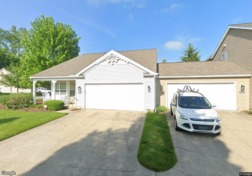
This home is located at 2810 Canvasback Cir, Akron, OH 44319 and is currently estimated at $235,756, approximately $160 per square foot. 2810 Canvasback Cir is a home located in Summit County with nearby schools including Coventry Middle School, Coventry High School, and St. Francis de Sales School.
Ownership History
Date
Name
Owned For
Owner Type
Purchase Details
Closed on
Aug 5, 2005
Sold by
Brighton Bay
Bought by
Blackmon Beth M and Blackmon Beth
Current Estimated Value
Home Financials for this Owner
Home Financials are based on the most recent Mortgage that was taken out on this home.
Original Mortgage
$121,950
Outstanding Balance
$63,460
Interest Rate
5.71%
Mortgage Type
Fannie Mae Freddie Mac
Estimated Equity
$172,296
Create a Home Valuation Report for This Property
The Home Valuation Report is an in-depth analysis detailing your home's value as well as a comparison with similar homes in the area
Home Values in the Area
Average Home Value in this Area
Purchase History
| Date | Buyer | Sale Price | Title Company |
|---|---|---|---|
| Blackmon Beth M | $152,440 | U S Title Agency Inc |
Source: Public Records
Mortgage History
| Date | Status | Borrower | Loan Amount |
|---|---|---|---|
| Open | Blackmon Beth M | $121,950 | |
| Closed | Blackmon Beth M | $22,800 |
Source: Public Records
Tax History
| Year | Tax Paid | Tax Assessment Tax Assessment Total Assessment is a certain percentage of the fair market value that is determined by local assessors to be the total taxable value of land and additions on the property. | Land | Improvement |
|---|---|---|---|---|
| 2024 | $3,441 | $58,640 | $13,108 | $45,532 |
| 2023 | $3,441 | $58,640 | $13,108 | $45,532 |
| 2022 | $2,960 | $41,521 | $9,233 | $32,288 |
| 2021 | $2,789 | $41,521 | $9,233 | $32,288 |
| 2020 | $2,708 | $41,520 | $9,230 | $32,290 |
| 2019 | $2,851 | $39,920 | $9,230 | $30,690 |
| 2018 | $2,824 | $39,920 | $9,230 | $30,690 |
| 2017 | $3,211 | $39,920 | $9,230 | $30,690 |
| 2016 | $2,853 | $39,920 | $9,230 | $30,690 |
| 2015 | $3,211 | $39,920 | $9,230 | $30,690 |
| 2014 | $3,015 | $39,920 | $9,230 | $30,690 |
| 2013 | $2,916 | $42,460 | $9,230 | $33,230 |
Source: Public Records
Map
Nearby Homes
- 0 W Warner Rd
- 202 W Warner Rd
- 2679 N Bender Ave
- 156 W Ingleside Dr
- 449 W Long Lake Blvd
- 2813 N Bender Ave
- 196 Olivet Ave
- 206 Olivet Ave
- 61 Leicester Dr
- 173 Portage Lakes Dr
- 3025 Lamb Dr
- 72 Weil Ave
- 2069 Penguin Ave
- 584 Apple Dr
- 511 Picadilly Cir
- 796 Portage Lakes Dr
- 253 Aqua Blvd
- 686 Portage Lakes Dr
- 2225 Abbey Ln
- 2162 Thornbury Ln
- 2806 Canvasback Cir
- 2802 Canvasback Cir
- 118 Mallard Point Dr
- 109 Mallard Point Dr
- 126 Mallard Point Dr
- 110 Mallard Point Dr
- 2709 Canvasback Cir
- 105 Mallard Point Dr
- 2704 Canvasback Cir
- 106 Mallard Point Dr
- 2705 Canvasback Cir
- 101 Mallard Point Dr
- 2700 Canvasback Cir
- 2701 Canvasback Cir
- 2696 Canvasback Cir
- 98 Mallard Point Dr
- 2671 Canvasback Cir
- 2611 Canvasback Cir
- 77 N House Dr
- 69 N House Dr
Your Personal Tour Guide
Ask me questions while you tour the home.