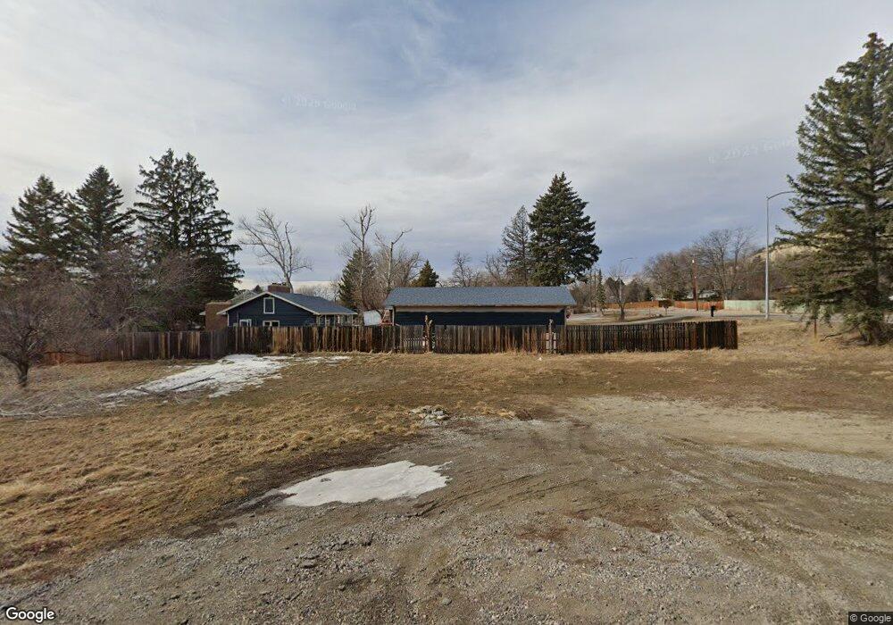
2812 Orchard Dr Billings, MT 59102
North Central Billings NeighborhoodEstimated Value: $464,000 - $561,000
4
Beds
2
Baths
1,574
Sq Ft
$330/Sq Ft
Est. Value
About This Home
This home is located at 2812 Orchard Dr, Billings, MT 59102 and is currently estimated at $518,690, approximately $329 per square foot. 2812 Orchard Dr is a home located in Yellowstone County with nearby schools including Poly Drive School, Lewis & Clark Junior High School, and Billings Senior High School.
Ownership History
Date
Name
Owned For
Owner Type
Purchase Details
Closed on
Nov 22, 2023
Sold by
Jeffrey C Leischner Trust
Bought by
Leischner Jeffrey C and Vashey Sharon L
Current Estimated Value
Purchase Details
Closed on
May 8, 2021
Sold by
Smith Mickenly and Smith Emily
Bought by
Leischner Jeffrey C and Jeffrey C Leischner Trust
Purchase Details
Closed on
Jan 8, 2016
Sold by
Bonini Enterprises Llc
Bought by
Smith Mickenly and Smith Emily
Home Financials for this Owner
Home Financials are based on the most recent Mortgage that was taken out on this home.
Original Mortgage
$72,900
Interest Rate
3.92%
Mortgage Type
Construction
Purchase Details
Closed on
Nov 15, 2011
Sold by
Kincaid Land Llc
Bought by
Bonini Enterprises Llc
Create a Home Valuation Report for This Property
The Home Valuation Report is an in-depth analysis detailing your home's value as well as a comparison with similar homes in the area
Home Values in the Area
Average Home Value in this Area
Purchase History
| Date | Buyer | Sale Price | Title Company |
|---|---|---|---|
| Leischner Jeffrey C | -- | First Montana Title | |
| Leischner Jeffrey C | -- | First American Title Company | |
| Smith Mickenly | -- | Chicago Title Comapny | |
| Bonini Enterprises Llc | -- | Chicago Title |
Source: Public Records
Mortgage History
| Date | Status | Borrower | Loan Amount |
|---|---|---|---|
| Previous Owner | Smith Mickenly | $72,900 |
Source: Public Records
Tax History Compared to Growth
Tax History
| Year | Tax Paid | Tax Assessment Tax Assessment Total Assessment is a certain percentage of the fair market value that is determined by local assessors to be the total taxable value of land and additions on the property. | Land | Improvement |
|---|---|---|---|---|
| 2025 | $4,521 | $560,800 | $62,042 | $498,758 |
| 2024 | $4,521 | $465,500 | $58,811 | $406,689 |
| 2023 | $1,931 | $175,641 | $58,811 | $116,830 |
| 2022 | $857 | $56,743 | $0 | $0 |
| 2021 | $793 | $56,743 | $0 | $0 |
| 2020 | $766 | $51,925 | $0 | $0 |
| 2019 | $735 | $51,925 | $0 | $0 |
| 2018 | $731 | $51,173 | $0 | $0 |
| 2017 | $708 | $51,173 | $0 | $0 |
| 2016 | $633 | $45,382 | $0 | $0 |
| 2015 | $818 | $45,382 | $0 | $0 |
| 2014 | $879 | $28,063 | $0 | $0 |
Source: Public Records
Map
Nearby Homes
- 2042 Green Terrace Dr
- 2206 Green Terrace Dr
- 3226 Country Club Cir
- 1833 Iris Ln
- 2124 Dahlia Ln
- 1944 Colton Blvd
- 2907 Brentwood Ln
- 2021 Beverly Hill Blvd
- 3441 Masterson Cir
- 2911 E Macdonald Dr
- 1734 Mariposa Ln
- 2422 Brentwood Ln
- 3540 Masterson Cir
- 1745 Parkhill Dr
- 2644 Rimrock Rd
- 2646 Rimrock Rd
- 2420 Elizabeth St
- 2035 Avenue D
- 1440 Granite Ave
- 2060 Edgewood Dr
- 2030 Rimrock Rd
- 2804 Orchard Dr
- 2041 Rimrock Rd
- 2813 Orchard Dr
- 2050 Rimrock Rd
- 2060 Rimrock Rd
- 2018 Rimrock Rd
- 2011 Mckay Ln
- 2025 Pryor Ln
- 2021 Rimrock Rd
- 2036 Green Terrace Dr
- 2022 Mckay Ln
- 2030 Green Terrace Dr
- 2054 Green Terrace Dr
- 2009 Mckay Ln
- 2024 Green Terrace Dr
- 2048 Green Terrace Dr
- 2035 Pryor Ln
- 2110 Rimrock Rd
- 2009 Rimrock Rd