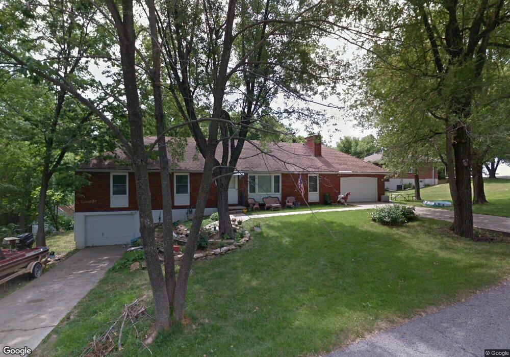
2815 Cedar Crest Dr Independence, MO 64057
Blackburn NeighborhoodEstimated Value: $228,000 - $269,000
3
Beds
2
Baths
1,450
Sq Ft
$170/Sq Ft
Est. Value
About This Home
This home is located at 2815 Cedar Crest Dr, Independence, MO 64057 and is currently estimated at $246,250, approximately $169 per square foot. 2815 Cedar Crest Dr is a home located in Jackson County with nearby schools including Blackburn Elementary School, Bridger Middle School, and Pioneer Ridge Middle School.
Ownership History
Date
Name
Owned For
Owner Type
Purchase Details
Closed on
Apr 16, 2010
Sold by
Mcentee Daniel P and Mcentee Janet L
Bought by
Dotson Marci
Current Estimated Value
Home Financials for this Owner
Home Financials are based on the most recent Mortgage that was taken out on this home.
Original Mortgage
$88,860
Outstanding Balance
$58,831
Interest Rate
4.88%
Mortgage Type
FHA
Estimated Equity
$187,419
Purchase Details
Closed on
Feb 22, 2010
Sold by
Mcentee Janet L
Bought by
Mcentee Daniel P
Home Financials for this Owner
Home Financials are based on the most recent Mortgage that was taken out on this home.
Original Mortgage
$88,860
Outstanding Balance
$58,831
Interest Rate
4.88%
Mortgage Type
FHA
Estimated Equity
$187,419
Purchase Details
Closed on
Aug 15, 2008
Sold by
Hopson Eugenia M
Bought by
Mcentee Daniel P and Mcentee Janet L
Create a Home Valuation Report for This Property
The Home Valuation Report is an in-depth analysis detailing your home's value as well as a comparison with similar homes in the area
Home Values in the Area
Average Home Value in this Area
Purchase History
| Date | Buyer | Sale Price | Title Company |
|---|---|---|---|
| Dotson Marci | -- | Coffelt Land Title Inc | |
| Mcentee Daniel P | -- | None Available | |
| Mcentee Daniel P | -- | Kansas City Title |
Source: Public Records
Mortgage History
| Date | Status | Borrower | Loan Amount |
|---|---|---|---|
| Open | Dotson Marci | $88,860 |
Source: Public Records
Tax History
| Year | Tax Paid | Tax Assessment Tax Assessment Total Assessment is a certain percentage of the fair market value that is determined by local assessors to be the total taxable value of land and additions on the property. | Land | Improvement |
|---|---|---|---|---|
| 2025 | $2,023 | $30,043 | $5,791 | $24,252 |
| 2024 | $1,977 | $29,199 | $4,456 | $24,743 |
| 2023 | $1,977 | $29,199 | $3,101 | $26,098 |
| 2022 | $1,740 | $23,560 | $4,123 | $19,437 |
| 2021 | $1,740 | $23,560 | $4,123 | $19,437 |
| 2020 | $1,701 | $22,382 | $4,123 | $18,259 |
| 2019 | $1,674 | $22,382 | $4,123 | $18,259 |
| 2018 | $1,234 | $15,754 | $3,151 | $12,603 |
| 2017 | $1,234 | $15,754 | $3,151 | $12,603 |
| 2016 | $1,084 | $13,699 | $4,110 | $9,589 |
Source: Public Records
Map
Nearby Homes
- 2804 S Whitney Ave
- 2805 Berry Ave
- 3011 Cedar Crest Dr Unit B
- 2900 S M 291 Hwy
- 2608 Baker Rd
- 17504 E R D Mize Rd
- 17813 E 26th St S
- 18013 E 26th Terrace Ct S
- 18208 E 27th St S
- 17201 E 32nd St S Unit 3
- 17201 E 32nd St S Unit 6
- 0 Multi Address N A Unit HMS2588688
- 2527 Queen Ridge Dr
- 18608 E 26th Terrace S
- 2431 S Ponca Ave
- 2417 S Ellison Way
- 3416 S Marshall Ct
- 3415 S Davidson Ct
- 16409 E 31st St S
- 2813 Trenchard Dr
- 2821 Cedar Crest Dr
- 2807 Cedar Crest Dr
- 2812 Cedar Crest Dr
- 2814 Cedar Crest Dr
- 2818 Cedar Crest Dr
- 2808 Cedar Crest Dr
- 2820 Cedar Crest Dr
- 17403 E 28th Terrace S
- 17401 E 28th Terrace S
- 2804 Cedar Crest Dr
- 17302 E 28th Terrace S
- 2804 S Cedar Crest Terrace
- 17309 E 28th Terrace S
- 2800 S Cedar Crest Terrace
- 17305 E 28th Terrace S
- 2801 S Maybrook Ave
- 2808 S Cedar Crest Terrace
- 2800 Cedar Crest Dr
- 2725 S Maybrook Ave
- 17300 E 28th Terrace S
Your Personal Tour Guide
Ask me questions while you tour the home.