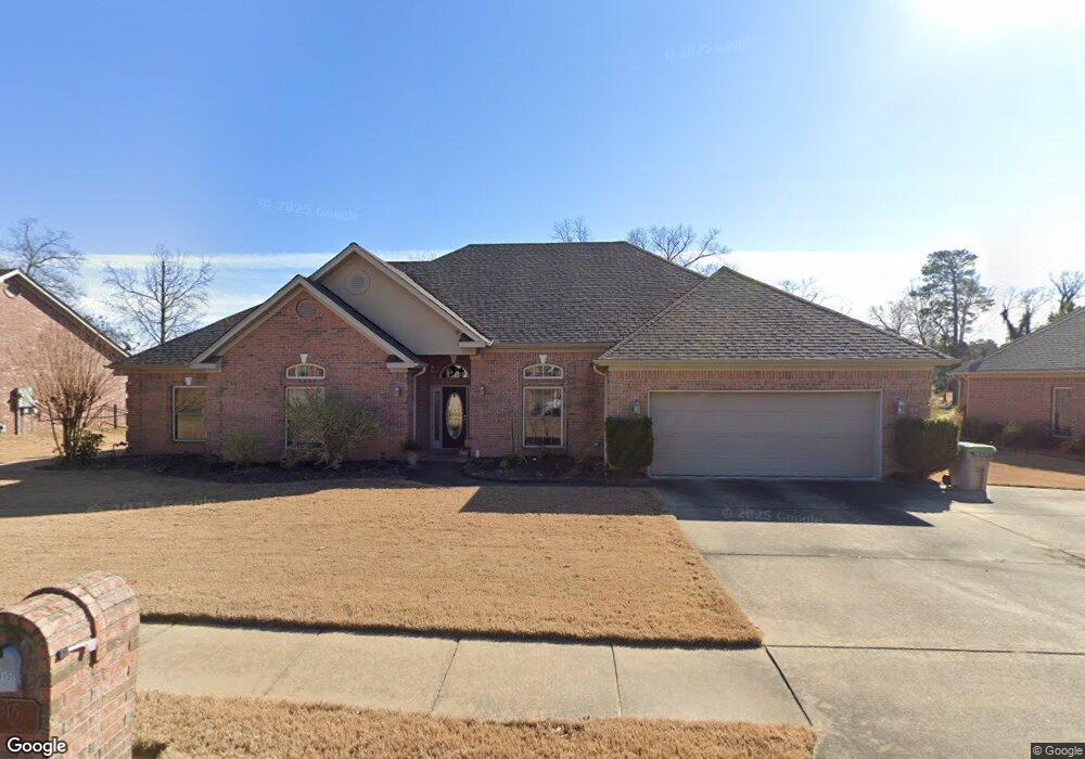
2815 Crooked Stick Benton, AR 72019
Salem NeighborhoodEstimated Value: $386,791 - $432,000
--
Bed
2
Baths
2,706
Sq Ft
$154/Sq Ft
Est. Value
About This Home
This home is located at 2815 Crooked Stick, Benton, AR 72019 and is currently estimated at $417,698, approximately $154 per square foot. 2815 Crooked Stick is a home located in Saline County with nearby schools including Perrin Elementary School, Benton Middle School, and Benton Junior High School.
Ownership History
Date
Name
Owned For
Owner Type
Purchase Details
Closed on
Jul 29, 2016
Sold by
Harris Daniel A and Harris Sheila J
Bought by
Billings Darren and Billings Nanette
Current Estimated Value
Home Financials for this Owner
Home Financials are based on the most recent Mortgage that was taken out on this home.
Original Mortgage
$160,000
Outstanding Balance
$127,563
Interest Rate
3.54%
Mortgage Type
New Conventional
Estimated Equity
$290,135
Purchase Details
Closed on
Jun 30, 2006
Sold by
Swenson Brian and Swenson Sonya
Bought by
Harris Daniel A and Harris Sheila J
Home Financials for this Owner
Home Financials are based on the most recent Mortgage that was taken out on this home.
Original Mortgage
$200,000
Interest Rate
6.63%
Mortgage Type
New Conventional
Purchase Details
Closed on
Sep 25, 2003
Bought by
Swenson
Purchase Details
Closed on
Mar 3, 2003
Bought by
Snellings
Create a Home Valuation Report for This Property
The Home Valuation Report is an in-depth analysis detailing your home's value as well as a comparison with similar homes in the area
Home Values in the Area
Average Home Value in this Area
Purchase History
| Date | Buyer | Sale Price | Title Company |
|---|---|---|---|
| Billings Darren | $270,000 | First National Title Company | |
| Harris Daniel A | $250,000 | -- | |
| Swenson | $245,000 | -- | |
| Snellings | $30,000 | -- |
Source: Public Records
Mortgage History
| Date | Status | Borrower | Loan Amount |
|---|---|---|---|
| Open | Billings Darren | $160,000 | |
| Previous Owner | Harris Daniel A | $200,000 |
Source: Public Records
Tax History Compared to Growth
Tax History
| Year | Tax Paid | Tax Assessment Tax Assessment Total Assessment is a certain percentage of the fair market value that is determined by local assessors to be the total taxable value of land and additions on the property. | Land | Improvement |
|---|---|---|---|---|
| 2025 | $3,359 | $68,209 | $13,000 | $55,209 |
| 2024 | $3,438 | $68,209 | $13,000 | $55,209 |
| 2023 | $2,788 | $68,209 | $13,000 | $55,209 |
| 2022 | $2,692 | $68,209 | $13,000 | $55,209 |
| 2021 | $2,546 | $52,720 | $10,000 | $42,720 |
| 2020 | $2,546 | $52,720 | $10,000 | $42,720 |
| 2019 | $2,413 | $50,320 | $10,000 | $40,320 |
| 2018 | $2,433 | $50,320 | $10,000 | $40,320 |
| 2017 | $2,433 | $50,320 | $10,000 | $40,320 |
| 2016 | $2,860 | $50,440 | $11,000 | $39,440 |
| 2015 | $2,830 | $50,440 | $11,000 | $39,440 |
| 2014 | $2,828 | $50,440 | $11,000 | $39,440 |
Source: Public Records
Map
Nearby Homes
- 2609 Pinehurst Cove
- 5107 Congressional Dr
- 5006 Colonial Ct
- 2915 Castle Valley Dr
- 2918 Cypress Point Dr
- 2918 Cypress Dr
- 513 Highway 5 N
- 3901 Spencer Crossing Dr
- 1756 White Oak Ln
- 3892 Spencer Crossing Dr
- 5012 Skilling Cove
- 1641 White Oak Cir
- 3881 Spencer Crossing Dr
- 3905 Deer Dr
- 6 acres Interstate 30
- 15.31 acres Interstate 30
- 1810 White Oak Cir
- 1725 White Oak Ln
- 3851 Spencer Crossing Dr
- 4321 Glenda Ln
- 2819 Crooked Stick
- 2807 Crooked Stick
- 2806 Crooked Stick
- 2812 Crooked Stick
- 0 Crooked Stick Unit 16018532
- 0 Crooked Stick Unit 16021407
- 0 Crooked Stick Unit 18005810
- 0 Crooked Stick Unit 20036423
- 0 Crooked Stick Unit 20028502
- 2825 Crooked Stick
- 2721 Crooked Stick
- 2818 Crooked Stick
- 2718 Crooked Stick
- 2720 Oak Tree Cove
- 5004 Congressional Dr
- 2717 Crooked Stick
- 5007 Congressional Dr
- 2715 Oak Tree Cove
- 5008 Congressional Dr
- 2712 Crooked Stick