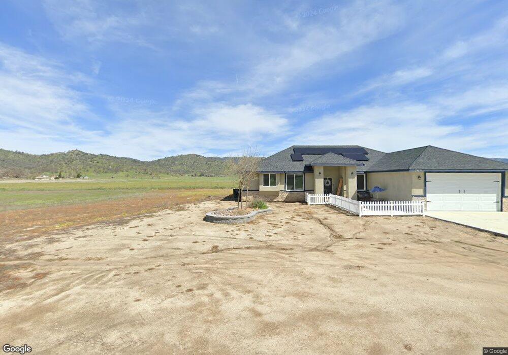
28201 Burning Tree Dr Stallion Springs, CA 93561
Estimated Value: $449,000 - $473,000
--
Bed
--
Bath
--
Sq Ft
0.92
Acres
About This Home
This home is located at 28201 Burning Tree Dr, Stallion Springs, CA 93561 and is currently estimated at $457,639. 28201 Burning Tree Dr is a home located in Kern County with nearby schools including Cummings Valley Elementary School, Jacobsen Middle School, and Tehachapi High School.
Ownership History
Date
Name
Owned For
Owner Type
Purchase Details
Closed on
Aug 5, 2021
Sold by
Agb Holdings Llc
Bought by
Hagerty Michelle Louise and Hajj Christopher Bryan
Current Estimated Value
Home Financials for this Owner
Home Financials are based on the most recent Mortgage that was taken out on this home.
Original Mortgage
$235,500
Interest Rate
3.11%
Mortgage Type
New Conventional
Purchase Details
Closed on
Mar 16, 2016
Sold by
Cisna Jeffrey R and Cisna Jennifer M
Bought by
Eloff Andrew C and Eloff Diana L
Purchase Details
Closed on
Mar 1, 2006
Sold by
A P Energy Inc
Bought by
Cisna Jeffrey R and Cisna Jennifer M
Purchase Details
Closed on
Feb 27, 2006
Sold by
Inteso Janet Y and Inteso Family Trust
Bought by
A P Energy Inc
Create a Home Valuation Report for This Property
The Home Valuation Report is an in-depth analysis detailing your home's value as well as a comparison with similar homes in the area
Home Values in the Area
Average Home Value in this Area
Purchase History
| Date | Buyer | Sale Price | Title Company |
|---|---|---|---|
| Hagerty Michelle Louise | $340,000 | Chicago Title | |
| Eloff Andrew C | $29,000 | Placer Title Company | |
| Cisna Jeffrey R | $55,000 | Chicago Title Company | |
| A P Energy Inc | $30,000 | Chicago Title Company |
Source: Public Records
Mortgage History
| Date | Status | Borrower | Loan Amount |
|---|---|---|---|
| Previous Owner | Hagerty Michelle Louise | $235,500 |
Source: Public Records
Tax History Compared to Growth
Tax History
| Year | Tax Paid | Tax Assessment Tax Assessment Total Assessment is a certain percentage of the fair market value that is determined by local assessors to be the total taxable value of land and additions on the property. | Land | Improvement |
|---|---|---|---|---|
| 2025 | $4,520 | $360,810 | $79,590 | $281,220 |
| 2024 | $4,368 | $353,736 | $78,030 | $275,706 |
| 2023 | $4,368 | $346,800 | $76,500 | $270,300 |
| 2022 | $4,221 | $330,600 | $30,600 | $300,000 |
| 2021 | $588 | $30,000 | $30,000 | $0 |
| 2020 | $588 | $31,389 | $31,389 | $0 |
| 2019 | $612 | $31,389 | $31,389 | $0 |
| 2018 | $599 | $30,171 | $30,171 | $0 |
| 2017 | $598 | $29,580 | $29,580 | $0 |
| 2016 | $962 | $63,488 | $63,488 | $0 |
| 2015 | $973 | $62,535 | $62,535 | $0 |
| 2014 | $965 | $61,311 | $61,311 | $0 |
Source: Public Records
Map
Nearby Homes
- 0 Burning Tree Dr
- 28360 Burning Tree Dr
- 0 Burlingame Ct Unit 202510791
- 0 Burlingame Ct Unit 9993187
- 0 Burlingame Ct Unit PI25226960
- 0 Saint Andrews Dr
- 28190 Braeburn Place
- 27910 Crofun Rd
- 28161 Stallion Springs Dr
- 18400 Wrangler Way
- 18441 Wrangler Way
- 27800 Crofun Rd
- 18381 Sulky Ln
- 0 Stallion Springs and Spyglass Unit 25599401
- 18901 Pinehurst Place
- 28401 Stallion Springs Dr
- 18451 Branding Iron Ct
- 27712 Stallion Springs Dr
- 18450 Branding Iron Ct
- 28840 Gleneagle Ct
- 28240 Burning Tree Dr
- 28320 Burning Tree Dr
- 28180 Burning Tree Dr
- 28090 Braeburn Place
- 28080 Braeburn Place
- 28080 Braeburn Place
- 28100 Braeburn Place
- 28070 Braeburn Place
- 28110 Braeburn Place
- 28150 Burning Tree Dr
- 28881 Burning Tree Dr
- 28040 Braeburn Place
- 20831 Braeburn Place
- 28120 Braeburn Place
- 28881 Burning Tree Ct
- 0 Burning Tree Ct
- 28101 Braeburn Place
- 28071 Braeburn Place
- 28160 Braeburn Place
- 18450 Burning Tree Ct