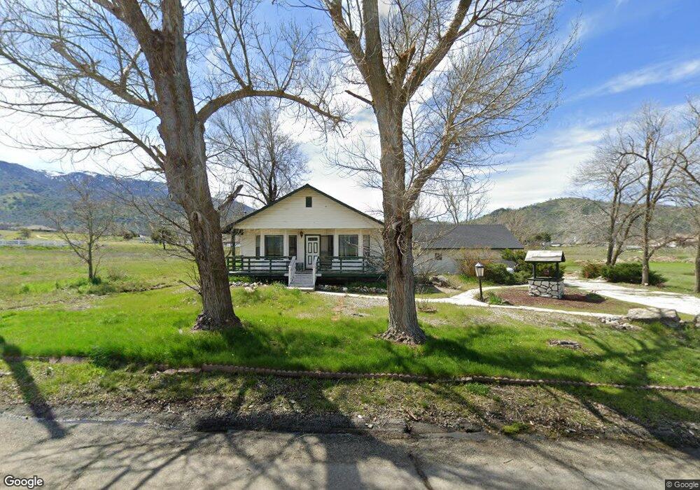
28240 Burning Tree Dr Tehachapi, CA 93561
Estimated Value: $295,000 - $380,000
2
Beds
3
Baths
1,378
Sq Ft
$257/Sq Ft
Est. Value
About This Home
This home is located at 28240 Burning Tree Dr, Tehachapi, CA 93561 and is currently estimated at $354,665, approximately $257 per square foot. 28240 Burning Tree Dr is a home located in Kern County with nearby schools including Cummings Valley Elementary School, Jacobsen Middle School, and Tehachapi High School.
Ownership History
Date
Name
Owned For
Owner Type
Purchase Details
Closed on
Mar 21, 2007
Sold by
Nicholson Joy E
Bought by
Czarnecki Ronald E
Current Estimated Value
Home Financials for this Owner
Home Financials are based on the most recent Mortgage that was taken out on this home.
Original Mortgage
$228,775
Outstanding Balance
$137,258
Interest Rate
6.1%
Mortgage Type
Purchase Money Mortgage
Estimated Equity
$217,408
Purchase Details
Closed on
Jun 13, 2001
Sold by
Thomas Lois C and Lois C Thomas Living Trust
Bought by
Nicholson James O and Nicholson Joy E
Home Financials for this Owner
Home Financials are based on the most recent Mortgage that was taken out on this home.
Original Mortgage
$105,000
Interest Rate
7.21%
Purchase Details
Closed on
Jul 27, 1998
Sold by
Thomas Lois C
Bought by
Thomas Lois C and Lois C Thomas Living Trust
Create a Home Valuation Report for This Property
The Home Valuation Report is an in-depth analysis detailing your home's value as well as a comparison with similar homes in the area
Home Values in the Area
Average Home Value in this Area
Purchase History
| Date | Buyer | Sale Price | Title Company |
|---|---|---|---|
| Czarnecki Ronald E | $236,000 | Commonwealth Land Title Co | |
| Nicholson James O | $125,000 | Commonwealth Land Title Co | |
| Thomas Lois C | -- | -- |
Source: Public Records
Mortgage History
| Date | Status | Borrower | Loan Amount |
|---|---|---|---|
| Open | Czarnecki Ronald E | $228,775 | |
| Previous Owner | Nicholson James O | $105,000 |
Source: Public Records
Tax History
| Year | Tax Paid | Tax Assessment Tax Assessment Total Assessment is a certain percentage of the fair market value that is determined by local assessors to be the total taxable value of land and additions on the property. | Land | Improvement |
|---|---|---|---|---|
| 2025 | $3,997 | $314,828 | $66,978 | $247,850 |
| 2024 | $3,862 | $308,656 | $65,665 | $242,991 |
| 2023 | $3,862 | $302,605 | $64,378 | $238,227 |
| 2022 | $3,828 | $296,672 | $63,116 | $233,556 |
| 2021 | $3,797 | $290,856 | $61,879 | $228,977 |
| 2020 | $3,813 | $287,875 | $61,245 | $226,630 |
| 2019 | $3,239 | $236,000 | $59,000 | $177,000 |
| 2018 | $2,885 | $211,000 | $53,000 | $158,000 |
| 2017 | $2,834 | $203,000 | $51,000 | $152,000 |
| 2016 | $2,443 | $177,000 | $44,000 | $133,000 |
| 2015 | $2,333 | $170,000 | $43,000 | $127,000 |
| 2014 | $2,422 | $176,000 | $44,000 | $132,000 |
Source: Public Records
Map
Nearby Homes
- 0 Burning Tree Dr
- 0 Burlingame Ct Unit 9993801
- 0 Burlingame Ct Unit 202603302
- 18461 Santa Anita St
- 0 Lot Number: 28 Tract:3427 Unit 202513529
- 18101 Ghost Town St
- 27961 Stallion Springs Dr
- 0 Stallion Springs and Spyglass Unit 25599401
- 27712 Stallion Springs Dr
- 18461 Branding Iron Ct
- 18400 Branding Iron Ct
- 18140 Flare Dr
- 28881 Shannon Ct Unit 27
- 28881 Shannon Ct Unit 4
- 28261 Preakness Dr
- 28701 Delaware Dr
- 28841 Delaware Dr
- 0 High Echelon Ct
- 28341 Carry Back Ct
- 28840 Birkdale Ct
- 28201 Burning Tree Dr
- 28180 Burning Tree Dr
- 0 Burning Tree Lot 24 Dr Unit 9991706
- 28100 Braeburn Place
- 28090 Braeburn Place
- 28110 Braeburn Place
- 28150 Burning Tree Dr
- 28080 Braeburn Place
- 28080 Braeburn Place
- 28881 Burning Tree Dr
- 28070 Braeburn Place
- 28120 Braeburn Place
- 28320 Burning Tree Dr
- 28881 Burning Tree Ct
- 28101 Braeburn Place
- 28160 Braeburn Place
- 0 Burning Tree Ct
- 28040 Braeburn Place
- 18450 Burning Tree Ct
- 28071 Braeburn Place
Your Personal Tour Guide
Ask me questions while you tour the home.