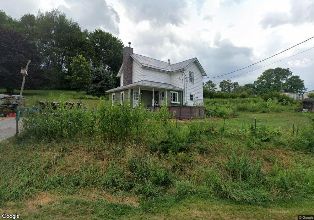
283 Wyant Rd Kittanning, PA 16201
North Buffalo Township NeighborhoodEstimated Value: $151,000 - $165,290
3
Beds
1
Bath
1,381
Sq Ft
$115/Sq Ft
Est. Value
About This Home
This home is located at 283 Wyant Rd, Kittanning, PA 16201 and is currently estimated at $158,145, approximately $114 per square foot. 283 Wyant Rd is a home located in Armstrong County with nearby schools including West Hills Intermediate School, West Hills Primary School, and Grace Christian School.
Ownership History
Date
Name
Owned For
Owner Type
Purchase Details
Closed on
Jan 15, 2010
Sold by
Toy Lynn A and Toy Darla S
Bought by
Buffalo Valley Ltd
Current Estimated Value
Purchase Details
Closed on
Aug 21, 2009
Sold by
Hillberry Deanna S
Bought by
Christy Jason D
Home Financials for this Owner
Home Financials are based on the most recent Mortgage that was taken out on this home.
Original Mortgage
$73,542
Interest Rate
5.19%
Mortgage Type
FHA
Purchase Details
Closed on
Jul 17, 2002
Create a Home Valuation Report for This Property
The Home Valuation Report is an in-depth analysis detailing your home's value as well as a comparison with similar homes in the area
Home Values in the Area
Average Home Value in this Area
Purchase History
| Date | Buyer | Sale Price | Title Company |
|---|---|---|---|
| Buffalo Valley Ltd | $185,000 | None Available | |
| Christy Jason D | $74,900 | None Available | |
| -- | $42,000 | -- |
Source: Public Records
Mortgage History
| Date | Status | Borrower | Loan Amount |
|---|---|---|---|
| Previous Owner | Christy Jason D | $73,542 |
Source: Public Records
Tax History Compared to Growth
Tax History
| Year | Tax Paid | Tax Assessment Tax Assessment Total Assessment is a certain percentage of the fair market value that is determined by local assessors to be the total taxable value of land and additions on the property. | Land | Improvement |
|---|---|---|---|---|
| 2025 | $2,036 | $22,910 | $14,950 | $7,960 |
| 2024 | $1,921 | $22,910 | $14,950 | $7,960 |
| 2023 | $1,791 | $22,910 | $14,950 | $7,960 |
| 2022 | $1,791 | $22,910 | $14,950 | $7,960 |
| 2021 | $1,770 | $22,910 | $14,950 | $7,960 |
| 2020 | $1,770 | $22,910 | $14,950 | $7,960 |
| 2019 | $1,770 | $22,910 | $14,950 | $7,960 |
| 2018 | $1,773 | $21,360 | $9,990 | $11,370 |
| 2017 | $1,760 | $22,910 | $14,950 | $7,960 |
| 2016 | $1,760 | $22,910 | $14,950 | $7,960 |
| 2015 | $1,531 | $22,910 | $14,950 | $7,960 |
| 2014 | $1,531 | $22,910 | $14,950 | $7,960 |
Source: Public Records
Map
Nearby Homes
- 1801 Freeport Rd
- 1039 Glade Park E
- 1339 Freeport Rd
- 115 Maple Ln
- 0 Wible Rd
- 208 Briar Hill Rd
- 217 Briar Hill Rd
- 1146 Worthington Slatelick Rd
- 334 Lemmon Hollow Rd
- 405 Hogg Rd
- 15291 U S 422
- 919 Pony Farm Rd
- 432 Bear St
- 536 1/2 Butler Rd
- 514 Southern Ave
- 417 2nd Ave
- 397 E Brady Rd
- 336 Walkchalk Rd
- 164 E Main St
- 228 Arthur St