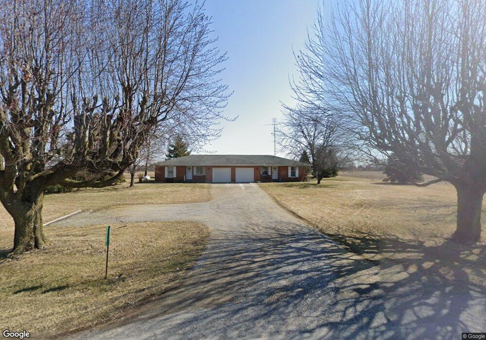
2830 N Pevee Rd Harrod, OH 45850
Estimated Value: $249,000 - $307,000
4
Beds
2
Baths
2,012
Sq Ft
$140/Sq Ft
Est. Value
About This Home
This home is located at 2830 N Pevee Rd, Harrod, OH 45850 and is currently estimated at $280,854, approximately $139 per square foot. 2830 N Pevee Rd is a home located in Allen County with nearby schools including Allen East Elementary School, Allen East Middle School, and Allen East High School.
Ownership History
Date
Name
Owned For
Owner Type
Purchase Details
Closed on
Dec 17, 2021
Sold by
Friesner Dwight T
Bought by
Friesner Farms
Current Estimated Value
Purchase Details
Closed on
Apr 21, 2016
Sold by
Friesner Keith Edward and Friesner Jennifer Anne
Bought by
Friesner Dwight T and Friesner Sharon Lee
Purchase Details
Closed on
Oct 23, 2013
Sold by
Friesner Sharon L and Rapp Dorcas E
Bought by
Friesner Keith Edward and Friesner Jennifer Anne
Purchase Details
Closed on
Sep 1, 1978
Bought by
Staley Mildred D
Create a Home Valuation Report for This Property
The Home Valuation Report is an in-depth analysis detailing your home's value as well as a comparison with similar homes in the area
Home Values in the Area
Average Home Value in this Area
Purchase History
| Date | Buyer | Sale Price | Title Company |
|---|---|---|---|
| Friesner Farms | $195,000 | None Available | |
| Friesner Sharon Lee | -- | None Available | |
| Friesner Dwight T | -- | None Available | |
| Friesner Dwight T | -- | None Available | |
| Friesner Keith Edward | $130,000 | None Available | |
| Staley Mildred D | $1,000 | -- |
Source: Public Records
Tax History Compared to Growth
Tax History
| Year | Tax Paid | Tax Assessment Tax Assessment Total Assessment is a certain percentage of the fair market value that is determined by local assessors to be the total taxable value of land and additions on the property. | Land | Improvement |
|---|---|---|---|---|
| 2024 | $3,215 | $91,840 | $11,340 | $80,500 |
| 2023 | $2,700 | $70,110 | $8,650 | $61,460 |
| 2022 | $2,721 | $70,110 | $8,650 | $61,460 |
| 2021 | $2,683 | $70,110 | $8,650 | $61,460 |
| 2020 | $2,468 | $62,720 | $8,050 | $54,670 |
| 2019 | $2,468 | $62,720 | $8,050 | $54,670 |
| 2018 | $2,358 | $62,720 | $8,050 | $54,670 |
| 2017 | $2,251 | $55,580 | $8,050 | $47,530 |
| 2016 | $2,248 | $55,580 | $8,050 | $47,530 |
| 2015 | $1,870 | $55,580 | $8,050 | $47,530 |
| 2014 | $1,870 | $53,380 | $7,670 | $45,710 |
| 2013 | $1,820 | $53,380 | $7,670 | $45,710 |
Source: Public Records
Map
Nearby Homes
- 2327 N Phillips Rd
- 118 E Main St
- 4985 N Phillips Rd
- 312 S Woodlawn Ave
- 000 Phillips Rd
- 000 Lincoln Hwy
- 9290 Lincoln Hwy
- 4071 Township Road 35
- 00 Lincoln Hwy
- 000 Napoleon Rd
- 0 Lincoln Hwy
- 647 Fisher Rd
- 128 W North Ave
- 211 W Buckeye Ave Unit 211 1/2
- 6782 County Road 15
- 210 N Gilbert St
- 629 N Main St
- 118 W Buckeye Ave
- 211 S Main St
- 613 S Gilbert St