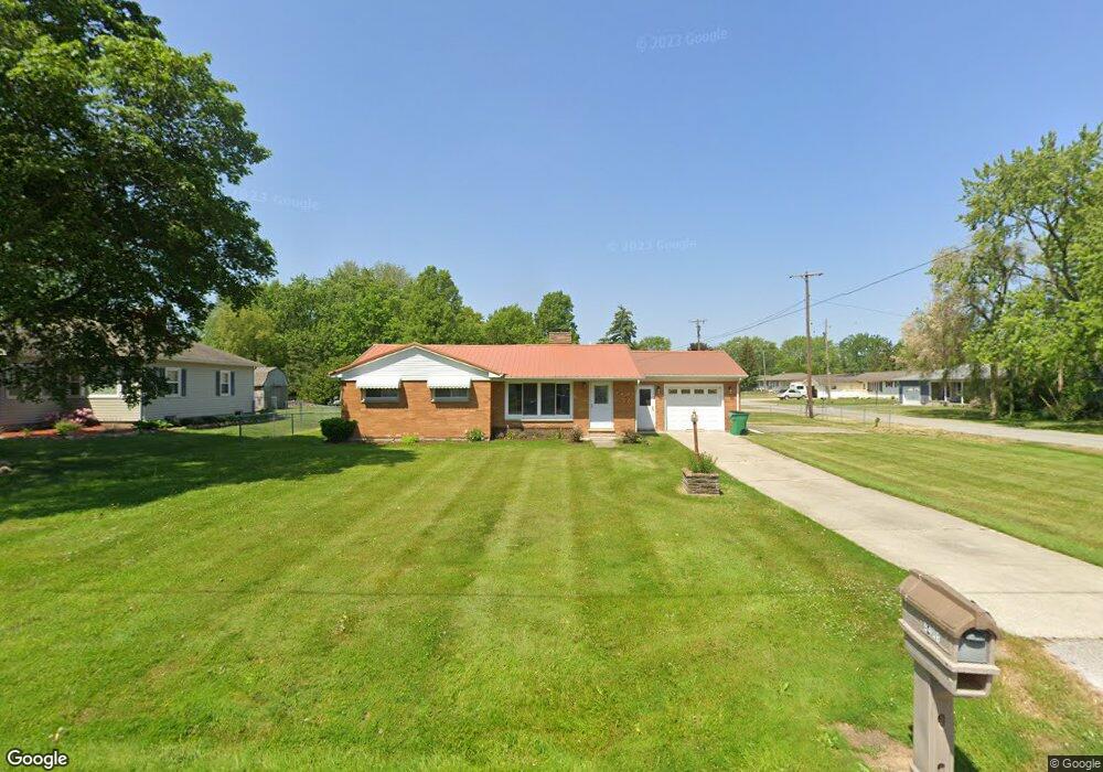
2834 Security Ln Bay City, MI 48706
Estimated Value: $143,000 - $177,000
3
Beds
1
Bath
864
Sq Ft
$180/Sq Ft
Est. Value
About This Home
This home is located at 2834 Security Ln, Bay City, MI 48706 and is currently estimated at $155,115, approximately $179 per square foot. 2834 Security Ln is a home located in Bay County with nearby schools including Mackensen Elementary School, Western Middle School, and Bay City Western High School.
Ownership History
Date
Name
Owned For
Owner Type
Purchase Details
Closed on
Mar 16, 2022
Sold by
Patrick Kalahar
Bought by
Timm Brian
Current Estimated Value
Home Financials for this Owner
Home Financials are based on the most recent Mortgage that was taken out on this home.
Original Mortgage
$93,279
Outstanding Balance
$85,450
Interest Rate
3.55%
Mortgage Type
FHA
Estimated Equity
$69,665
Purchase Details
Closed on
May 1, 2013
Sold by
Polisuk Gregory and Polisuk Joan
Bought by
Kalahar Patrick
Home Financials for this Owner
Home Financials are based on the most recent Mortgage that was taken out on this home.
Original Mortgage
$84,932
Interest Rate
3.51%
Mortgage Type
FHA
Purchase Details
Closed on
May 29, 2009
Sold by
Tomczak Michael L and Tomczak Jill
Bought by
Polisuk Gregory
Purchase Details
Closed on
Feb 17, 2005
Sold by
Tomczak Joyce B
Bought by
Tomczak Michael L
Create a Home Valuation Report for This Property
The Home Valuation Report is an in-depth analysis detailing your home's value as well as a comparison with similar homes in the area
Home Values in the Area
Average Home Value in this Area
Purchase History
We collect this data history from publicly available records. To have your information removed, we recommend requesting removal directly through your county’s website.
| Date | Buyer | Sale Price | Title Company |
|---|---|---|---|
| Timm Brian | $95,000 | Homeland Title Services | |
| Kalahar Patrick | $86,500 | None Available | |
| Polisuk Gregory | $92,300 | First American Title Ins Co | |
| Tomczak Michael L | -- | -- |
Source: Public Records
Mortgage History
We collect this data history from publicly available records. To have your information removed, we recommend requesting removal directly through your county’s website.
| Date | Status | Borrower | Loan Amount |
|---|---|---|---|
| Open | Timm Brian | $93,279 | |
| Previous Owner | Kalahar Patrick | $84,932 |
Source: Public Records
Tax History
| Year | Tax Paid | Tax Assessment Tax Assessment Total Assessment is a certain percentage of the fair market value that is determined by local assessors to be the total taxable value of land and additions on the property. | Land | Improvement |
|---|---|---|---|---|
| 2025 | $1,004 | $72,200 | $0 | $0 |
| 2024 | $974 | $66,200 | $0 | $0 |
| 2023 | $957 | $65,000 | $0 | $0 |
| 2022 | $1,556 | $53,200 | $0 | $0 |
| 2021 | $2,141 | $55,700 | $55,700 | $0 |
| 2020 | $2,140 | $46,800 | $46,800 | $0 |
| 2019 | $2,054 | $39,900 | $0 | $0 |
| 2018 | $1,343 | $42,400 | $0 | $0 |
| 2017 | $1,261 | $41,200 | $0 | $0 |
| 2016 | $1,264 | $40,300 | $0 | $40,300 |
| 2015 | $586 | $34,500 | $0 | $34,500 |
| 2014 | $586 | $39,400 | $0 | $39,400 |
Source: Public Records
Map
Nearby Homes
- 5677 Michael Dr
- 5620 W Spring Knoll Dr
- 5610 W Spring Knoll Dr Unit 99
- 2985 Continental Dr
- 5629 Firethorne Dr
- 5643 Firethorne Dr
- 0 3 Mile Rd
- 5661 Macintosh Dr
- 2880 E Fisher Rd
- 2921 E Fisher Rd
- 40 Westside Saginaw Rd
- 3052 E Fisher Rd
- 3193 Haberland Dr
- 3345 Brentway Dr
- 2469 2 Mile Rd
- 3176 E Fisher Rd
- 3345 Northway Dr
- 0 S Two Mile Rd Unit 50142051
- 3244 E Fisher Rd
- 0 Fisher Rd
- 5408 Harvest Ct
- 5424 Harvest Ct
- 2826 Security Ln
- 5398 Harvest Ct
- 2833 Security Ln
- 2823 Security Ln
- 2816 Security Ln
- 2819 Security Ln
- 5390 Harvest Ct
- 5441 Homestead Ln
- 2815 Security Ln
- 5380 Harvest Ct
- 5442 Harvest Ct
- 2806 Security Ln
- 5417 Harvest Ct
- 5405 Harvest Ct
- 5437 Homestead Ln
- 5429 Harvest Ct
- 5399 Harvest Ct
- 5370 Harvest Ct
Your Personal Tour Guide
Ask me questions while you tour the home.