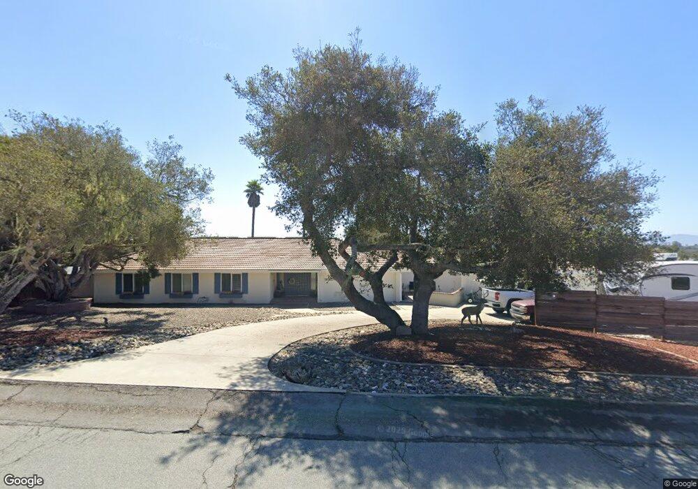
284 Saint Andrews Way Lompoc, CA 93436
Estimated Value: $951,000 - $1,035,000
3
Beds
3
Baths
3,397
Sq Ft
$290/Sq Ft
Est. Value
About This Home
This home is located at 284 Saint Andrews Way, Lompoc, CA 93436 and is currently estimated at $986,384, approximately $290 per square foot. 284 Saint Andrews Way is a home located in Santa Barbara County with nearby schools including Buena Vista Elementary School, Cabrillo High School, and Olive Grove Charter - Lompoc.
Ownership History
Date
Name
Owned For
Owner Type
Purchase Details
Closed on
Sep 22, 2022
Sold by
Cruz Robert M and Cruz Jennifer M
Bought by
Robert And Jennifer Cruz Family Trust
Current Estimated Value
Purchase Details
Closed on
Jan 27, 2022
Sold by
Means Family Trust
Bought by
Cruz Robert and Cruz Jennifer M
Home Financials for this Owner
Home Financials are based on the most recent Mortgage that was taken out on this home.
Original Mortgage
$704,000
Interest Rate
3.55%
Mortgage Type
New Conventional
Purchase Details
Closed on
Dec 17, 1998
Sold by
Means James A and Means Therese L
Bought by
Means James A and Means Therese L
Create a Home Valuation Report for This Property
The Home Valuation Report is an in-depth analysis detailing your home's value as well as a comparison with similar homes in the area
Home Values in the Area
Average Home Value in this Area
Purchase History
| Date | Buyer | Sale Price | Title Company |
|---|---|---|---|
| Robert And Jennifer Cruz Family Trust | -- | -- | |
| Cruz Robert | $880,000 | First American Title | |
| Means James A | -- | -- |
Source: Public Records
Mortgage History
| Date | Status | Borrower | Loan Amount |
|---|---|---|---|
| Previous Owner | Cruz Robert | $704,000 |
Source: Public Records
Tax History
| Year | Tax Paid | Tax Assessment Tax Assessment Total Assessment is a certain percentage of the fair market value that is determined by local assessors to be the total taxable value of land and additions on the property. | Land | Improvement |
|---|---|---|---|---|
| 2025 | $7,088 | $623,373 | $246,067 | $377,306 |
| 2023 | $7,088 | $599,168 | $236,513 | $362,655 |
| 2022 | $4,365 | $362,231 | $71,126 | $291,105 |
| 2021 | $4,410 | $355,130 | $69,732 | $285,398 |
| 2020 | $4,365 | $351,489 | $69,017 | $282,472 |
| 2019 | $4,299 | $344,598 | $67,664 | $276,934 |
| 2018 | $4,238 | $337,842 | $66,338 | $271,504 |
| 2017 | $4,076 | $331,219 | $65,038 | $266,181 |
| 2016 | $3,735 | $324,725 | $63,763 | $260,962 |
| 2014 | $3,653 | $313,584 | $61,576 | $252,008 |
Source: Public Records
Map
Nearby Homes
- 250 Saint Andrews Way
- 384 Falcon Crest Dr
- 372 Falcon Crest Dr
- 4166 Oakwood Ct
- 4173 Oakwood Ct
- 649 Burning Tree Way
- 372 Oak Hill Dr
- 73 Stanford Cir
- 6 Stanford Cir
- 0 Oak Hill Dr Unit 24-783
- 4473 Greenbrier Rd
- 240 Oak Hill Dr
- 18 Galaxy Way
- 113 Gemini Ave
- 3939 Mesa Circle Dr
- 3922 Mesa Circle Dr
- 3916 Mesa Circle Dr Unit A
- 4447 Falcon Dr
- 3725 Jupiter Ave
- 3843 Cassini Cir Unit 3
- 3991 Burnham Dr
- 289 St Andrews Way
- 289 Saint Andrews Way
- 266 Saint Andrews Way
- 310 Saint Andrews Way
- 3979 Burnham Dr
- 3985 Burnham Dr
- 3996 Burnham Dr
- 271 Saint Andrews Way
- 4019 Saint Andrews Ct
- 311 Falcon Crest Dr
- 259 St Andrews Way Unit 259 S
- 4030 Saint Andrews Ct
- 3988 Burnham Dr
- 318 Saint Andrews Way
- 3965 Burnham Dr
- 3974 Burnham Dr
- 317 Saint Andrews Way
- 299 Falcon Crest Dr
- 313 Falcon Crest Dr
Your Personal Tour Guide
Ask me questions while you tour the home.