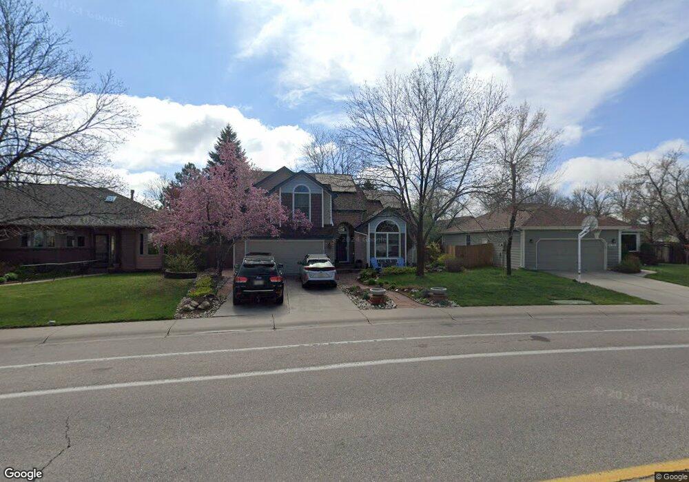
2842 Dunbar Ave Fort Collins, CO 80526
Estimated Value: $549,000 - $600,000
3
Beds
3
Baths
1,805
Sq Ft
$318/Sq Ft
Est. Value
About This Home
This home is located at 2842 Dunbar Ave, Fort Collins, CO 80526 and is currently estimated at $574,104, approximately $318 per square foot. 2842 Dunbar Ave is a home located in Larimer County with nearby schools including Bennett Elementary School, Blevins Middle School, and Rocky Mountain High School.
Ownership History
Date
Name
Owned For
Owner Type
Purchase Details
Closed on
Aug 24, 2004
Sold by
Hall Patricia A
Bought by
Watkins Donald and Simonson Patricia
Current Estimated Value
Home Financials for this Owner
Home Financials are based on the most recent Mortgage that was taken out on this home.
Original Mortgage
$150,500
Interest Rate
5.73%
Mortgage Type
Unknown
Purchase Details
Closed on
Jan 7, 1999
Sold by
Hall Roger D
Bought by
Hall Patricia A
Home Financials for this Owner
Home Financials are based on the most recent Mortgage that was taken out on this home.
Original Mortgage
$116,000
Interest Rate
6.68%
Create a Home Valuation Report for This Property
The Home Valuation Report is an in-depth analysis detailing your home's value as well as a comparison with similar homes in the area
Home Values in the Area
Average Home Value in this Area
Purchase History
| Date | Buyer | Sale Price | Title Company |
|---|---|---|---|
| Watkins Donald | -- | North American Title | |
| Hall Patricia A | -- | -- |
Source: Public Records
Mortgage History
| Date | Status | Borrower | Loan Amount |
|---|---|---|---|
| Previous Owner | Watkins Donald | $150,500 | |
| Previous Owner | Hall Patricia A | $116,000 |
Source: Public Records
Tax History Compared to Growth
Tax History
| Year | Tax Paid | Tax Assessment Tax Assessment Total Assessment is a certain percentage of the fair market value that is determined by local assessors to be the total taxable value of land and additions on the property. | Land | Improvement |
|---|---|---|---|---|
| 2025 | $2,693 | $38,451 | $3,015 | $35,436 |
| 2024 | $2,562 | $38,451 | $3,015 | $35,436 |
| 2022 | $2,772 | $29,357 | $3,128 | $26,229 |
| 2021 | $2,801 | $30,202 | $3,218 | $26,984 |
| 2020 | $2,676 | $28,601 | $3,218 | $25,383 |
| 2019 | $2,688 | $28,601 | $3,218 | $25,383 |
| 2018 | $2,316 | $25,409 | $3,240 | $22,169 |
| 2017 | $2,308 | $25,409 | $3,240 | $22,169 |
| 2016 | $2,022 | $22,145 | $3,582 | $18,563 |
| 2015 | $2,007 | $22,140 | $3,580 | $18,560 |
| 2014 | $1,749 | $19,170 | $3,580 | $15,590 |
Source: Public Records
Map
Nearby Homes
- 2855 Trenton Way
- 2918 Silverplume Dr Unit C1
- 1601 W Swallow Rd Unit 1
- 1601 W Swallow Rd Unit 9
- 1601 W Swallow Rd
- 2718 Dunbar Ave
- 1531 W Swallow Rd Unit 25
- 1531 W Swallow Rd Unit 28
- 2706 Dunbar Ave
- 2828 Silverplume Dr
- 2828 Silverplume Dr Unit R3
- 2738 Bradford Square
- 1401 Sioux Blvd
- 1419 Glen Haven Dr
- 2109 W Drake Rd
- 2613 Hanover Dr
- 1231 W Swallow Rd Unit 323
- 1231 W Swallow Rd Unit 316
- 1231 W Swallow Rd Unit 314
- 1213 W Swallow Rd Unit 213
- 2848 Dunbar Ave
- 2836 Dunbar Ave
- 2931 Silverplume Dr
- 2925 Silverplume Dr
- 2854 Dunbar Ave
- 2937 Silverplume Dr
- 2919 Silverplume Dr
- 2843 Dunbar Ave
- 2837 Dunbar Ave
- 2943 Silverplume Dr
- 2944 Telluride Ct
- 2945 Telluride Ct
- 2849 Dunbar Ave
- 2831 Dunbar Ave
- 1525 Hull St Unit B3
- 1525 Hull St Unit B2
- 1525 Hull St Unit B1
- 1525 Hull St Unit A6
- 1525 Hull St Unit A5
- 1525 Hull St Unit A4