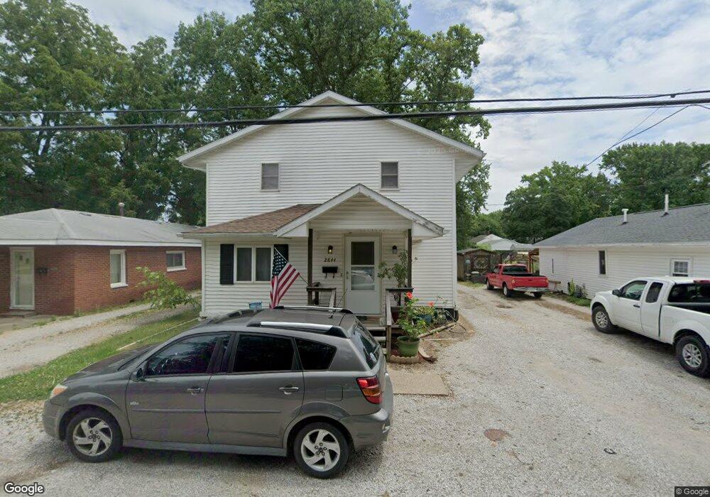
2844 S 15th St Unit 1 Springfield, IL 62703
Estimated Value: $110,000 - $131,711
5
Beds
2
Baths
2,100
Sq Ft
$56/Sq Ft
Est. Value
About This Home
This home is located at 2844 S 15th St Unit 1, Springfield, IL 62703 and is currently estimated at $117,178, approximately $55 per square foot. 2844 S 15th St Unit 1 is a home located in Sangamon County with nearby schools including Edwin A. Lee Elementary School, Jefferson Middle School, and Springfield Southeast High School.
Ownership History
Date
Name
Owned For
Owner Type
Purchase Details
Closed on
Jul 24, 2024
Sold by
Ushman Martha
Bought by
Forbes Angela
Current Estimated Value
Purchase Details
Closed on
Jun 17, 2011
Purchase Details
Closed on
Jun 14, 2010
Purchase Details
Closed on
Sep 22, 2009
Purchase Details
Closed on
May 27, 2005
Create a Home Valuation Report for This Property
The Home Valuation Report is an in-depth analysis detailing your home's value as well as a comparison with similar homes in the area
Home Values in the Area
Average Home Value in this Area
Purchase History
| Date | Buyer | Sale Price | Title Company |
|---|---|---|---|
| Forbes Angela | -- | None Listed On Document | |
| -- | $39,500 | -- | |
| -- | -- | -- | |
| -- | -- | -- | |
| -- | $79,500 | -- |
Source: Public Records
Tax History Compared to Growth
Tax History
| Year | Tax Paid | Tax Assessment Tax Assessment Total Assessment is a certain percentage of the fair market value that is determined by local assessors to be the total taxable value of land and additions on the property. | Land | Improvement |
|---|---|---|---|---|
| 2024 | $2,612 | $32,423 | $6,747 | $25,676 |
| 2023 | $2,561 | $30,021 | $6,247 | $23,774 |
| 2022 | $2,458 | $28,410 | $5,912 | $22,498 |
| 2021 | $2,380 | $27,296 | $5,680 | $21,616 |
| 2020 | $2,296 | $26,999 | $5,618 | $21,381 |
| 2019 | $2,214 | $26,527 | $5,520 | $21,007 |
| 2018 | $2,137 | $26,413 | $5,496 | $20,917 |
| 2017 | $2,087 | $26,008 | $5,412 | $20,596 |
| 2016 | $2,023 | $25,336 | $5,272 | $20,064 |
| 2015 | $1,984 | $24,764 | $5,153 | $19,611 |
| 2014 | $1,951 | $24,558 | $5,110 | $19,448 |
| 2013 | $1,921 | $24,821 | $5,165 | $19,656 |
Source: Public Records
Map
Nearby Homes
- 2910 S 14th St
- 2828 S Hoover Ave
- 2942 S 11th St
- 3106 S Woodward St Unit 1
- 1725 Adlai Stevenson Dr Unit 1
- 3201/3201 1/2 S 3rd St
- Lot 1 & 2 Bunn Dr
- 1004 Bryn Mawr Blvd
- 2800 Via Rosso St Unit 135
- 2800 Via Rosso St Unit 50
- 2800 Via Rosso St Unit 194
- 3209 Buckner St Unit 1
- 2110 Bradley Ct
- 3301 Stanton St Unit 1
- 3213 Sherman St Unit 1
- 3100 Butler St Unit 1833
- 2516 S 10th St
- 2517 S 10th St
- 1937 E Pickett St Unit 1
- 2339 S 10th St
- 2842 S 15th St Unit 1
- 2850 S 15th St
- 2849 S 15th St Unit 1
- 2845 S 15th St Unit 1
- 2856 S 15th St
- 2841 S 15th St
- 2828 S 15th St
- 2837 S 15th St
- 2826 S 15th St Unit 1
- 2860 S 15th St Unit 1
- 2824 S 15th St Unit 1
- 2833 S 16th St Unit 1
- 2864 S 15th St Unit 1
- 2829 S 15th St Unit 1
- 2855 S 15th St
- 2835 S 16th St Unit 1
- 1511 E Knox Ave Unit 1
- 2831 S 16th St Unit 1
- 2825 S 15th St
- 2827 S 16th St