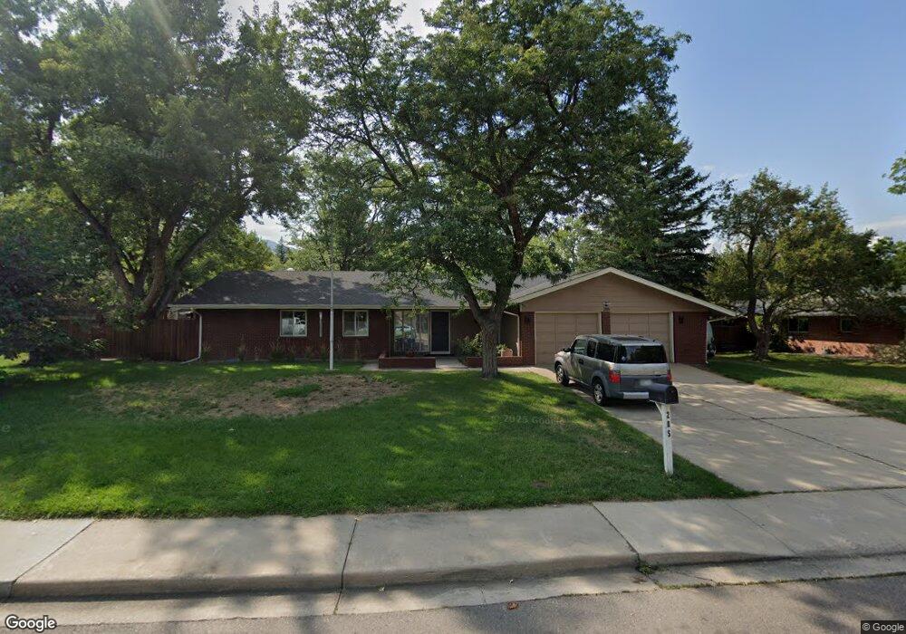
285 Lipan Way Boulder, CO 80303
Southeast Boulder NeighborhoodEstimated Value: $1,338,474 - $1,461,000
4
Beds
3
Baths
2,965
Sq Ft
$474/Sq Ft
Est. Value
About This Home
This home is located at 285 Lipan Way, Boulder, CO 80303 and is currently estimated at $1,404,369, approximately $473 per square foot. 285 Lipan Way is a home located in Boulder County with nearby schools including Eisenhower Elementary School, Manhattan Middle School of the Arts & Academics, and Fairview High School.
Ownership History
Date
Name
Owned For
Owner Type
Purchase Details
Closed on
Jun 5, 2009
Sold by
Djay Peter
Bought by
Clemensen Scott E
Current Estimated Value
Home Financials for this Owner
Home Financials are based on the most recent Mortgage that was taken out on this home.
Original Mortgage
$436,000
Outstanding Balance
$274,727
Interest Rate
4.72%
Mortgage Type
Purchase Money Mortgage
Estimated Equity
$1,129,642
Purchase Details
Closed on
Nov 5, 2004
Sold by
Johnson Cynthia L
Bought by
Djay Peter
Home Financials for this Owner
Home Financials are based on the most recent Mortgage that was taken out on this home.
Original Mortgage
$333,700
Interest Rate
5.66%
Mortgage Type
Purchase Money Mortgage
Purchase Details
Closed on
Oct 7, 1999
Sold by
Evans Edmund T
Bought by
Evans Edmund T
Purchase Details
Closed on
Jan 13, 1965
Bought by
Clemensen Scott E and Clemensen Bessie Odea
Create a Home Valuation Report for This Property
The Home Valuation Report is an in-depth analysis detailing your home's value as well as a comparison with similar homes in the area
Home Values in the Area
Average Home Value in this Area
Purchase History
| Date | Buyer | Sale Price | Title Company |
|---|---|---|---|
| Clemensen Scott E | $545,000 | 1St Colorado Title | |
| Djay Peter | $535,000 | -- | |
| Evans Edmund T | -- | -- | |
| Clemensen Scott E | -- | -- |
Source: Public Records
Mortgage History
| Date | Status | Borrower | Loan Amount |
|---|---|---|---|
| Open | Clemensen Scott E | $436,000 | |
| Previous Owner | Djay Peter | $333,700 |
Source: Public Records
Tax History Compared to Growth
Tax History
| Year | Tax Paid | Tax Assessment Tax Assessment Total Assessment is a certain percentage of the fair market value that is determined by local assessors to be the total taxable value of land and additions on the property. | Land | Improvement |
|---|---|---|---|---|
| 2025 | $7,300 | $74,969 | $53,013 | $21,956 |
| 2024 | $7,300 | $74,969 | $53,013 | $21,956 |
| 2023 | $7,174 | $83,067 | $64,521 | $22,231 |
| 2022 | $5,979 | $64,385 | $46,155 | $18,230 |
| 2021 | $5,701 | $66,237 | $47,483 | $18,754 |
| 2020 | $5,382 | $61,827 | $38,682 | $23,145 |
| 2019 | $5,299 | $61,827 | $38,682 | $23,145 |
| 2018 | $5,082 | $58,615 | $36,360 | $22,255 |
| 2017 | $4,923 | $64,802 | $40,198 | $24,604 |
| 2016 | $4,633 | $53,523 | $26,825 | $26,698 |
| 2015 | $4,387 | $43,263 | $19,900 | $23,363 |
| 2014 | $3,638 | $43,263 | $19,900 | $23,363 |
Source: Public Records
Map
Nearby Homes
- 325 Fox Ct
- 500 Mohawk Dr Unit 510
- 4835 Moorhead Ave
- 4415 Laguna Place Unit 201
- 4500 Baseline Rd Unit 3302
- 4500 Baseline Rd Unit 4104
- 4500 Baseline Rd Unit 2107
- 450 S 41st St
- 611 Tantra Dr
- 625 Manhattan Place Unit 308
- 450 S 40th St
- 4630 Talbot Dr
- 645 Manhattan Place Unit 304
- 500 Manhattan Dr Unit B1
- 695 Manhattan Dr Unit 109
- 695 Manhattan Dr Unit 219
- 3410 Ash Ave
- 20 S Boulder Cir Unit 2312
- 20 S Boulder Cir Unit 2314
- 20 S Boulder Cir Unit 2109