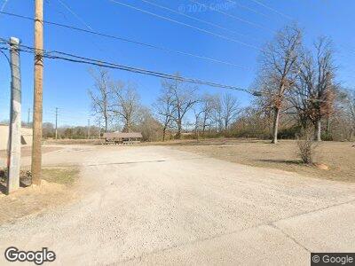
285 Moose Lodge Loop Savannah, TN 38372
Estimated Value: $534,000 - $1,164,911
--
Bed
5
Baths
3,930
Sq Ft
$216/Sq Ft
Est. Value
About This Home
This home is located at 285 Moose Lodge Loop, Savannah, TN 38372 and is currently estimated at $849,456, approximately $216 per square foot. 285 Moose Lodge Loop is a home located in Hardin County with nearby schools including Hardin County High School and Hardin County Christian School.
Ownership History
Date
Name
Owned For
Owner Type
Purchase Details
Closed on
Oct 31, 2008
Sold by
Prince Dee
Bought by
Roach Mark
Current Estimated Value
Purchase Details
Closed on
Jan 7, 2002
Sold by
Carter Timber And Land Dev
Bought by
Mark Roach
Purchase Details
Closed on
Dec 10, 2001
Bought by
Carter Timber & Land Development Inc
Purchase Details
Closed on
Jun 30, 1998
Sold by
Jones Blount
Bought by
Harvey Mcfall
Purchase Details
Closed on
Jun 20, 1966
Bought by
Blount Jones and Blount Beulah
Purchase Details
Closed on
Mar 20, 1951
Bought by
Not Available
Create a Home Valuation Report for This Property
The Home Valuation Report is an in-depth analysis detailing your home's value as well as a comparison with similar homes in the area
Home Values in the Area
Average Home Value in this Area
Purchase History
| Date | Buyer | Sale Price | Title Company |
|---|---|---|---|
| Roach Mark | $6,000 | -- | |
| Mark Roach | $240,000 | -- | |
| Carter Timber & Land Development Inc | $227,000 | -- | |
| Harvey Mcfall | $15,000 | -- | |
| Blount Jones | -- | -- | |
| -- | -- | -- |
Source: Public Records
Tax History Compared to Growth
Tax History
| Year | Tax Paid | Tax Assessment Tax Assessment Total Assessment is a certain percentage of the fair market value that is determined by local assessors to be the total taxable value of land and additions on the property. | Land | Improvement |
|---|---|---|---|---|
| 2024 | $4,739 | $270,775 | $37,825 | $232,950 |
| 2023 | $4,739 | $270,775 | $37,825 | $232,950 |
| 2022 | $3,593 | $174,400 | $23,950 | $150,450 |
| 2021 | $3,593 | $174,400 | $23,950 | $150,450 |
| 2020 | $3,399 | $174,400 | $23,950 | $150,450 |
| 2019 | $3,399 | $165,000 | $23,950 | $141,050 |
| 2018 | $3,286 | $165,000 | $23,950 | $141,050 |
| 2017 | $3,378 | $162,400 | $17,000 | $145,400 |
| 2016 | $3,378 | $162,400 | $17,000 | $145,400 |
| 2015 | $2,956 | $162,400 | $17,000 | $145,400 |
| 2014 | $2,835 | $155,750 | $17,000 | $138,750 |
Source: Public Records
Map
Nearby Homes
- 0 226 Hwy Unit 10195976
- 0 226 Hwy Unit 10175525
- 130 Tree Canopy Cove
- 285 Music Way
- 85 Two Boys Rd
- 11445 U S 64
- 150 Moore Rd
- 150 Cassandra Way
- 70 Holt St
- 415 Cagle Cir
- 500 Central Ave
- 95 Cedar Cove Ln
- 195 Carrie B Dr
- 00 Squaw St
- 1225 Main St E
- 485 Moore Rd
- 415 Cedar Cove Ln
- 200 Hardin Rd
- 135 Beech St
- 134 Horse Creek Rd
- 285 Moose Lodge Loop
- 10375 Highway 64
- 145 Moose Lodge Loop
- 145 Moose Lodge Loop
- 12165 Highway 226 St
- 65 Moose Lodge Loop
- 6910 Highway 226
- 35 Moose Lodge Loop
- 165 Laden Ln
- 0 Laden Ln
- 40 Laden Ln
- 235 Laden Ln
- 235 Laden Ln
- 100 Laden Ln
- 15 Moose Lodge Loop
- 42 Laden Ln
- 16 Moose Lodge Loop
- 180 Laden Ln
- 45 Alfred Rd
- 9859 Highway 64-9859
