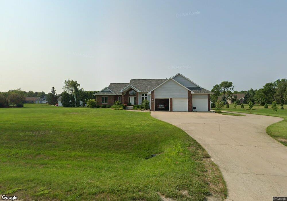
2864 Hunt Trail Cedar Rapids, IA 52411
Estimated Value: $488,000 - $664,000
5
Beds
5
Baths
2,561
Sq Ft
$229/Sq Ft
Est. Value
About This Home
This home is located at 2864 Hunt Trail, Cedar Rapids, IA 52411 and is currently estimated at $587,349, approximately $229 per square foot. 2864 Hunt Trail is a home located in Linn County with nearby schools including Hiawatha Elementary School, Harding Middle School, and John F. Kennedy High School.
Ownership History
Date
Name
Owned For
Owner Type
Purchase Details
Closed on
Jul 20, 1998
Sold by
Schmitt Ricky A and Miller Marin E
Bought by
Houser Larry J and Houser Patricia K
Current Estimated Value
Home Financials for this Owner
Home Financials are based on the most recent Mortgage that was taken out on this home.
Original Mortgage
$60,000
Interest Rate
7.03%
Create a Home Valuation Report for This Property
The Home Valuation Report is an in-depth analysis detailing your home's value as well as a comparison with similar homes in the area
Home Values in the Area
Average Home Value in this Area
Purchase History
| Date | Buyer | Sale Price | Title Company |
|---|---|---|---|
| Houser Larry J | $284,500 | -- |
Source: Public Records
Mortgage History
| Date | Status | Borrower | Loan Amount |
|---|---|---|---|
| Closed | Houser Larry J | $60,000 |
Source: Public Records
Tax History
| Year | Tax Paid | Tax Assessment Tax Assessment Total Assessment is a certain percentage of the fair market value that is determined by local assessors to be the total taxable value of land and additions on the property. | Land | Improvement |
|---|---|---|---|---|
| 2025 | $5,516 | $548,200 | $66,300 | $481,900 |
| 2024 | $5,372 | $492,600 | $66,300 | $426,300 |
| 2023 | $5,372 | $492,600 | $66,300 | $426,300 |
| 2022 | $5,308 | $389,000 | $66,300 | $322,700 |
| 2021 | $5,562 | $389,000 | $66,300 | $322,700 |
| 2020 | $5,562 | $376,900 | $50,300 | $326,600 |
| 2019 | $5,080 | $352,000 | $50,300 | $301,700 |
Source: Public Records
Map
Nearby Homes
- 3012 Prairielight Ct
- 3025 Valley Ct
- 9800 Hall Rd
- 2874 Grassland Ct
- 2872 Grassland Ct
- 2870 Grassland Ct
- 2877 Grassland Ct
- 2879 Grassland Ct
- 2875 Grassland Ct
- 2873 Grassland Ct
- 2856 Mary Green Rd
- 2853 Mary Green Rd
- 2851 Mary Green Rd
- 10101 Hall Rd
- 3551 Mclain Way
- 3553 Mclain Way
- 2830 Prairie Wind Ct
- 3526 Reed Rd
- 3012 Prairielight Dr
- 2821 Prairielight Dr
- 2856 Hunt Trail
- 2870 Hunt Trail
- 2871 Hunt Trail
- 2863 Hunt Trail
- 2875 Hunt Trail
- 2859 Hunt Trail
- 2852 Hunt Trail
- 2855 Hunt Trail
- 5781 Hunt Ridge Dr
- 5735 Hunt Rd
- 5799 Hunt Ridge Dr
- 5759 Hunt Ridge Dr
- 2848 Hunt Trail
- 5697 Hunt Ridge Dr
- 5683 Hunt Ridge Dr
- 2847 Hunt Trail
- 5803 Hunt Rd
- 5719 Hunt Ridge Dr
- 5737 Hunt Ridge Dr
- 5655 Hunt Ridge Dr
Your Personal Tour Guide
Ask me questions while you tour the home.