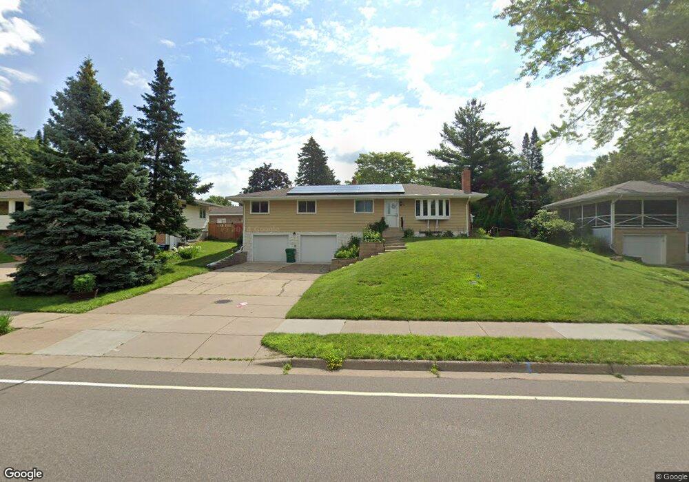
2864 Western Ave N Saint Paul, MN 55113
South Owasso NeighborhoodEstimated Value: $373,628 - $424,000
3
Beds
2
Baths
830
Sq Ft
$479/Sq Ft
Est. Value
About This Home
This home is located at 2864 Western Ave N, Saint Paul, MN 55113 and is currently estimated at $397,907, approximately $479 per square foot. 2864 Western Ave N is a home located in Ramsey County with nearby schools including Central Park Elementary School, Roseville Area Middle School, and Roseville Area Senior High School.
Ownership History
Date
Name
Owned For
Owner Type
Purchase Details
Closed on
Jan 17, 2018
Sold by
Komm Christine Ellen
Bought by
Cline Leonard J
Current Estimated Value
Home Financials for this Owner
Home Financials are based on the most recent Mortgage that was taken out on this home.
Original Mortgage
$242,100
Outstanding Balance
$204,304
Interest Rate
3.94%
Mortgage Type
New Conventional
Estimated Equity
$193,603
Create a Home Valuation Report for This Property
The Home Valuation Report is an in-depth analysis detailing your home's value as well as a comparison with similar homes in the area
Home Values in the Area
Average Home Value in this Area
Purchase History
| Date | Buyer | Sale Price | Title Company |
|---|---|---|---|
| Cline Leonard J | $277,151 | Entitle Inc |
Source: Public Records
Mortgage History
| Date | Status | Borrower | Loan Amount |
|---|---|---|---|
| Open | Cline Leonard J | $242,100 |
Source: Public Records
Tax History Compared to Growth
Tax History
| Year | Tax Paid | Tax Assessment Tax Assessment Total Assessment is a certain percentage of the fair market value that is determined by local assessors to be the total taxable value of land and additions on the property. | Land | Improvement |
|---|---|---|---|---|
| 2025 | $4,444 | $341,300 | $95,000 | $246,300 |
| 2023 | $4,444 | $321,000 | $85,500 | $235,500 |
| 2022 | $4,096 | $301,300 | $85,500 | $215,800 |
| 2021 | $3,402 | $280,400 | $85,500 | $194,900 |
| 2020 | $3,670 | $252,600 | $76,000 | $176,600 |
| 2019 | $3,450 | $254,600 | $80,000 | $174,600 |
| 2018 | $3,300 | $234,900 | $80,700 | $154,200 |
| 2017 | $2,770 | $220,700 | $80,700 | $140,000 |
| 2016 | $2,736 | $0 | $0 | $0 |
| 2015 | $1,484 | $195,300 | $77,900 | $117,400 |
| 2014 | $2,652 | $0 | $0 | $0 |
Source: Public Records
Map
Nearby Homes
- 405 Judith Ave
- 387 Iona Ln
- 2814 Matilda St
- 2970 Western Ave N
- 255 County Road C2 W
- 2802 Marion St
- 2720 MacKubin St
- 2687 Galtier St
- 437 County Road C W
- 540 Woodhill Dr Unit 71
- 350 County Road C W
- 613 S Owasso Blvd W
- 2748 Kent St
- 2730 Dale St N Unit D101
- 2730 Dale St N Unit D309
- 2580 Western Ave N
- 2720 Dale St N Unit C208
- 2710 Dale St N Unit B212
- 556 County Road C W
- 3020 Rice St Unit Trailer B16
- 2856 Western Ave N
- 2874 Western Ave N
- 2865 Virginia Ave
- 2857 Virginia Ave
- 2873 Virginia Ave
- 2848 Western Ave N
- 388 Centennial Dr
- 2849 Virginia Ave
- 2840 Western Ave N
- 369 County Road C2 W
- 363 County Road C2 W
- 2841 Virginia Ave
- 397 Centennial Dr
- 398 Centennial Dr
- 2843 Western Ave N
- 355 County Road C2 W
- 2856 Virginia Ave
- 2834 Western Ave N
- 2874 Virginia Ave
- 2833 Virginia Ave