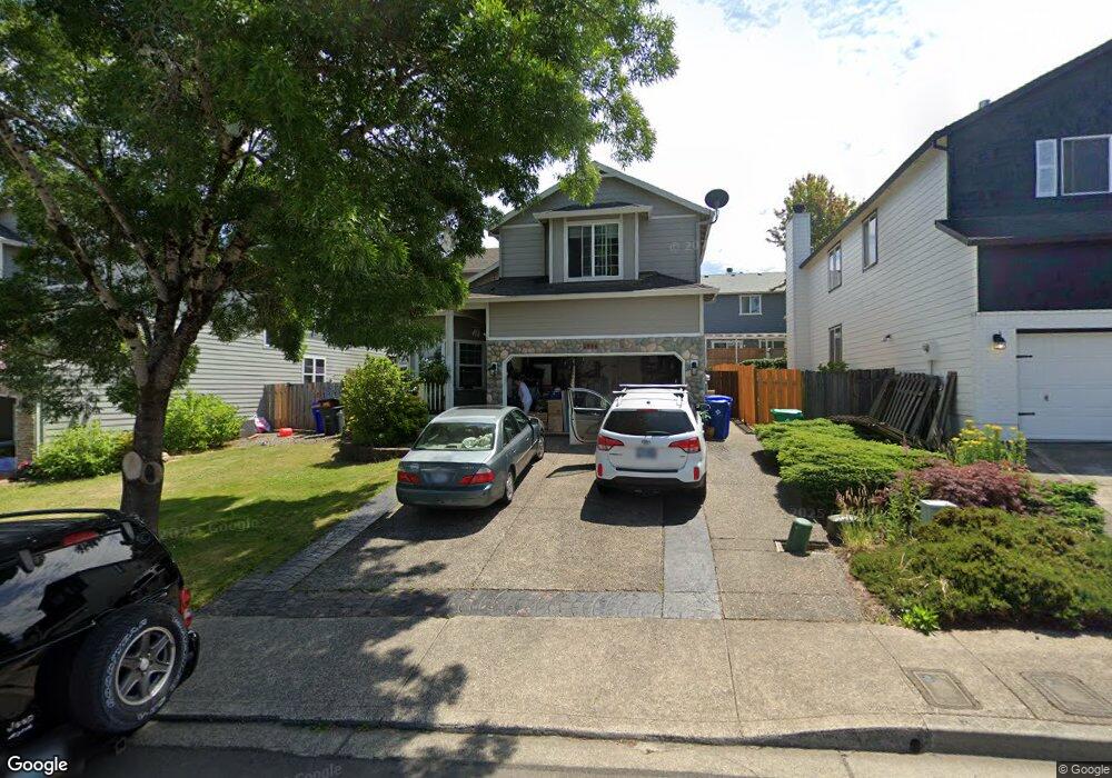
2868 SE Quail Dr Gresham, OR 97080
Kelly Creek NeighborhoodEstimated Value: $501,000 - $545,000
4
Beds
3
Baths
1,936
Sq Ft
$265/Sq Ft
Est. Value
About This Home
This home is located at 2868 SE Quail Dr, Gresham, OR 97080 and is currently estimated at $512,605, approximately $264 per square foot. 2868 SE Quail Dr is a home located in Multnomah County with nearby schools including East Orient Elementary School, West Orient Middle School, and Sam Barlow High School.
Ownership History
Date
Name
Owned For
Owner Type
Purchase Details
Closed on
Jul 22, 2014
Sold by
Payne Donald
Bought by
Phillips Dean M and Phillips Barbara J
Current Estimated Value
Home Financials for this Owner
Home Financials are based on the most recent Mortgage that was taken out on this home.
Original Mortgage
$195,375
Outstanding Balance
$148,382
Interest Rate
4.16%
Mortgage Type
New Conventional
Estimated Equity
$364,223
Purchase Details
Closed on
Jan 29, 2001
Sold by
D R Horton Inc Portland
Bought by
Payne Donald and Payne Nancy
Home Financials for this Owner
Home Financials are based on the most recent Mortgage that was taken out on this home.
Original Mortgage
$137,600
Interest Rate
7.13%
Mortgage Type
Purchase Money Mortgage
Create a Home Valuation Report for This Property
The Home Valuation Report is an in-depth analysis detailing your home's value as well as a comparison with similar homes in the area
Home Values in the Area
Average Home Value in this Area
Purchase History
| Date | Buyer | Sale Price | Title Company |
|---|---|---|---|
| Phillips Dean M | $260,500 | First American | |
| Payne Donald | $170,000 | First American Title Co |
Source: Public Records
Mortgage History
| Date | Status | Borrower | Loan Amount |
|---|---|---|---|
| Open | Phillips Dean M | $195,375 | |
| Previous Owner | Payne Donald | $137,600 |
Source: Public Records
Tax History
| Year | Tax Paid | Tax Assessment Tax Assessment Total Assessment is a certain percentage of the fair market value that is determined by local assessors to be the total taxable value of land and additions on the property. | Land | Improvement |
|---|---|---|---|---|
| 2025 | $5,449 | $267,750 | -- | -- |
| 2024 | $5,216 | $259,960 | -- | -- |
| 2023 | $4,752 | $252,390 | $0 | $0 |
| 2022 | $4,619 | $245,040 | $0 | $0 |
| 2021 | $4,503 | $237,910 | $0 | $0 |
| 2020 | $4,237 | $230,990 | $0 | $0 |
| 2019 | $4,126 | $224,270 | $0 | $0 |
| 2018 | $3,934 | $217,740 | $0 | $0 |
| 2017 | $3,774 | $211,400 | $0 | $0 |
| 2016 | $3,328 | $205,250 | $0 | $0 |
Source: Public Records
Map
Nearby Homes
- 6055 SE 28th St
- 6366 SE 33rd Way
- 2766 SE Teal Ave
- 2404 SE Jasmine Way
- 6421 SE 22nd St
- 6443 SE 22nd St
- 2314 SE Keller Ave
- 6490 SE 21st St
- 6106 SE 16th St
- 6112 SE 16th St
- 6118 SE 16th St
- 6109 SE 16th St
- 6115 SE 16th St
- 27238 SE Carl St
- 6171 SE 16th St
- 6187 SE 16th St
- 6195 SE 16th St
- 5827 SE 16th Loop
- 2813 SE Baker Ave
- 6184 SE 15th St
- 2862 SE Quail Dr
- 2876 SE Quail Dr
- 2932 SE Osprey Loop
- 2944 SE Osprey Loop
- 2903 SE Osprey Loop
- 2861 SE Quail Dr
- 6121 SE 29th Way
- 2867 SE Quail Dr
- 2875 SE Quail Dr
- 6122 SE 29th Way
- 2889 SE Quail Dr
- 2911 SE Osprey Loop
- 2939 SE Osprey Loop
- 2894 SE Quail Dr
- 2945 SE Osprey Loop
- 2853 SE Pheasant Way
- 2945 SE Osprey Loop Mt View
- 2900 SE 282nd Ave
- 2933 SE Osprey Loop
- 6137 SE 29th Way
Your Personal Tour Guide
Ask me questions while you tour the home.