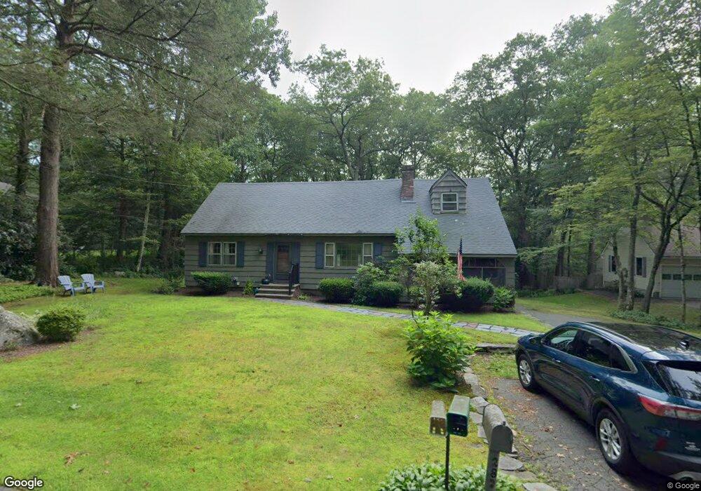
287 Coles Meadow Rd Northampton, MA 01060
Florence NeighborhoodEstimated Value: $443,845 - $583,000
5
Beds
2
Baths
2,132
Sq Ft
$235/Sq Ft
Est. Value
About This Home
This home is located at 287 Coles Meadow Rd, Northampton, MA 01060 and is currently estimated at $501,711, approximately $235 per square foot. 287 Coles Meadow Rd is a home located in Hampshire County with nearby schools including Northampton High School, The Montessori School of Northampton, and Lander Grinspoon Academy.
Ownership History
Date
Name
Owned For
Owner Type
Purchase Details
Closed on
Jan 13, 2017
Sold by
Walton Mary L and Walton Louise M
Bought by
Walton Jill M
Current Estimated Value
Home Financials for this Owner
Home Financials are based on the most recent Mortgage that was taken out on this home.
Original Mortgage
$200,000
Outstanding Balance
$160,130
Interest Rate
2.99%
Mortgage Type
Adjustable Rate Mortgage/ARM
Estimated Equity
$341,581
Create a Home Valuation Report for This Property
The Home Valuation Report is an in-depth analysis detailing your home's value as well as a comparison with similar homes in the area
Home Values in the Area
Average Home Value in this Area
Purchase History
| Date | Buyer | Sale Price | Title Company |
|---|---|---|---|
| Walton Jill M | -- | -- |
Source: Public Records
Mortgage History
| Date | Status | Borrower | Loan Amount |
|---|---|---|---|
| Open | Walton Jill M | $200,000 | |
| Previous Owner | Walton Bruce W | $187,000 | |
| Previous Owner | Walton Bruce W | $200,000 | |
| Previous Owner | Walton Bruce W | $141,000 | |
| Previous Owner | Walton Bruce W | $56,500 | |
| Previous Owner | Walton Bruce W | $75,000 |
Source: Public Records
Tax History Compared to Growth
Tax History
| Year | Tax Paid | Tax Assessment Tax Assessment Total Assessment is a certain percentage of the fair market value that is determined by local assessors to be the total taxable value of land and additions on the property. | Land | Improvement |
|---|---|---|---|---|
| 2025 | $5,295 | $380,100 | $89,600 | $290,500 |
| 2024 | $5,702 | $375,400 | $85,400 | $290,000 |
| 2023 | $4,643 | $293,100 | $77,500 | $215,600 |
| 2022 | $4,682 | $261,700 | $72,500 | $189,200 |
| 2021 | $4,285 | $246,700 | $69,100 | $177,600 |
| 2020 | $4,145 | $246,700 | $69,100 | $177,600 |
| 2019 | $3,917 | $225,500 | $81,600 | $143,900 |
| 2018 | $3,751 | $220,100 | $81,600 | $138,500 |
| 2017 | $3,673 | $220,100 | $81,600 | $138,500 |
| 2016 | $3,557 | $220,100 | $81,600 | $138,500 |
| 2015 | $3,564 | $225,600 | $86,600 | $139,000 |
| 2014 | $3,472 | $225,600 | $86,600 | $139,000 |
Source: Public Records
Map
Nearby Homes
- 66 Laurel Park Unit 66
- 43 Laurel Park Unit 43
- 93 Laurel Park Unit 93
- 2B Linseed Rd
- 21 Dwight St
- 32 Stonewall Dr
- 12 Dwight St
- 106 Elm St
- 34 Gore Ave
- 121 West St
- 80 Damon Rd Unit 5104
- 80 Damon Rd Unit 8203
- 76 Cooke Ave
- 0 Old Stage Rd Unit 73394977
- 18 Elm St
- 45 N Farms Rd
- 37 N Farms Rd
- 51 1/2 Hatfield St Unit 6
- 0 Terrace Ln
- 74 Barrett St Unit 105
- 301 Coles Meadow Rd
- 279 Coles Meadow Rd
- 323 Coles Meadow Rd
- 310 Coles Meadow Rd
- 255 Coles Meadow Rd
- 262 Coles Meadow Rd
- 248 Coles Meadow Rd
- 327 Coles Meadow Rd
- 247 Coles Meadow Rd
- 330 Coles Meadow Rd
- 349 Coles Meadow Rd
- 235 Coles Meadow Rd
- 336 Coles Meadow Rd
- 357 Coles Meadow Rd
- 218 Coles Meadow Rd
- 367 Coles Meadow Rd
- 219 Coles Meadow Rd
- 206 Coles Meadow Rd
- 192 Coles Meadow Rd
- 377 Coles Meadow Rd