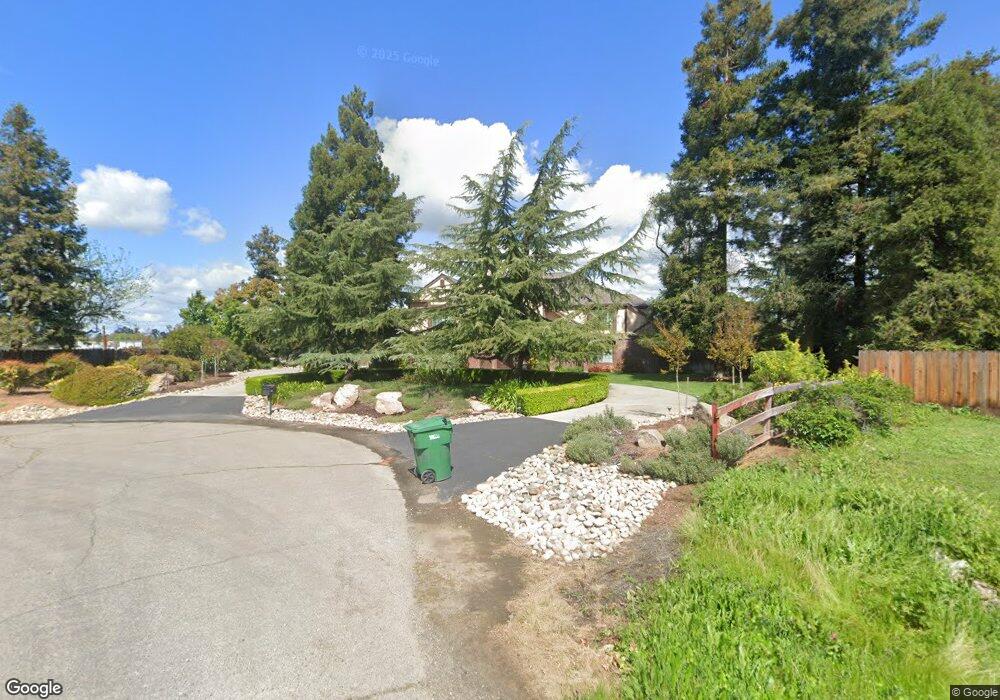
2880 Atlantic St Merced, CA 95340
Estimated Value: $730,000 - $942,000
4
Beds
3
Baths
3,889
Sq Ft
$220/Sq Ft
Est. Value
About This Home
This home is located at 2880 Atlantic St, Merced, CA 95340 and is currently estimated at $855,609, approximately $220 per square foot. 2880 Atlantic St is a home located in Merced County with nearby schools including Donn B. Chenoweth Elementary School, Herbert H. Cruickshank Middle School, and El Capitan High School.
Ownership History
Date
Name
Owned For
Owner Type
Purchase Details
Closed on
Jan 3, 2019
Sold by
Fife Roger
Bought by
Fife Roger
Current Estimated Value
Purchase Details
Closed on
Jul 17, 1998
Sold by
Fife and Christina
Bought by
Fife Roger L and Fife Christina
Home Financials for this Owner
Home Financials are based on the most recent Mortgage that was taken out on this home.
Original Mortgage
$190,340
Interest Rate
6.91%
Create a Home Valuation Report for This Property
The Home Valuation Report is an in-depth analysis detailing your home's value as well as a comparison with similar homes in the area
Purchase History
| Date | Buyer | Sale Price | Title Company |
|---|---|---|---|
| Fife Roger | -- | None Available | |
| Fife Roger | -- | None Available | |
| Fife Roger L | -- | First American Title |
Source: Public Records
Mortgage History
| Date | Status | Borrower | Loan Amount |
|---|---|---|---|
| Closed | Fife Roger L | $190,340 |
Source: Public Records
Tax History
| Year | Tax Paid | Tax Assessment Tax Assessment Total Assessment is a certain percentage of the fair market value that is determined by local assessors to be the total taxable value of land and additions on the property. | Land | Improvement |
|---|---|---|---|---|
| 2025 | $4,938 | $467,658 | $60,068 | $407,590 |
| 2024 | $4,938 | $458,490 | $58,891 | $399,599 |
| 2023 | $4,869 | $449,501 | $57,737 | $391,764 |
| 2022 | $4,805 | $440,688 | $56,605 | $384,083 |
| 2021 | $4,793 | $432,048 | $55,496 | $376,552 |
| 2020 | $4,829 | $427,618 | $54,927 | $372,691 |
| 2019 | $4,752 | $419,234 | $53,850 | $365,384 |
| 2018 | $4,342 | $411,015 | $52,795 | $358,220 |
| 2017 | $4,502 | $402,957 | $51,760 | $351,197 |
| 2016 | $4,432 | $395,057 | $50,746 | $344,311 |
| 2015 | $4,362 | $389,124 | $49,984 | $339,140 |
| 2014 | $4,268 | $381,502 | $49,005 | $332,497 |
Source: Public Records
Map
Nearby Homes
- 3646 Harbor Dr
- 2965 Dunn Rd
- 2367 Explorador Dr
- 2419 Gabriel Dr
- 2446 Valverde Dr
- 2475 Bastidas Dr
- 2396 Aviles
- 2421 Freestone Dr
- 2428 Freestone Dr
- 3515 E Yosemite Ave
- 2377 Mariner Way
- 3516 Windsong Ct
- 3507 Creekview Ct
- 3969 Hatch Rd
- 1862 Dunn Rd
- 3437 Cypress Point Dr
- 3692 N Gardner Ave
- 2144 King Arthur Ct
- 2067 Robin Hood Ln
- 3632 Swan Ct
- 2910 Atlantic St
- 3615 N Lake Rd
- 2850 Atlantic St
- 2960 Atlantic St
- 3629 N Lake Rd
- 3639 Lake Rd
- 3655 N Lake Rd
- 2909 Atlantic St
- 3645 N Lake Rd
- 2959 Atlantic St
- 2899 Atlantic St
- 2780 Atlantic St
- 3665 N Lake Rd
- 2779 Atlantic St
- 3553 N Lake Rd
- 3576 Surf Ct
- 2720 Atlantic St
- 2719 Atlantic St
- 3535 N Lake Rd
- 3701 N Lake Rd
Your Personal Tour Guide
Ask me questions while you tour the home.