
Seller's Agent in 2025
Cindy O'Hare Owens
5 College REALTORS®
(413) 262-7186
23 in this area
81 Total Sales

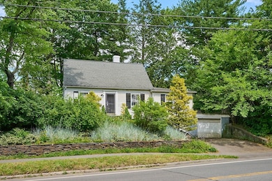
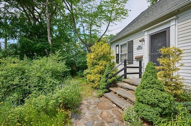
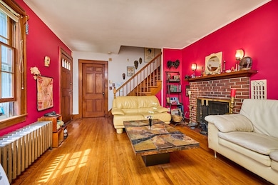
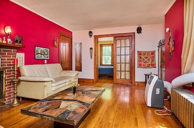
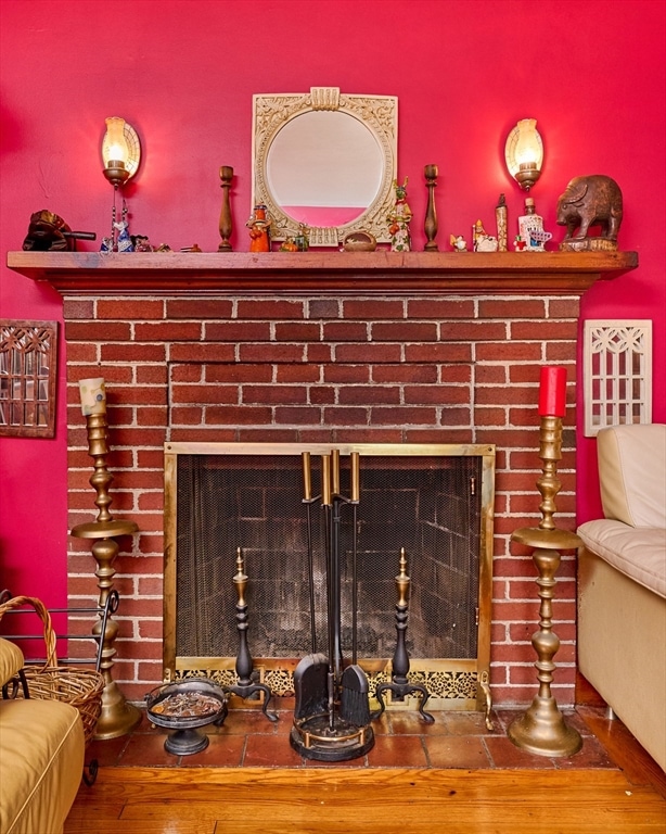
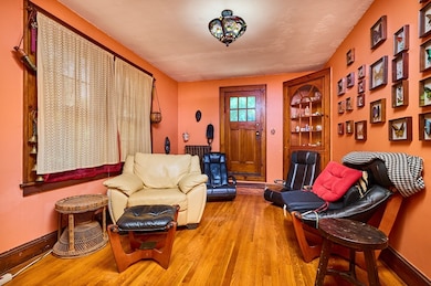
This charming three bedroom, two full bath Cape offers 1564 SQ ft, ideally situated a short walk to town center or UMass. The home has many original features including hardwood floors, fireplace, classic cabinetry in the kitchen and many built ins. The living room with fireplace, sun room, family room, first floor bedroom, full bath & kitchen with dining area complete the first floor. Two generous bedrooms and full bath on the second level. Step outside to enjoy two private decks, stone walls, Goshen stone stairs and established perennials. Two car garage a plus! This home combines charm with convenience for anyone looking to enjoy the amenities of in town living! First showings @ Open House Saturday July 19, noon to 2pm.
| Date | Type | Sale Price | Title Company |
|---|---|---|---|
| Warranty Deed | $537,000 | -- | |
| Warranty Deed | $537,000 | -- | |
| Deed | $321,800 | -- | |
| Deed | $321,800 | -- | |
| Deed | $321,800 | -- | |
| Deed | $90,000 | -- | |
| Deed | $90,000 | -- |
| Date | Status | Loan Amount | Loan Type |
|---|---|---|---|
| Open | $500,000 | New Conventional | |
| Closed | $500,000 | New Conventional | |
| Previous Owner | $252,000 | Purchase Money Mortgage |
| Date | Event | Price | List to Sale | Price per Sq Ft |
|---|---|---|---|---|
| 08/29/2025 08/29/25 | Sold | $537,000 | +7.4% | $347 / Sq Ft |
| 07/23/2025 07/23/25 | Pending | -- | -- | -- |
| 07/16/2025 07/16/25 | For Sale | $499,900 | -- | $323 / Sq Ft |
| Year | Tax Paid | Tax Assessment Tax Assessment Total Assessment is a certain percentage of the fair market value that is determined by local assessors to be the total taxable value of land and additions on the property. | Land | Improvement |
|---|---|---|---|---|
| 2025 | $8,603 | $479,300 | $199,000 | $280,300 |
| 2024 | $8,376 | $452,500 | $187,700 | $264,800 |
| 2023 | $8,002 | $398,100 | $170,600 | $227,500 |
| 2022 | $7,725 | $363,200 | $155,100 | $208,100 |
| 2021 | $7,336 | $336,200 | $143,600 | $192,600 |
| 2020 | $7,168 | $336,200 | $143,600 | $192,600 |
| 2019 | $6,948 | $318,700 | $143,600 | $175,100 |
| 2018 | $6,737 | $318,700 | $143,600 | $175,100 |
| 2017 | $6,387 | $292,600 | $136,800 | $155,800 |
| 2016 | $6,209 | $292,600 | $136,800 | $155,800 |
| 2015 | $6,010 | $292,600 | $136,800 | $155,800 |
Seller's Agent in 2025
Cindy O'Hare Owens
5 College REALTORS®
(413) 262-7186
23 in this area
81 Total Sales
Buyer's Agent in 2025
Gregory Haughton
5 College REALTORS®
(413) 687-2710
87 in this area
173 Total Sales
Source: MLS Property Information Network (MLS PIN)
MLS Number: 73405090
APN: AMHE-000011C-000000-000251
Disclaimer: Certain information contained herein is derived from information provided by parties other than Homes.com. All information provided is deemed reliable, but is not guaranteed to be accurate and should be independently verified.
![]() The property listing data and information, or the Images, set forth herein were provided to MLS Property Information Network, Inc. from third party sources, including sellers, lessors and public records, and were compiled by MLS Property Information Network, Inc. The property listing data and information, and the Images, are for the personal, non-commercial use of consumers having a good faith interest in purchasing or leasing listed properties of the type displayed to them and may not be used for any purpose other than to identify prospective properties which such consumers may have a good faith interest in purchasing or leasing. MLS Property Information Network, Inc. and its subscribers disclaim any and all representations and warranties as to the accuracy of the property listing data and information, or as to the accuracy of any of the Images, set forth herein.
The property listing data and information, or the Images, set forth herein were provided to MLS Property Information Network, Inc. from third party sources, including sellers, lessors and public records, and were compiled by MLS Property Information Network, Inc. The property listing data and information, and the Images, are for the personal, non-commercial use of consumers having a good faith interest in purchasing or leasing listed properties of the type displayed to them and may not be used for any purpose other than to identify prospective properties which such consumers may have a good faith interest in purchasing or leasing. MLS Property Information Network, Inc. and its subscribers disclaim any and all representations and warranties as to the accuracy of the property listing data and information, or as to the accuracy of any of the Images, set forth herein.
Ask me questions while you tour the home.