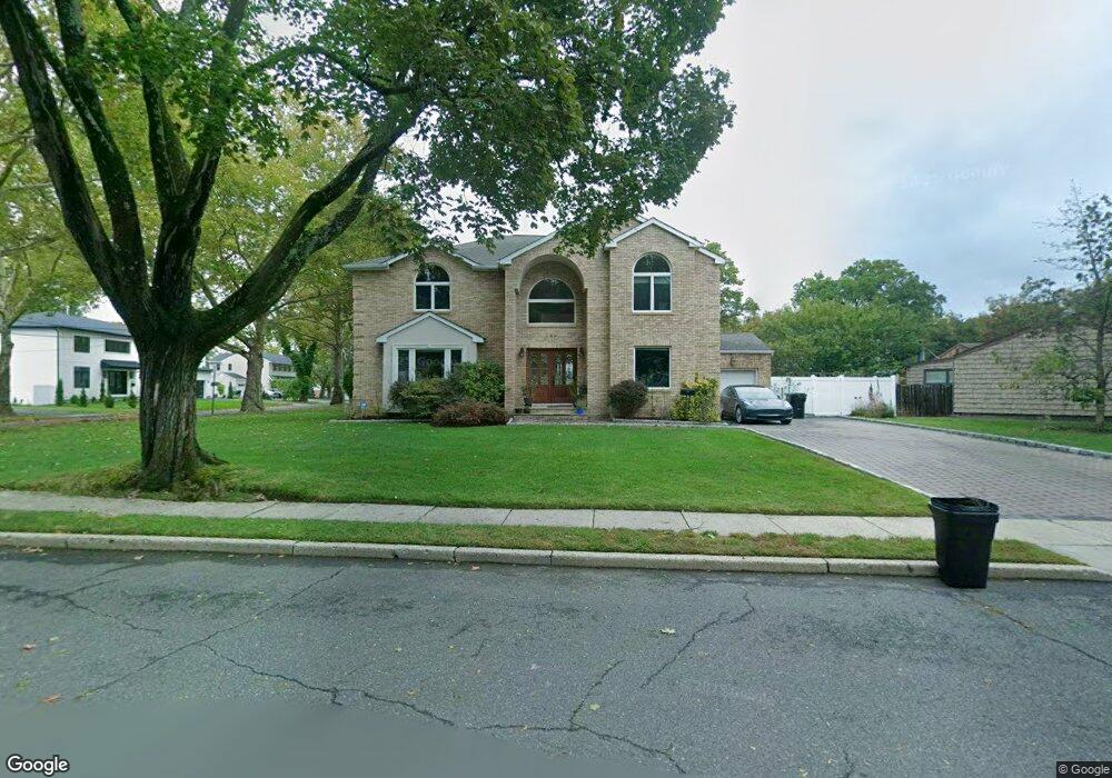
289 West Dr Paramus, NJ 07652
Estimated Value: $1,106,000 - $1,631,000
Studio
--
Bath
2,845
Sq Ft
$457/Sq Ft
Est. Value
About This Home
This home is located at 289 West Dr, Paramus, NJ 07652 and is currently estimated at $1,300,565, approximately $457 per square foot. 289 West Dr is a home located in Bergen County with nearby schools including Paramus High School, David Gregory School, and St. Joseph School.
Ownership History
Date
Name
Owned For
Owner Type
Purchase Details
Closed on
Mar 10, 2025
Sold by
Varughese Annamma
Bought by
Varughese Vinson and Varughese Annamma
Current Estimated Value
Purchase Details
Closed on
Nov 15, 2001
Sold by
Monarch Developers Llc
Bought by
Varughese P Thomas and Varughese Annamma
Home Financials for this Owner
Home Financials are based on the most recent Mortgage that was taken out on this home.
Original Mortgage
$340,000
Interest Rate
6.55%
Purchase Details
Closed on
May 15, 2001
Sold by
Estate Of Nancy E Sattely
Bought by
Monarch Developers Llc
Home Financials for this Owner
Home Financials are based on the most recent Mortgage that was taken out on this home.
Original Mortgage
$228,000
Interest Rate
7.2%
Create a Home Valuation Report for This Property
The Home Valuation Report is an in-depth analysis detailing your home's value as well as a comparison with similar homes in the area
Home Values in the Area
Average Home Value in this Area
Purchase History
| Date | Buyer | Sale Price | Title Company |
|---|---|---|---|
| Varughese Vinson | -- | None Listed On Document | |
| Varughese P Thomas | $599,900 | -- | |
| Monarch Developers Llc | $285,000 | -- |
Source: Public Records
Mortgage History
| Date | Status | Borrower | Loan Amount |
|---|---|---|---|
| Previous Owner | Varughese P Thomas | $340,000 | |
| Previous Owner | Monarch Developers Llc | $228,000 |
Source: Public Records
Tax History
| Year | Tax Paid | Tax Assessment Tax Assessment Total Assessment is a certain percentage of the fair market value that is determined by local assessors to be the total taxable value of land and additions on the property. | Land | Improvement |
|---|---|---|---|---|
| 2025 | $15,287 | $1,080,900 | $371,700 | $709,200 |
| 2024 | $14,849 | $1,009,700 | $337,800 | $671,900 |
| 2023 | $14,091 | $968,000 | $323,300 | $644,700 |
| 2022 | $14,091 | $907,900 | $302,900 | $605,000 |
| 2021 | $13,793 | $833,900 | $279,000 | $554,900 |
| 2020 | $13,071 | $819,500 | $274,000 | $545,500 |
| 2019 | $11,917 | $642,100 | $275,500 | $366,600 |
| 2018 | $11,770 | $642,100 | $275,500 | $366,600 |
| 2017 | $11,564 | $642,100 | $275,500 | $366,600 |
| 2016 | $11,250 | $642,100 | $275,500 | $366,600 |
| 2015 | $11,134 | $642,100 | $275,500 | $366,600 |
| 2014 | $11,038 | $642,100 | $275,500 | $366,600 |
Source: Public Records
Map
Nearby Homes
- 623 Alberta Dr
- 624 West Dr
- 319 Franklin Place
- 645 Cambridge Rd
- 672 Rutgers Place
- 949 Oradell Ave
- 6 Merrimack Ct
- 492 Oaktree Rd
- 454 E Ridgewood Ave
- 461 Arthur Terrace
- 922 Wildwood Rd
- 277 Columbia Terrace
- 261 Idaho St
- 216 E Midland Ave
- 743 Boyd Rd
- 360 Valley View Ave
- 375 Burnet Place
- 206 Harwood Place
- 828 Pascack Rd
- 719 Neill Ct
Your Personal Tour Guide
Ask me questions while you tour the home.