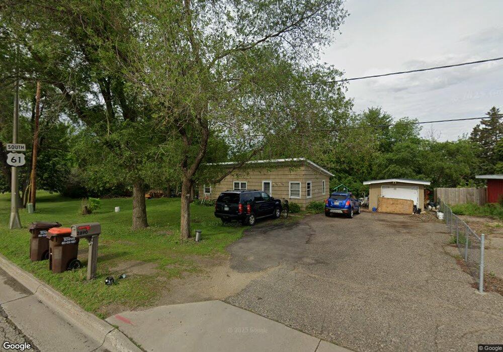
2890 Highway 61 Hastings, MN 55033
Hastings-Marshan Township NeighborhoodEstimated Value: $152,945 - $249,000
2
Beds
1
Bath
720
Sq Ft
$264/Sq Ft
Est. Value
About This Home
This home is located at 2890 Highway 61, Hastings, MN 55033 and is currently estimated at $190,236, approximately $264 per square foot. 2890 Highway 61 is a home located in Dakota County with nearby schools including Pinecrest Elementary School, Hastings Middle School, and Hastings High School.
Ownership History
Date
Name
Owned For
Owner Type
Purchase Details
Closed on
Apr 24, 2015
Sold by
Ruud Eric A and Ruud Rebecca L
Bought by
Backes Gary R and Backes Sherrill A
Current Estimated Value
Home Financials for this Owner
Home Financials are based on the most recent Mortgage that was taken out on this home.
Original Mortgage
$41,825
Interest Rate
3.77%
Mortgage Type
Purchase Money Mortgage
Purchase Details
Closed on
Jul 30, 2013
Sold by
Mulvihill Glenn M
Bought by
Ruud Eric A
Home Financials for this Owner
Home Financials are based on the most recent Mortgage that was taken out on this home.
Original Mortgage
$175,000
Interest Rate
4.49%
Mortgage Type
New Conventional
Purchase Details
Closed on
Jan 31, 2002
Sold by
Aspley Darlene and Aspley Sam
Bought by
Mulvihill Bonnie J and Mulvihill Glenn M
Create a Home Valuation Report for This Property
The Home Valuation Report is an in-depth analysis detailing your home's value as well as a comparison with similar homes in the area
Home Values in the Area
Average Home Value in this Area
Purchase History
| Date | Buyer | Sale Price | Title Company |
|---|---|---|---|
| Backes Gary R | $50,000 | Dca Title | |
| Ruud Eric A | $175,000 | None Available | |
| Mulvihill Bonnie J | $65,000 | -- |
Source: Public Records
Mortgage History
| Date | Status | Borrower | Loan Amount |
|---|---|---|---|
| Closed | Backes Gary R | $41,825 | |
| Previous Owner | Ruud Eric A | $175,000 |
Source: Public Records
Tax History Compared to Growth
Tax History
| Year | Tax Paid | Tax Assessment Tax Assessment Total Assessment is a certain percentage of the fair market value that is determined by local assessors to be the total taxable value of land and additions on the property. | Land | Improvement |
|---|---|---|---|---|
| 2024 | $1,286 | $114,100 | $46,100 | $68,000 |
| 2023 | $1,286 | $111,400 | $46,100 | $65,300 |
| 2022 | $1,134 | $109,100 | $46,000 | $63,100 |
| 2021 | $1,092 | $92,100 | $40,000 | $52,100 |
| 2020 | $1,132 | $88,100 | $38,100 | $50,000 |
| 2019 | $1,052 | $88,200 | $36,300 | $51,900 |
| 2018 | $1,000 | $77,800 | $34,600 | $43,200 |
| 2017 | $920 | $71,400 | $32,900 | $38,500 |
| 2016 | $936 | $65,400 | $30,800 | $34,600 |
| 2015 | $922 | $64,800 | $29,900 | $34,900 |
| 2014 | -- | $64,200 | $28,800 | $35,400 |
| 2013 | -- | $59,300 | $26,000 | $33,300 |
Source: Public Records
Map
Nearby Homes
- 131 24th St W
- 3525 Vermillion St
- 3575 Vermillion St
- 1942 Eddy St
- 2970 Highview Knolls
- 2000 Forest St
- 531 Tiffany Dr
- 664 35th St W
- 456 Hayes Dr Unit 59
- 217 Tiffany Dr
- 3525 Douglas Dr
- 3200 Malcolm Ave
- 235 Tiffany Dr
- 313 Frederick Cir Unit 106
- 3560 Malcolm Ave
- 528 17th St E
- 1600 Ramsey St
- 753 Greten Ln
- 1906 Oak St
- 1600 Spring St
- 2880 Highway 61
- 2504 Vermillion St
- 31XX Red Wing Blvd
- 1XX 25th St E
- 1XX W 25th St
- 1XX 25th St W
- 111 25th St W
- 113 25th St W
- 117 117 25th-Street-w
- 117 25th St W
- 105 25th St W
- 1 27th St E
- 125 25th St W
- 103 25th St W
- 1 Highway 316
- 316 316 5th-Street-w
- 118 25th St W
- 116 25th St W
- 120 25th St W
- 104 25th St W