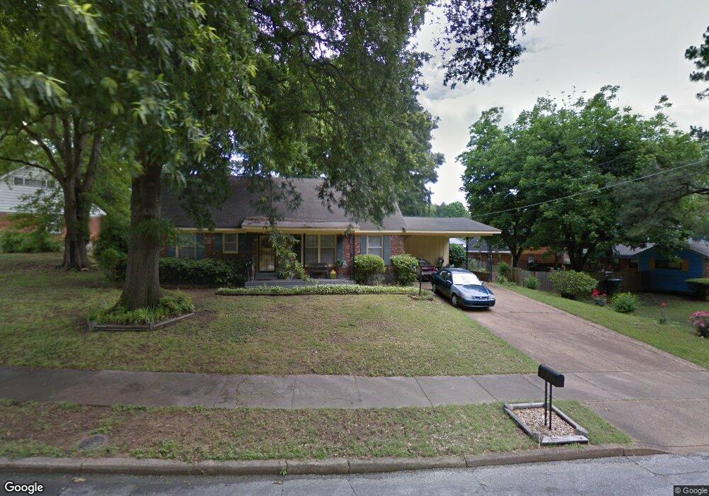
2890 Sky Way Dr Memphis, TN 38127
Frayser NeighborhoodEstimated Value: $123,000 - $156,000
4
Beds
2
Baths
2,540
Sq Ft
$54/Sq Ft
Est. Value
About This Home
This home is located at 2890 Sky Way Dr, Memphis, TN 38127 and is currently estimated at $138,162, approximately $54 per square foot. 2890 Sky Way Dr is a home located in Shelby County with nearby schools including Lucie E. Campbell Elementary School, Grandview Heights Middle, and Trezevant High School.
Ownership History
Date
Name
Owned For
Owner Type
Purchase Details
Closed on
Aug 20, 1998
Sold by
Enos Wesley C and Enos Thomas C
Bought by
Saulsberry Christine
Current Estimated Value
Home Financials for this Owner
Home Financials are based on the most recent Mortgage that was taken out on this home.
Original Mortgage
$76,775
Interest Rate
6.99%
Mortgage Type
FHA
Create a Home Valuation Report for This Property
The Home Valuation Report is an in-depth analysis detailing your home's value as well as a comparison with similar homes in the area
Home Values in the Area
Average Home Value in this Area
Purchase History
| Date | Buyer | Sale Price | Title Company |
|---|---|---|---|
| Saulsberry Christine | $76,900 | Security Title Company Inc | |
| Saulsberry Christine | $76,900 | Security Title Company Inc | |
| Saulsberry Christine | $76,900 | Security Title Company Inc | |
| Saulsberry Christine | $76,900 | Security Title Company Inc | |
| Saulsberry Christine | $76,900 | Security Title Company Inc |
Source: Public Records
Mortgage History
| Date | Status | Borrower | Loan Amount |
|---|---|---|---|
| Previous Owner | Saulsberry Christine | $76,775 |
Source: Public Records
Tax History
| Year | Tax Paid | Tax Assessment Tax Assessment Total Assessment is a certain percentage of the fair market value that is determined by local assessors to be the total taxable value of land and additions on the property. | Land | Improvement |
|---|---|---|---|---|
| 2025 | $813 | $33,400 | $3,375 | $30,025 |
| 2024 | $813 | $23,975 | $2,600 | $21,375 |
| 2023 | $1,460 | $23,975 | $2,600 | $21,375 |
| 2022 | $1,460 | $23,975 | $2,600 | $21,375 |
| 2021 | $1,478 | $23,975 | $2,600 | $21,375 |
| 2020 | $1,239 | $17,100 | $2,600 | $14,500 |
| 2019 | $1,239 | $17,100 | $2,600 | $14,500 |
| 2018 | $1,239 | $17,100 | $2,600 | $14,500 |
| 2017 | $703 | $17,100 | $2,600 | $14,500 |
| 2016 | $773 | $17,700 | $0 | $0 |
| 2014 | $773 | $17,700 | $0 | $0 |
Source: Public Records
Map
Nearby Homes
- 2838 Birchfield Dr
- 2800 Spring Hill Dr
- 2869 Dumbarton Oaks Dr
- 3034 Laurencekirk Rd
- 3095 Spring Hill Dr
- 2976 Scotland Rd
- 2934 N Trezevant St
- 3091 Range Line Rd Unit 6
- 2958 E Glengarry Rd
- 0 Allen Rd Unit 10207133
- 3034 Bannockburn Rd
- 2535 Clearpark Dr
- 3151 Range Line Rd
- 0 Range Line Rd Unit 10207554
- 3153 Kirkcaldy Rd
- 3010 Falkirk Rd
- 0 Taransay Rd
- 3323 Scenic Hwy
- 3212 Whitney Ave
- 0 Helmsdale Rd
- 2906 Sky Way Dr
- 2905 Spring Hill Dr
- 2907 Spring Hill Dr
- 2916 Sky Way Dr
- 2891 Sky Way Dr
- 2915 Spring Hill Dr
- 2883 Spring Hill Dr
- 2895 Sky Way Dr
- 2901 Sky Way Dr
- 2911 Sky Way Dr
- 2925 Spring Hill Dr
- 2896 Spring Hill Dr
- 2890 Spring Hill Dr
- 2875 Spring Hill Dr
- 2875 Spring View Dr
- 2885 Spring View Dr
- 2884 Spring Hill Dr
- 2902 Spring Hill Dr
- 2919 Sky Way Dr
- 2893 Spring View Dr
Your Personal Tour Guide
Ask me questions while you tour the home.