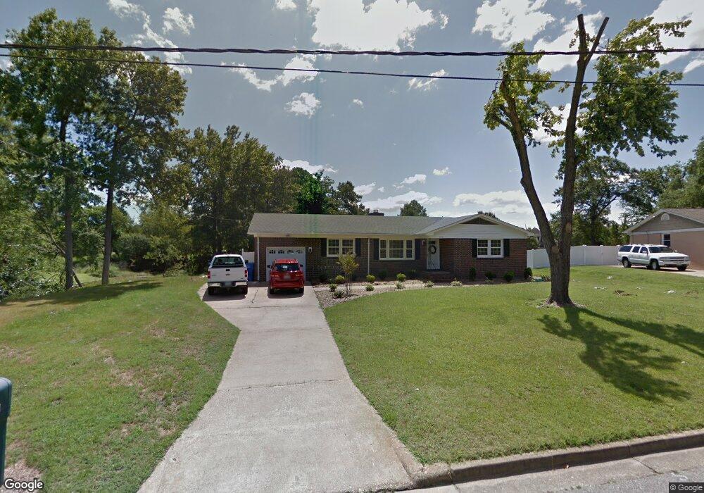
2896 E Point Dr Chesapeake, VA 23321
Western Branch NeighborhoodEstimated Value: $387,000 - $435,000
3
Beds
2
Baths
1,580
Sq Ft
$260/Sq Ft
Est. Value
About This Home
This home is located at 2896 E Point Dr, Chesapeake, VA 23321 and is currently estimated at $410,035, approximately $259 per square foot. 2896 E Point Dr is a home located in Chesapeake City with nearby schools including Western Branch Primary School, Western Branch Intermediate School, and Western Branch Middle School.
Ownership History
Date
Name
Owned For
Owner Type
Purchase Details
Closed on
Oct 10, 2013
Sold by
Warner Fred A
Bought by
Graham Ronnie W
Current Estimated Value
Home Financials for this Owner
Home Financials are based on the most recent Mortgage that was taken out on this home.
Original Mortgage
$255,272
Outstanding Balance
$192,041
Interest Rate
4.53%
Mortgage Type
VA
Estimated Equity
$217,994
Purchase Details
Closed on
Mar 2, 2011
Sold by
Anello Deborah A
Bought by
Warner Fred A
Create a Home Valuation Report for This Property
The Home Valuation Report is an in-depth analysis detailing your home's value as well as a comparison with similar homes in the area
Home Values in the Area
Average Home Value in this Area
Purchase History
| Date | Buyer | Sale Price | Title Company |
|---|---|---|---|
| Graham Ronnie W | $249,900 | -- | |
| Warner Fred A | $206,000 | -- |
Source: Public Records
Mortgage History
| Date | Status | Borrower | Loan Amount |
|---|---|---|---|
| Open | Graham Ronnie W | $255,272 |
Source: Public Records
Tax History
| Year | Tax Paid | Tax Assessment Tax Assessment Total Assessment is a certain percentage of the fair market value that is determined by local assessors to be the total taxable value of land and additions on the property. | Land | Improvement |
|---|---|---|---|---|
| 2025 | $3,571 | $367,200 | $190,000 | $177,200 |
| 2024 | $3,571 | $353,600 | $190,000 | $163,600 |
| 2023 | $3,297 | $326,400 | $180,000 | $146,400 |
| 2022 | $3,092 | $306,100 | $160,000 | $146,100 |
| 2021 | $2,884 | $274,700 | $130,000 | $144,700 |
| 2020 | $2,789 | $265,600 | $125,000 | $140,600 |
| 2019 | $2,760 | $262,900 | $125,000 | $137,900 |
| 2018 | $2,589 | $240,000 | $120,000 | $120,000 |
| 2017 | $2,514 | $239,400 | $120,000 | $119,400 |
| 2016 | $2,514 | $239,400 | $120,000 | $119,400 |
| 2015 | $2,514 | $239,400 | $120,000 | $119,400 |
| 2014 | $2,514 | $239,400 | $120,000 | $119,400 |
Source: Public Records
Map
Nearby Homes
- 2804 Lilley Cove Dr
- 2832 Martin's Point Way
- 4165 Stonebridge Landing
- 2642 Meadows Landing
- 3711 Whitechapel Arch
- 3821 Cannon Point Dr
- 2913 Stratford Dr
- 2804 Meadow Wood Dr W
- 2935 Bruce Station
- 4244 Meadow Wood Dr
- 2617 N Elizabeth Harbor Dr
- 450 Robin Rd
- 412 Robin Rd
- 42 Sandie Point Ln
- 34 Sandie Point Ln
- 53 Sandie Point Ln
- 59 Sandie Point Ln
- 3809 Harding Dr
- 14 Sandie Point Ln
- 12 Warren Dr
- 2892 E Point Dr
- 2900 E Point Dr
- 2897 E Point Dr
- 2904 E Point Dr
- 2893 E Point Dr
- 2901 E Point Dr
- 2889 E Point Dr
- 2905 E Point Dr
- 2906 E Point Dr
- 2818 Lilley Cove Dr
- 2924 Mintwood Dr
- 2890 E Point Dr
- 2925 Mintwood Dr
- 2888 E Point Dr
- 2814 Lilley Cove Dr
- 2824 Lilley Cove Dr
- 2885 E Point Dr
- 2909 E Point Dr
- 2908 E Point Dr
- 2810 Lilley Cove Dr
Your Personal Tour Guide
Ask me questions while you tour the home.