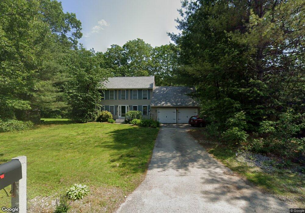
29 Brenton St Litchfield, NH 03052
Estimated Value: $620,540 - $691,000
3
Beds
2
Baths
2,297
Sq Ft
$284/Sq Ft
Est. Value
About This Home
This home is located at 29 Brenton St, Litchfield, NH 03052 and is currently estimated at $651,885, approximately $283 per square foot. 29 Brenton St is a home with nearby schools including Griffin Memorial School, Litchfield Middle School, and Campbell High School.
Ownership History
Date
Name
Owned For
Owner Type
Purchase Details
Closed on
Dec 15, 1997
Sold by
Ashwood Dev Co Inc
Bought by
Jozitis Joseph C and Jozitis Susan C
Current Estimated Value
Home Financials for this Owner
Home Financials are based on the most recent Mortgage that was taken out on this home.
Original Mortgage
$119,919
Interest Rate
7.14%
Create a Home Valuation Report for This Property
The Home Valuation Report is an in-depth analysis detailing your home's value as well as a comparison with similar homes in the area
Home Values in the Area
Average Home Value in this Area
Purchase History
| Date | Buyer | Sale Price | Title Company |
|---|---|---|---|
| Jozitis Joseph C | $120,400 | -- | |
| Ashwood Dev Co Inc | $38,000 | -- |
Source: Public Records
Mortgage History
| Date | Status | Borrower | Loan Amount |
|---|---|---|---|
| Open | Ashwood Dev Co Inc | $112,500 | |
| Closed | Ashwood Dev Co Inc | $119,919 |
Source: Public Records
Tax History Compared to Growth
Tax History
| Year | Tax Paid | Tax Assessment Tax Assessment Total Assessment is a certain percentage of the fair market value that is determined by local assessors to be the total taxable value of land and additions on the property. | Land | Improvement |
|---|---|---|---|---|
| 2024 | $7,716 | $371,300 | $156,800 | $214,500 |
| 2023 | $7,775 | $371,300 | $156,800 | $214,500 |
| 2022 | $7,066 | $371,300 | $156,800 | $214,500 |
| 2021 | $6,847 | $371,300 | $156,800 | $214,500 |
| 2020 | $6,899 | $371,300 | $156,800 | $214,500 |
| 2019 | $7,019 | $296,800 | $126,200 | $170,600 |
| 2017 | $5,099 | $298,800 | $126,200 | $172,600 |
| 2016 | $6,454 | $298,800 | $126,200 | $172,600 |
| 2015 | $6,090 | $298,800 | $126,200 | $172,600 |
| 2014 | $6,098 | $294,600 | $131,900 | $162,700 |
| 2013 | $6,068 | $295,000 | $131,900 | $163,100 |
Source: Public Records
Map
Nearby Homes
- 1 Morrill St
- 41 Century Ln
- 0 Tallarico St Unit Lot 11 5056385
- 0 Tallarico St Unit 10 5044310
- 0 Tallarico St Unit 25 5043170
- 0 Tallarico St Unit 5041169
- 0 Tallarico St Unit 12 5033131
- 0 Tallarico St Unit 5 5032751
- 0 Tallarico St Unit 3 5032471
- 1 Tallarico St Unit 2
- 1 Tallarico St Unit 14
- 25 Chatfield Dr
- 343 Charles Bancroft Hwy
- 24 Windsor Dr Unit 10
- 27 Windsor Dr Unit A
- 35 Windsor Dr Unit 5
- 315 Charles Bancroft Hwy
- 7 Chamberlin Dr
- 26 Moose Hollow Rd
- 13 Moose Hollow Rd