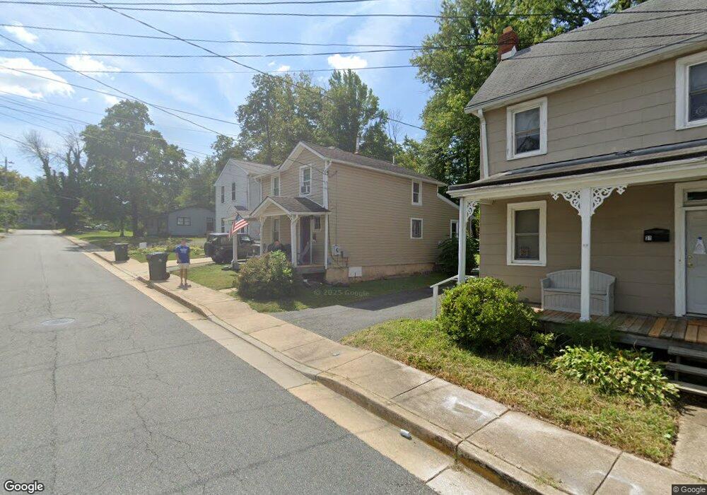
29 Corbit St Newark, DE 19711
Estimated Value: $184,000 - $501,000
2
Beds
2
Baths
984
Sq Ft
$317/Sq Ft
Est. Value
About This Home
This home is located at 29 Corbit St, Newark, DE 19711 and is currently estimated at $312,417, approximately $317 per square foot. 29 Corbit St is a home located in New Castle County with nearby schools including Downes (John R.) Elementary School, Shue-Medill Middle School, and Newark High School.
Ownership History
Date
Name
Owned For
Owner Type
Purchase Details
Closed on
May 17, 2013
Sold by
Simmons Brian W and Chan Bik Sai
Bought by
Bayside Group Llc Series A
Current Estimated Value
Home Financials for this Owner
Home Financials are based on the most recent Mortgage that was taken out on this home.
Original Mortgage
$162,516
Outstanding Balance
$115,005
Interest Rate
3.45%
Mortgage Type
Future Advance Clause Open End Mortgage
Estimated Equity
$197,412
Purchase Details
Closed on
Feb 26, 2013
Sold by
The Bayside Group Llc
Bought by
Simmons Brian W and Chan Bik Sai
Purchase Details
Closed on
Jan 2, 2007
Sold by
Simmons Brian W and Chan Bik Sai
Bought by
The Bayside Group Llc Series A
Purchase Details
Closed on
Mar 24, 2006
Sold by
Shaffer Gunter Rolf and Ackerman Ken
Bought by
Simmons Brian W and Chan Bic Sai
Home Financials for this Owner
Home Financials are based on the most recent Mortgage that was taken out on this home.
Original Mortgage
$178,400
Interest Rate
6.32%
Mortgage Type
Fannie Mae Freddie Mac
Create a Home Valuation Report for This Property
The Home Valuation Report is an in-depth analysis detailing your home's value as well as a comparison with similar homes in the area
Home Values in the Area
Average Home Value in this Area
Purchase History
| Date | Buyer | Sale Price | Title Company |
|---|---|---|---|
| Bayside Group Llc Series A | -- | None Available | |
| Simmons Brian W | -- | None Available | |
| The Bayside Group Llc Series A | -- | None Available | |
| Simmons Brian W | $223,000 | None Available |
Source: Public Records
Mortgage History
| Date | Status | Borrower | Loan Amount |
|---|---|---|---|
| Open | Bayside Group Llc Series A | $162,516 | |
| Previous Owner | Simmons Brian W | $178,400 |
Source: Public Records
Tax History
| Year | Tax Paid | Tax Assessment Tax Assessment Total Assessment is a certain percentage of the fair market value that is determined by local assessors to be the total taxable value of land and additions on the property. | Land | Improvement |
|---|---|---|---|---|
| 2024 | $252 | $23,900 | $5,300 | $18,600 |
| 2023 | $864 | $23,900 | $5,300 | $18,600 |
| 2022 | $855 | $23,900 | $5,300 | $18,600 |
| 2021 | $833 | $23,900 | $5,300 | $18,600 |
| 2020 | $809 | $23,900 | $5,300 | $18,600 |
| 2019 | $709 | $23,900 | $5,300 | $18,600 |
| 2018 | $693 | $23,900 | $5,300 | $18,600 |
| 2017 | $672 | $23,900 | $5,300 | $18,600 |
| 2016 | $670 | $23,900 | $5,300 | $18,600 |
| 2015 | $601 | $23,900 | $5,300 | $18,600 |
| 2014 | $601 | $23,900 | $5,300 | $18,600 |
Source: Public Records
Map
Nearby Homes
- 105 Tanglewood Ln
- 104 Country Club Dr
- 113 E Main St Unit 311
- 180 Madison Dr
- 306 Willa Rd
- 311 Stamford Dr
- 102 Joshua (6 Building Lots) Ln
- 303 Lynley Ln
- 8 Hearn Place
- 30 Julie Ln
- 4 Clear Spring Ln
- 108 Lena Dr
- 2 Leahy Dr
- 104 Leahy Dr
- 153 King William St Unit 153
- 313 Chickory Way
- 3 Leahy Dr
- 0001 Leahy Dr
- 405 Leahy Dr
- 402 Leahy Dr
Your Personal Tour Guide
Ask me questions while you tour the home.