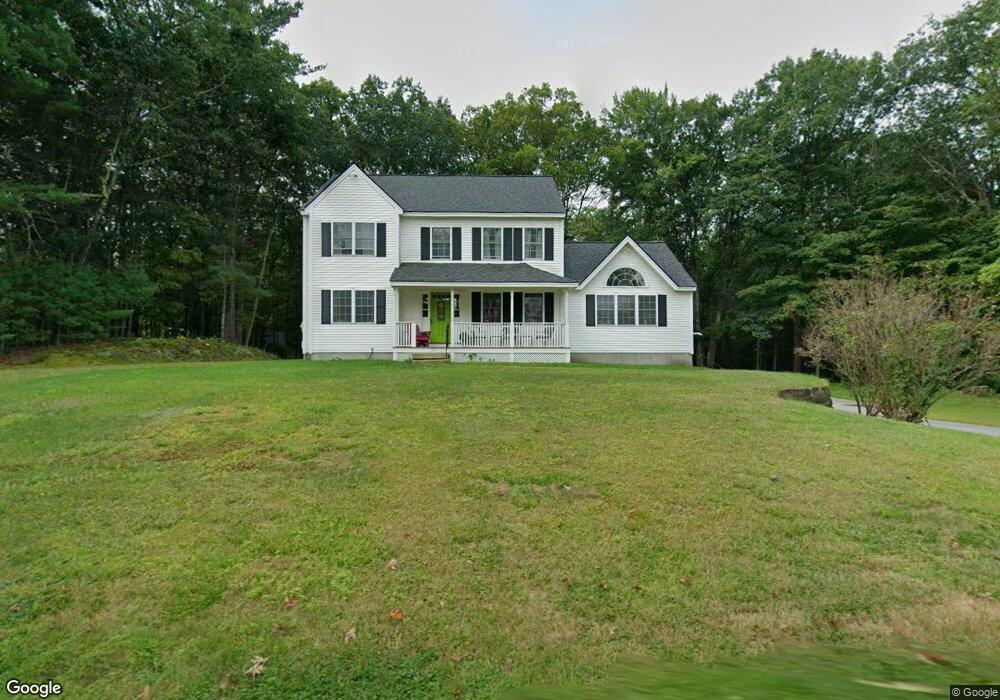
29 Merrimack Rd Amherst, NH 03031
Estimated Value: $642,000 - $744,000
4
Beds
4
Baths
2,756
Sq Ft
$251/Sq Ft
Est. Value
About This Home
This home is located at 29 Merrimack Rd, Amherst, NH 03031 and is currently estimated at $692,244, approximately $251 per square foot. 29 Merrimack Rd is a home located in Hillsborough County with nearby schools including Wilkins Elementary School, Amherst Middle School, and Souhegan Cooperative High School.
Ownership History
Date
Name
Owned For
Owner Type
Purchase Details
Closed on
Mar 31, 2015
Sold by
Cunis Brian W and Cunis Ellen F
Bought by
Cunis Ft and Cunis Brian W
Current Estimated Value
Purchase Details
Closed on
Apr 17, 2014
Sold by
Martel Joseph J and Martal Joan
Bought by
Cunis Brain W and Cunis Ellen F
Purchase Details
Closed on
Jul 26, 2005
Sold by
Ela Jeffrey H
Bought by
Cunis Brian W and Cunis Ellen F
Create a Home Valuation Report for This Property
The Home Valuation Report is an in-depth analysis detailing your home's value as well as a comparison with similar homes in the area
Home Values in the Area
Average Home Value in this Area
Purchase History
| Date | Buyer | Sale Price | Title Company |
|---|---|---|---|
| Cunis Ft | -- | -- | |
| Cunis Brain W | -- | -- | |
| Cunis Brian W | $392,000 | -- |
Source: Public Records
Mortgage History
| Date | Status | Borrower | Loan Amount |
|---|---|---|---|
| Previous Owner | Cunis Brian W | $100,000 | |
| Previous Owner | Cunis Brian W | $111,000 |
Source: Public Records
Tax History Compared to Growth
Tax History
| Year | Tax Paid | Tax Assessment Tax Assessment Total Assessment is a certain percentage of the fair market value that is determined by local assessors to be the total taxable value of land and additions on the property. | Land | Improvement |
|---|---|---|---|---|
| 2024 | $10,351 | $451,400 | $109,800 | $341,600 |
| 2023 | $9,877 | $451,400 | $109,800 | $341,600 |
| 2022 | $9,538 | $451,400 | $109,800 | $341,600 |
| 2021 | $9,619 | $451,400 | $109,800 | $341,600 |
| 2020 | $3,396 | $325,700 | $87,800 | $237,900 |
| 2019 | $7,799 | $332,700 | $87,800 | $244,900 |
| 2018 | $2,758 | $332,700 | $87,800 | $244,900 |
| 2017 | $4,247 | $332,700 | $87,800 | $244,900 |
| 2016 | $8,351 | $332,700 | $87,800 | $244,900 |
| 2015 | $8,344 | $315,100 | $107,600 | $207,500 |
| 2014 | $8,401 | $315,100 | $107,600 | $207,500 |
| 2013 | $7,951 | $300,600 | $104,600 | $196,000 |
Source: Public Records
Map
Nearby Homes
- 0 Claude Rd
- 7 Fox Run Rd
- 377 Nashua St
- 40 North St
- 26 Oak St
- 18 Adams St
- 30 Perkins St Unit 1
- 7 Miles Rd
- 7 Corduroy Rd Unit 20
- 3 Abby Ln Unit 2
- 57 Patch Hill Ln
- 25 Atherton Ln
- 6 Whittemore Ln
- 44 Osgood Rd
- 24 Spaulding St
- 9 Northfield Rd
- 33 David Dr
- 229 Mont Vernon Rd
- 135 Amherst St Unit 28
- 8 Carriage Ln
- 109 Souhegan Ave
- 109 Souhegan Ave
- 108 Souhegan St
- 27 Merrimack Rd
- 25 Merrimack Rd
- 33 Merrimack Rd Unit B
- 33 Merrimack Rd Unit D
- 33 Merrimack Rd Unit A
- 28 Merrimack Rd
- 120 Souhegan St
- 30 Merrimack Rd Unit 2
- 30 Merrimack Rd Unit 3
- 3 Claude St
- 25 Border St
- 21 Border St
- 23 Border St
- 19 Border St
- 105 Souhegan Ave
- 17 Border St
- 26 Merrimack Rd