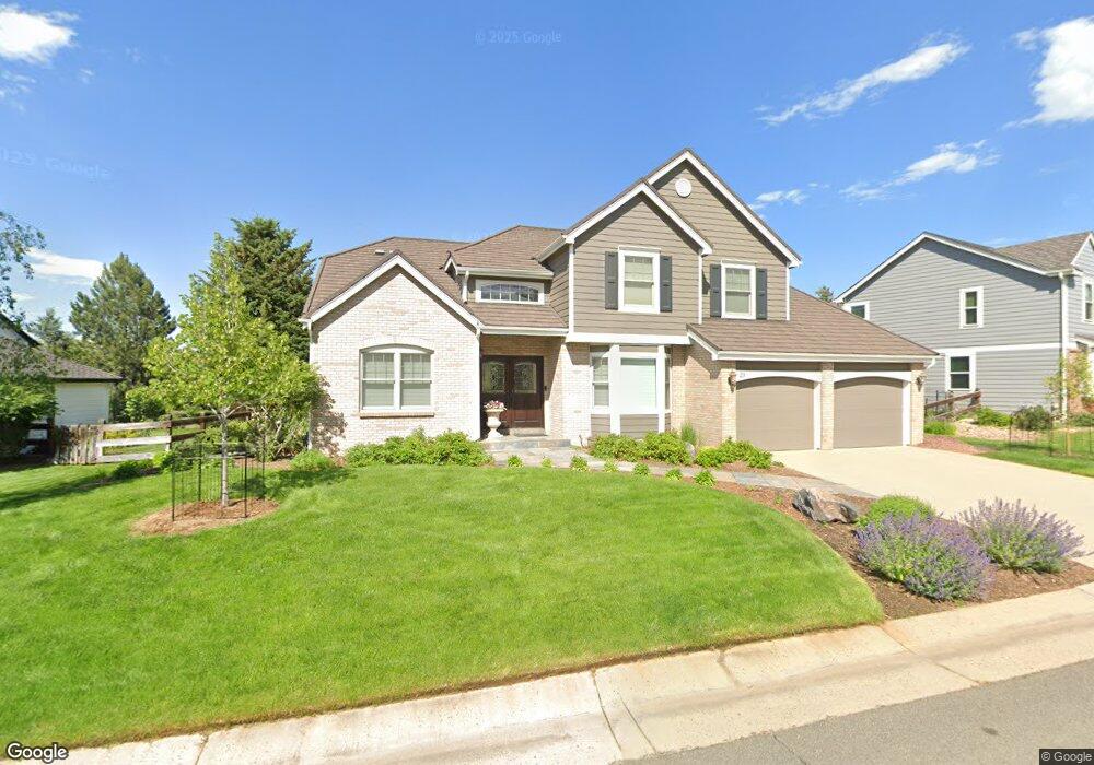
29 Mountain Pine Dr Littleton, CO 80127
Valley Heirloom NeighborhoodEstimated Value: $1,051,000 - $1,334,000
4
Beds
7
Baths
3,284
Sq Ft
$374/Sq Ft
Est. Value
About This Home
This home is located at 29 Mountain Pine Dr, Littleton, CO 80127 and is currently estimated at $1,228,306, approximately $374 per square foot. 29 Mountain Pine Dr is a home located in Jefferson County with nearby schools including Bradford K8 South, Bradford K8 North, and Chatfield High School.
Ownership History
Date
Name
Owned For
Owner Type
Purchase Details
Closed on
May 5, 2022
Sold by
Leidy Donald J
Bought by
The Donald And Judy Leidy Trust
Current Estimated Value
Purchase Details
Closed on
Sep 25, 1995
Sold by
Leone Daniel M and Leone Candace C
Bought by
Tangye Candace C
Home Financials for this Owner
Home Financials are based on the most recent Mortgage that was taken out on this home.
Original Mortgage
$240,000
Interest Rate
7.77%
Purchase Details
Closed on
Sep 18, 1995
Sold by
Bark Carol M and Bark Patrick J
Bought by
Leidy Donald J and Leidy Judy K
Home Financials for this Owner
Home Financials are based on the most recent Mortgage that was taken out on this home.
Original Mortgage
$240,000
Interest Rate
7.77%
Create a Home Valuation Report for This Property
The Home Valuation Report is an in-depth analysis detailing your home's value as well as a comparison with similar homes in the area
Home Values in the Area
Average Home Value in this Area
Purchase History
| Date | Buyer | Sale Price | Title Company |
|---|---|---|---|
| The Donald And Judy Leidy Trust | -- | None Listed On Document | |
| Tangye Candace C | -- | -- | |
| Leidy Donald J | $300,000 | First American Heritage Titl |
Source: Public Records
Mortgage History
| Date | Status | Borrower | Loan Amount |
|---|---|---|---|
| Previous Owner | Leidy Donald J | $240,000 |
Source: Public Records
Tax History Compared to Growth
Tax History
| Year | Tax Paid | Tax Assessment Tax Assessment Total Assessment is a certain percentage of the fair market value that is determined by local assessors to be the total taxable value of land and additions on the property. | Land | Improvement |
|---|---|---|---|---|
| 2024 | $7,238 | $74,308 | $18,358 | $55,950 |
| 2023 | $7,238 | $74,308 | $18,358 | $55,950 |
| 2022 | $5,652 | $58,586 | $16,439 | $42,147 |
| 2021 | $6,512 | $60,272 | $16,912 | $43,360 |
| 2020 | $5,724 | $53,152 | $13,899 | $39,253 |
| 2019 | $5,656 | $53,152 | $13,899 | $39,253 |
| 2018 | $5,401 | $49,015 | $12,356 | $36,659 |
| 2017 | $5,022 | $49,015 | $12,356 | $36,659 |
| 2016 | $5,404 | $49,913 | $11,721 | $38,192 |
| 2015 | $4,975 | $49,913 | $11,721 | $38,192 |
| 2014 | $4,975 | $43,294 | $9,894 | $33,400 |
Source: Public Records
Map
Nearby Homes
- 16 Honey Locust
- 25 Summit Ash
- 10 Oakmont Ln
- 4 Oakmont Ln
- 8 Oakmont Ln
- 39 Buckthorn Dr
- 1 Cliffrose
- 5 Tamarade Dr
- 1 Amaranth Dr
- 85 Willowleaf Dr
- 87 Deerwood Dr
- 12 Long Spur
- 2 Silvermound
- 18 Blue Sage
- 7367 S Yank Ct
- 7346 S Yank Ct
- 7316 S Yank Ct
- 12750 W Glasgow Place
- 12740 W Glasgow Place
- 12720 W Glasgow Place
- 27 Mountain Pine Dr
- 31 Mountain Pine Dr
- 5 Red Cedar
- 25 Mountain Pine Dr
- 28 Mountain Pine Dr
- 26 Mountain Pine Dr
- 33 Mountain Pine Dr
- 3 Red Cedar
- 30 Mountain Pine Dr
- 24 Mountain Pine Dr
- 1 Red Cedar
- 32 Mountain Pine Dr
- 23 Mountain Pine Dr
- 22 Mountain Pine Dr
- 6 Blue Cedar
- 35 Mountain Pine Dr
- 8 Blue Cedar
- 34 Mountain Pine Dr
- 20 Mountain Pine Dr
- 4 Blue Cedar