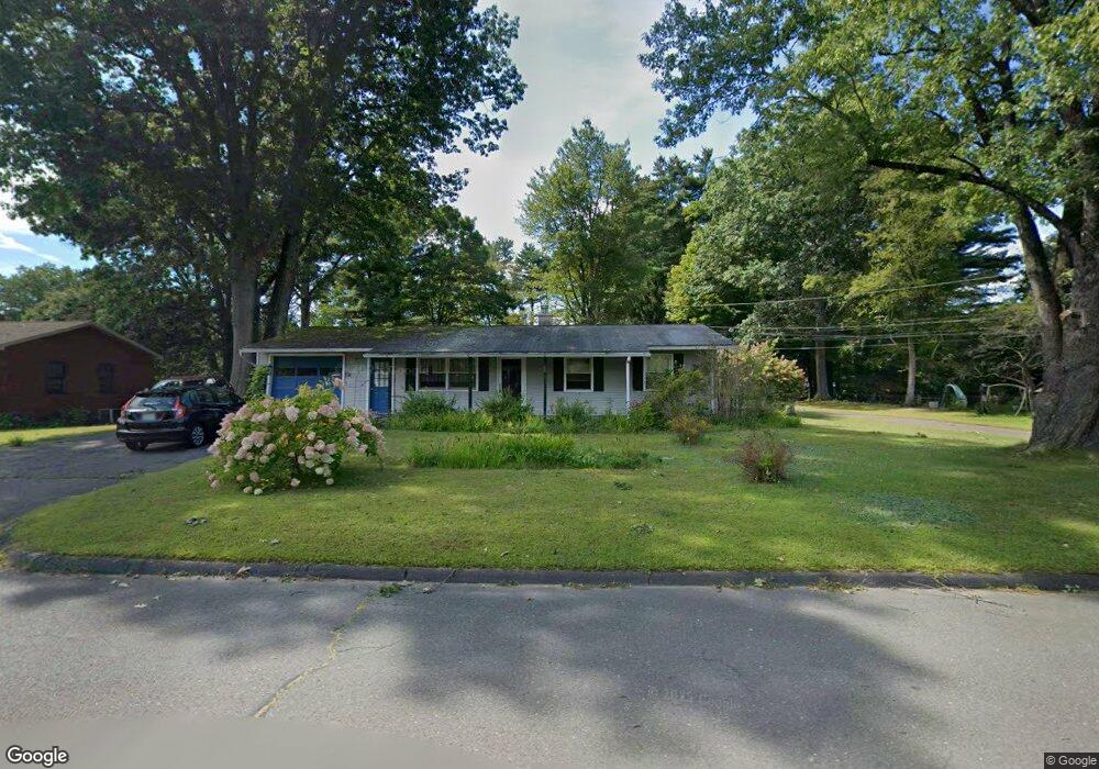
29 Odonnell Dr Florence, MA 01062
Florence NeighborhoodEstimated Value: $379,000 - $401,000
3
Beds
1
Bath
1,275
Sq Ft
$306/Sq Ft
Est. Value
About This Home
This home is located at 29 Odonnell Dr, Florence, MA 01062 and is currently estimated at $390,708, approximately $306 per square foot. 29 Odonnell Dr is a home located in Hampshire County with nearby schools including Northampton High School, Hilltown Cooperative Charter Public School, and Lander Grinspoon Academy.
Create a Home Valuation Report for This Property
The Home Valuation Report is an in-depth analysis detailing your home's value as well as a comparison with similar homes in the area
Home Values in the Area
Average Home Value in this Area
Tax History
| Year | Tax Paid | Tax Assessment Tax Assessment Total Assessment is a certain percentage of the fair market value that is determined by local assessors to be the total taxable value of land and additions on the property. | Land | Improvement |
|---|---|---|---|---|
| 2025 | $4,948 | $355,200 | $143,400 | $211,800 |
| 2024 | $4,946 | $325,600 | $137,200 | $188,400 |
| 2023 | $4,350 | $274,600 | $124,300 | $150,300 |
| 2022 | $4,294 | $240,000 | $117,000 | $123,000 |
| 2021 | $3,851 | $221,700 | $112,000 | $109,700 |
| 2020 | $3,725 | $221,700 | $112,000 | $109,700 |
| 2019 | $3,516 | $202,400 | $96,900 | $105,500 |
| 2018 | $3,437 | $201,700 | $96,900 | $104,800 |
| 2017 | $3,366 | $201,700 | $96,900 | $104,800 |
| 2016 | $3,259 | $201,700 | $96,900 | $104,800 |
| 2015 | $3,010 | $190,500 | $96,900 | $93,600 |
| 2014 | $2,932 | $190,500 | $96,900 | $93,600 |
Source: Public Records
Map
Nearby Homes
- 723 Lot B Ryan Rd
- 815 Burts Pit Rd
- 296 Ryan Rd Unit A
- 296 Ryan Rd
- 296 Ryan Rd Unit B
- 72 Emerson Way
- 0 W Farms Rd
- 892 Westhampton Rd
- 404 Sylvester Rd
- 42 Clark St
- 635 Florence Rd
- 589 Florence Rd
- 20-11 Sylvester Rd
- 967 Florence Rd
- 98 Park Hill Rd
- 296 Old Wilson Rd
- 41 Landy Ave
- 37 Landy Ave
- 33 Landy Ave
- 22 Lilly St
Your Personal Tour Guide
Ask me questions while you tour the home.