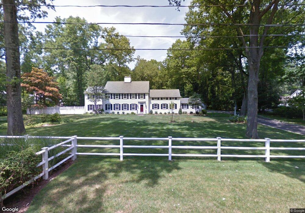
29 Point o Woods Rd Darien, CT 06820
Estimated Value: $3,976,000 - $4,552,000
5
Beds
6
Baths
4,603
Sq Ft
$915/Sq Ft
Est. Value
About This Home
This home is located at 29 Point o Woods Rd, Darien, CT 06820 and is currently estimated at $4,210,182, approximately $914 per square foot. 29 Point o Woods Rd is a home located in Fairfield County with nearby schools including Ox Ridge Elementary School, Middlesex Middle School, and Darien High School.
Ownership History
Date
Name
Owned For
Owner Type
Purchase Details
Closed on
May 13, 2008
Sold by
Parker Robert and Parker Julia R
Bought by
Cippoletti Michael and Cippoletti Jennifer
Current Estimated Value
Purchase Details
Closed on
Jul 1, 1994
Sold by
Pitts Tilghman and Pitts Margaret
Bought by
Parker Robert and Parker Julia
Purchase Details
Closed on
Aug 23, 1993
Sold by
Upton Harry and Upton Peggy
Bought by
Pitts Tilghman G and Pitts Margaret
Create a Home Valuation Report for This Property
The Home Valuation Report is an in-depth analysis detailing your home's value as well as a comparison with similar homes in the area
Home Values in the Area
Average Home Value in this Area
Purchase History
| Date | Buyer | Sale Price | Title Company |
|---|---|---|---|
| Cippoletti Michael | $2,800,000 | -- | |
| Parker Robert | $899,000 | -- | |
| Pitts Tilghman G | $830,000 | -- |
Source: Public Records
Mortgage History
| Date | Status | Borrower | Loan Amount |
|---|---|---|---|
| Open | Pitts Tilghman G | $1,760,000 | |
| Closed | Pitts Tilghman G | $890,000 |
Source: Public Records
Tax History Compared to Growth
Tax History
| Year | Tax Paid | Tax Assessment Tax Assessment Total Assessment is a certain percentage of the fair market value that is determined by local assessors to be the total taxable value of land and additions on the property. | Land | Improvement |
|---|---|---|---|---|
| 2025 | $39,677 | $2,563,120 | $1,032,850 | $1,530,270 |
| 2024 | $37,652 | $2,563,120 | $1,032,850 | $1,530,270 |
| 2023 | $34,866 | $1,979,880 | $737,730 | $1,242,150 |
| 2022 | $34,113 | $1,979,880 | $737,730 | $1,242,150 |
| 2021 | $33,341 | $1,979,880 | $737,730 | $1,242,150 |
| 2020 | $32,391 | $1,979,880 | $737,730 | $1,242,150 |
| 2019 | $32,609 | $1,979,880 | $737,730 | $1,242,150 |
| 2018 | $10,287 | $2,004,730 | $714,770 | $1,289,960 |
| 2017 | $24,605 | $1,522,570 | $714,770 | $807,800 |
| 2016 | $24,011 | $1,522,570 | $714,770 | $807,800 |
| 2015 | $23,371 | $1,522,570 | $714,770 | $807,800 |
| 2014 | $22,854 | $1,522,570 | $714,770 | $807,800 |
Source: Public Records
Map
Nearby Homes
- 97 Richards Ave Unit B10
- 97 Richards Ave Unit E12
- 105 Richards Ave Unit 2305
- 5 Wakeman Rd
- 7 Morehouse Ln
- 10 Pine Brook Ln
- 17 Pine Brook Ln Unit 17
- 29 Priscilla Rd
- 175 W Norwalk Rd
- 10 Prospect Ave
- 13 Joemar Rd
- 7 Tommys Ln
- 6 Orlando Rd
- 93 Mansfield Ave
- 8 Sedgewick Village Ln
- 19 Littlebrook Rd
- 19 Woodchuck Ct
- 20 Marianne Rd
- 9 Hollow Spring Rd
- 39 Chatham Dr
- 20 Maywood Rd
- 31 Point o Woods Rd
- 2 Maywood Rd
- 30 Point o Woods Rd
- 26 Point o Woods Rd
- 4 Dellwood Rd
- 25 Point o Woods Rd
- 37 Point o Woods Rd
- 8 Dellwood Rd
- 17 Maywood Rd
- 24 Point o Woods Rd
- 23 Richmond Dr
- 21 Richmond Dr
- 34 Point o Woods Rd
- 17 Point o Woods Rd
- 19 Richmond Dr
- 25 Richmond Dr
- 12 Dellwood Rd
- 9 Dellwood Rd
- 20 Point o Woods Rd