Estimated Value: $236,000 - $271,000
3
Beds
2
Baths
1,814
Sq Ft
$141/Sq Ft
Est. Value
About This Home
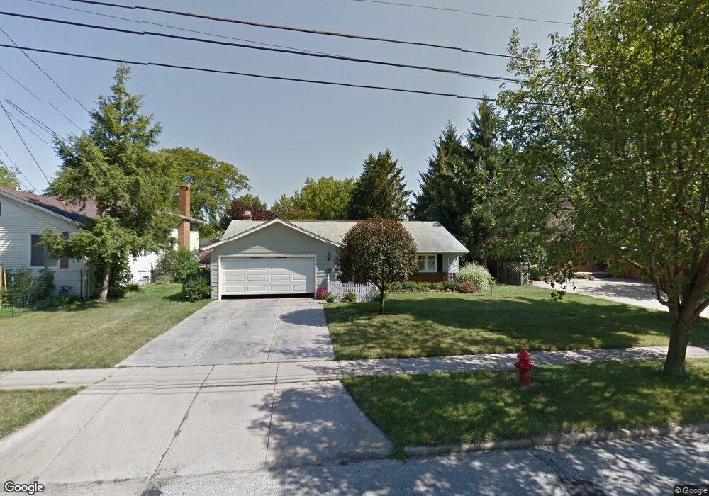
This home is located at 290 Kraft St, Berea, OH 44017 and is currently estimated at $255,969, approximately $141 per square foot. 290 Kraft St is a home located in Cuyahoga County with nearby schools including Grindstone Elementary School, Berea-Midpark Middle School, and Berea-Midpark High School.
Ownership History
Date
Name
Owned For
Owner Type
Purchase Details
Closed on
Jun 22, 2022
Sold by
Bresson Christopher E and Craine Ruth
Bought by
Bresson Michael A
Current Estimated Value
Purchase Details
Closed on
Jun 1, 1990
Sold by
Gallaher Viva P
Bought by
Bresson John J
Purchase Details
Closed on
Jun 30, 1989
Sold by
Gallaher Paul C
Bought by
Gallaher Viva P
Purchase Details
Closed on
Jan 3, 1984
Sold by
Kelly Juliann
Bought by
Gallaher Paul C
Purchase Details
Closed on
Jul 12, 1983
Sold by
Kelly Bernard V and Kelly Juliann M
Bought by
Kelly Juliann
Purchase Details
Closed on
Jan 1, 1975
Bought by
Kelly Bernard and Kelly Juliann M
Create a Home Valuation Report for This Property
The Home Valuation Report is an in-depth analysis detailing your home's value as well as a comparison with similar homes in the area
Home Values in the Area
Average Home Value in this Area
Purchase History
| Date | Buyer | Sale Price | Title Company |
|---|---|---|---|
| Bresson Michael A | -- | Neal M Jamison Co Lpa | |
| Bresson John J | $92,000 | -- | |
| Gallaher Viva P | -- | -- | |
| Gallaher Paul C | $74,500 | -- | |
| Kelly Juliann | -- | -- | |
| Kelly Bernard | -- | -- |
Source: Public Records
Tax History
| Year | Tax Paid | Tax Assessment Tax Assessment Total Assessment is a certain percentage of the fair market value that is determined by local assessors to be the total taxable value of land and additions on the property. | Land | Improvement |
|---|---|---|---|---|
| 2025 | $4,391 | $75,810 | $11,515 | $64,295 |
| 2024 | $4,390 | $75,810 | $11,515 | $64,295 |
| 2023 | $4,128 | $59,780 | $10,360 | $49,420 |
| 2022 | $3,515 | $59,780 | $10,360 | $49,420 |
| 2021 | $3,484 | $59,780 | $10,360 | $49,420 |
| 2020 | $3,230 | $50,680 | $8,790 | $41,900 |
| 2019 | $3,144 | $144,800 | $25,100 | $119,700 |
| 2018 | $3,084 | $50,680 | $8,790 | $41,900 |
| 2017 | $3,259 | $49,320 | $7,740 | $41,580 |
| 2016 | $3,235 | $49,320 | $7,740 | $41,580 |
| 2015 | $3,058 | $49,320 | $7,740 | $41,580 |
| 2014 | $3,058 | $49,320 | $7,740 | $41,580 |
Source: Public Records
Map
Nearby Homes
- 160 Marian Ln Unit 6A
- 146 Marian Ln
- 169 Kempton Dr
- 143 Baker St
- 380 Adrian Dr
- 211 W Bridge St
- 347 Beeler Dr
- 333 Parkway Dr
- 516 Fair St
- 57 Riverside Dr
- 132 Stonefield Dr
- 147 Stone Ridge Way
- 487 Karen Dr
- 49 Monroe St
- 23002 Chandlers Ln
- 23002 Chandlers Ln Unit 221
- 8783 Roberts Ct Unit 22A
- 487 Bridle Ln
- 23003 Chandlers Ln Unit 224
- 23155 Wainwright Terrace
Your Personal Tour Guide
Ask me questions while you tour the home.