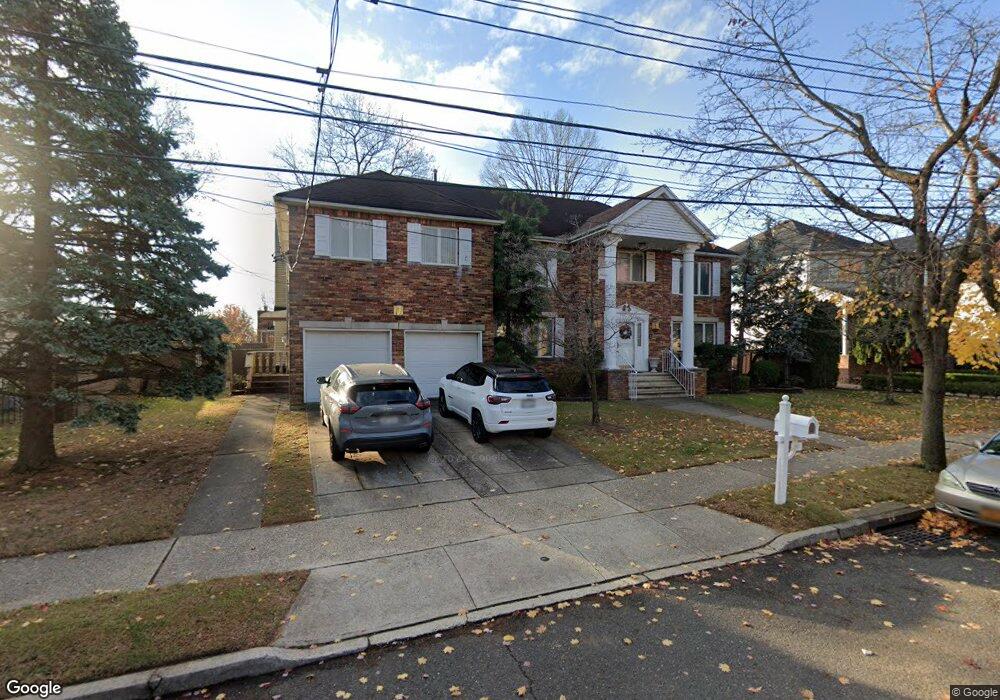
290 McBaine Ave Staten Island, NY 10309
Rossville NeighborhoodEstimated Value: $1,498,000 - $1,731,000
6
Beds
4
Baths
4,100
Sq Ft
$392/Sq Ft
Est. Value
About This Home
This home is located at 290 McBaine Ave, Staten Island, NY 10309 and is currently estimated at $1,606,064, approximately $391 per square foot. 290 McBaine Ave is a home located in Richmond County with nearby schools including P.S. 56 - The Louis Desario School, Is 34 Tottenville, and Tottenville High School.
Ownership History
Date
Name
Owned For
Owner Type
Purchase Details
Closed on
Feb 17, 2000
Sold by
Ippolito Michael
Bought by
Napoli Anthony and Napoli Lucille V
Current Estimated Value
Home Financials for this Owner
Home Financials are based on the most recent Mortgage that was taken out on this home.
Original Mortgage
$300,000
Interest Rate
8.23%
Create a Home Valuation Report for This Property
The Home Valuation Report is an in-depth analysis detailing your home's value as well as a comparison with similar homes in the area
Home Values in the Area
Average Home Value in this Area
Purchase History
| Date | Buyer | Sale Price | Title Company |
|---|---|---|---|
| Napoli Anthony | $499,000 | -- |
Source: Public Records
Mortgage History
| Date | Status | Borrower | Loan Amount |
|---|---|---|---|
| Previous Owner | Napoli Anthony | $300,000 |
Source: Public Records
Tax History Compared to Growth
Tax History
| Year | Tax Paid | Tax Assessment Tax Assessment Total Assessment is a certain percentage of the fair market value that is determined by local assessors to be the total taxable value of land and additions on the property. | Land | Improvement |
|---|---|---|---|---|
| 2025 | $14,168 | $80,400 | $22,820 | $57,580 |
| 2024 | $14,180 | $71,940 | $26,671 | $45,269 |
| 2023 | $14,995 | $75,235 | $21,427 | $53,808 |
| 2022 | $13,882 | $85,260 | $24,060 | $61,200 |
| 2021 | $13,789 | $88,020 | $24,060 | $63,960 |
| 2020 | $13,877 | $79,080 | $24,060 | $55,020 |
| 2019 | $13,609 | $79,080 | $24,060 | $55,020 |
| 2018 | $12,483 | $62,696 | $23,387 | $39,309 |
| 2017 | $11,758 | $59,148 | $22,828 | $36,320 |
| 2016 | $10,845 | $55,800 | $23,211 | $32,589 |
| 2015 | $10,323 | $55,800 | $17,886 | $37,914 |
| 2014 | $10,323 | $55,381 | $17,752 | $37,629 |
Source: Public Records
Map
Nearby Homes
- 300 McBaine Ave
- 280 McBaine Ave
- 309 Kramer Ave
- 323 Kramer Ave
- 310 McBaine Ave
- 289 McBaine Ave
- 299 McBaine Ave
- 279 McBaine Ave
- 270 McBaine Ave
- 284 Winant Ave
- 289 Kramer Ave
- 309 McBaine Ave
- 333 Kramer Ave
- 310 Kramer Ave
- 320 Kramer Ave
- 294 Mason Blvd
- 308 Winant Ave
- 302 Mason Blvd
- 330 Kramer Ave
- 284 Mason Blvd