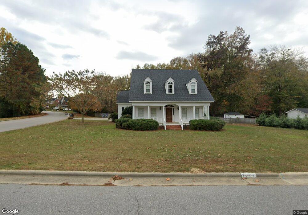
2900 Brassfield Dr Rocky Mount, NC 27803
Estimated Value: $324,908 - $385,000
4
Beds
3
Baths
1,869
Sq Ft
$183/Sq Ft
Est. Value
About This Home
This home is located at 2900 Brassfield Dr, Rocky Mount, NC 27803 and is currently estimated at $342,227, approximately $183 per square foot. 2900 Brassfield Dr is a home located in Nash County with nearby schools including Williford Elementary School, Winstead Avenue Elementary School, and G.R. Edwards Middle School.
Ownership History
Date
Name
Owned For
Owner Type
Purchase Details
Closed on
Jul 30, 2021
Sold by
Rose Michael Scott and Rose Mary Hadley
Bought by
Anderson Dylan Wayne and Anderson Holly Nichole
Current Estimated Value
Home Financials for this Owner
Home Financials are based on the most recent Mortgage that was taken out on this home.
Original Mortgage
$250,260
Outstanding Balance
$227,072
Interest Rate
2.9%
Mortgage Type
New Conventional
Estimated Equity
$115,155
Purchase Details
Closed on
May 28, 1999
Bought by
Rose M Scott Mary Hadley W
Create a Home Valuation Report for This Property
The Home Valuation Report is an in-depth analysis detailing your home's value as well as a comparison with similar homes in the area
Home Values in the Area
Average Home Value in this Area
Purchase History
| Date | Buyer | Sale Price | Title Company |
|---|---|---|---|
| Anderson Dylan Wayne | $258,000 | None Available | |
| Rose M Scott Mary Hadley W | $185,000 | -- |
Source: Public Records
Mortgage History
| Date | Status | Borrower | Loan Amount |
|---|---|---|---|
| Open | Anderson Dylan Wayne | $250,260 |
Source: Public Records
Tax History Compared to Growth
Tax History
| Year | Tax Paid | Tax Assessment Tax Assessment Total Assessment is a certain percentage of the fair market value that is determined by local assessors to be the total taxable value of land and additions on the property. | Land | Improvement |
|---|---|---|---|---|
| 2025 | $2,123 | $336,990 | $74,390 | $262,600 |
| 2024 | $2,123 | $201,460 | $74,390 | $127,070 |
| 2023 | $1,350 | $201,460 | $0 | $0 |
| 2022 | $1,380 | $201,460 | $74,390 | $127,070 |
| 2021 | $1,350 | $201,460 | $74,390 | $127,070 |
| 2020 | $1,350 | $201,460 | $74,390 | $127,070 |
| 2019 | $1,350 | $201,460 | $74,390 | $127,070 |
| 2018 | $1,350 | $201,460 | $0 | $0 |
| 2017 | $1,350 | $201,460 | $0 | $0 |
| 2015 | $1,466 | $218,867 | $0 | $0 |
| 2014 | $1,466 | $218,867 | $0 | $0 |
Source: Public Records
Map
Nearby Homes
- 5025 Netherwood Rd
- 3904 Crosswinds Dr
- 4037 Brassfield Dr
- 616 Chad St
- 3905 Crosswinds Dr
- 5013 Brassfield Dr
- 108 Chelsea Ct
- 600 Nichole Ln
- 113 Edinborough Ct
- 4204 Carybrook Rd
- 3812 Gloucester Rd
- 1921 Bethlehem Rd
- 3545 Chelsea Dr
- 108 Buckingham Ct
- 1012 Turnstone Dr
- 512 Drexel Rd
- 106 Jennings Ct
- 132 Rockfall Way
- 0 Off of Bethlehem Rd Unit LotWP001
- 3801 Hawthorne Rd
- 2904 Brassfield Dr
- 2208 Joelene Dr
- 3000 Brassfield Dr
- 1216 Michael Scott Dr
- 1217 Michael Scott Dr
- 1217 Michael Scott Dr
- 105 Charleston Ct
- 3004 Brassfield Dr
- 1308 Michael Scott Dr
- 2204 Joelene Dr
- 2205 Joelene Dr
- 1212 Michael Scott Dr
- 109 Charleston Ct
- 1312 Michael Scott Dr
- 3008 Brassfield Dr
- 1213 Michael Scott Dr
- 108 Charleston Ct
- 104 Charleston Ct
- 5053 Netherwood Rd
- 2201 Joelene Dr