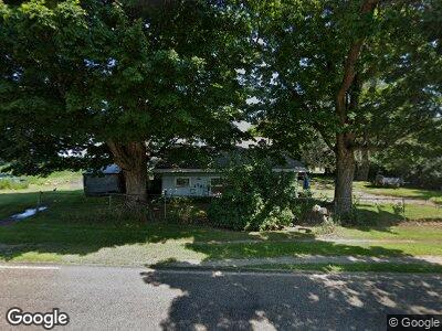
29017 S Dr N Springport, MI 49284
Marshall/Albion NeighborhoodEstimated Value: $130,000 - $203,000
4
Beds
1
Bath
1,670
Sq Ft
$102/Sq Ft
Est. Value
About This Home
This home is located at 29017 S Dr N, Springport, MI 49284 and is currently estimated at $170,889, approximately $102 per square foot. 29017 S Dr N is a home located in Calhoun County with nearby schools including Springport Elementary School, Springport Middle School, and Springport High School.
Ownership History
Date
Name
Owned For
Owner Type
Purchase Details
Closed on
Jan 19, 2007
Sold by
Piepkow Ronald B
Bought by
Wells Fargo Bank Na
Current Estimated Value
Create a Home Valuation Report for This Property
The Home Valuation Report is an in-depth analysis detailing your home's value as well as a comparison with similar homes in the area
Home Values in the Area
Average Home Value in this Area
Purchase History
| Date | Buyer | Sale Price | Title Company |
|---|---|---|---|
| Wells Fargo Bank Na | $111,399 | None Available |
Source: Public Records
Mortgage History
| Date | Status | Borrower | Loan Amount |
|---|---|---|---|
| Open | Piepkow Ronald B | $25,000 | |
| Previous Owner | Piepkow Ronald B | $107,600 | |
| Previous Owner | Piepkow Ronald B | $26,900 |
Source: Public Records
Tax History Compared to Growth
Tax History
| Year | Tax Paid | Tax Assessment Tax Assessment Total Assessment is a certain percentage of the fair market value that is determined by local assessors to be the total taxable value of land and additions on the property. | Land | Improvement |
|---|---|---|---|---|
| 2024 | $274 | $74,300 | $0 | $0 |
| 2023 | $700 | $66,800 | $0 | $0 |
| 2022 | $700 | $58,400 | $0 | $0 |
| 2021 | $635 | $47,200 | $0 | $0 |
| 2020 | $635 | $46,600 | $0 | $0 |
| 2019 | $0 | $41,300 | $0 | $0 |
| 2018 | $0 | $36,700 | $6,800 | $29,900 |
| 2017 | $0 | $33,500 | $0 | $0 |
| 2016 | $0 | $31,200 | $0 | $0 |
| 2015 | -- | $31,900 | $11,790 | $20,110 |
| 2014 | -- | $27,600 | $11,790 | $15,810 |
Source: Public Records
Map
Nearby Homes
- 22120 29 1 2 Mile Rd
- 0 R-Drive N
- 19874 27 1 2 Mile Rd
- 2401 Country Club Way
- 3261 Country Club Way
- 309 Grand St
- 0 Green St
- 00000 M-Drive N
- 231 Bay Port Cir Unit 68
- 268 Bay Port Cir Unit 23
- 219 Bay Port Cir Unit 71
- 4643 Anderson Rd
- 14310 Town Rd
- 0 Vl McClure Rd - Wolf Hwy Unit 24051186
- 2503 Butterfield Hwy
- 12555 Eaton Rapids Rd
- 24246 V Dr N
- 22624 24 Mile Rd
- 4327 E Bellevue Hwy
- 16445 29 Mile Rd
- 29017 S Dr N
- 29150 S Dr N
- 28538 S Dr N
- 29255 S Dr N
- 29255 S Dr N Unit S DR N
- 21110 29 Mile Rd
- 21110 29 1/2 Mile Rd
- 29510 S Dr N
- 28358 S Dr N
- 21098 29 1/2 Mile Rd
- 20977 29 1/2 Mile Rd
- 20963 29 1/2 Mile Rd
- 20963 29 1 2 Mile Rd
- 0 29 1 2 Mile Rd Unit 186193
- 0 29 1 2 Mile Rd Unit 15434
- 0 29 1 2 Mile Rd Unit 22217
- 0 29 1 2 Mile Rd Unit 22217
- 0 29 1 2 Mile Rd Unit 186193
- 0 29 1 2 Mile Rd Unit 168098
- 21180 29 1/2 Mile Rd