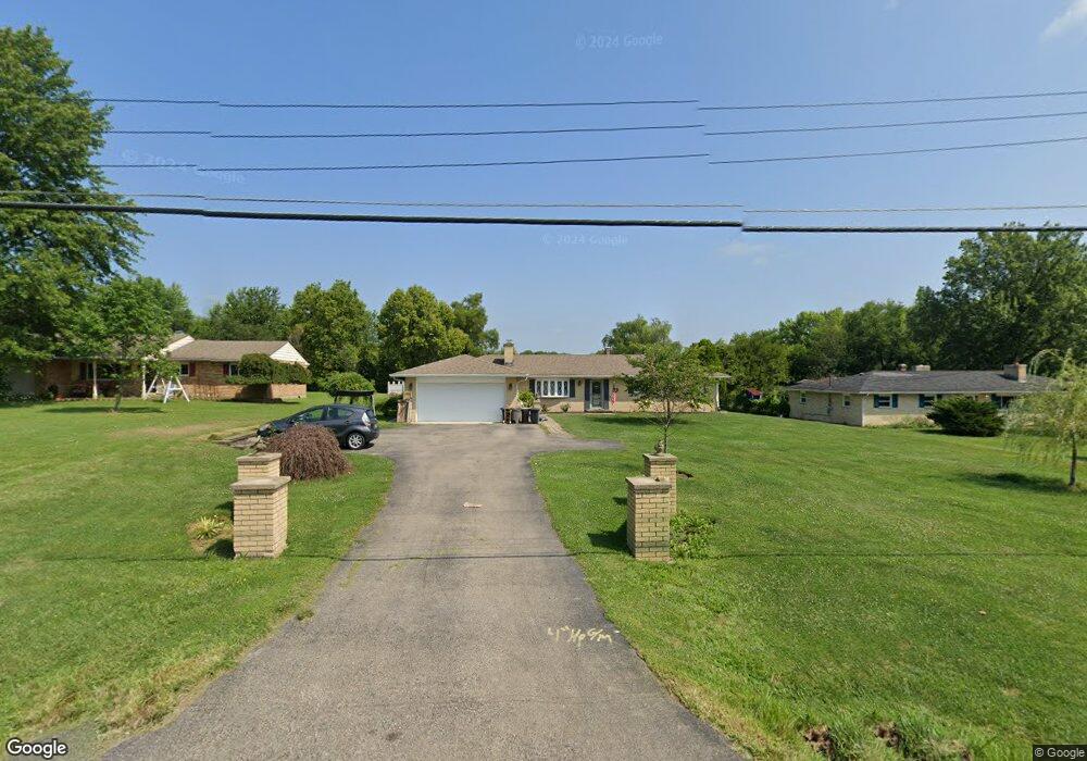
2902 State Route 122 Franklin, OH 45005
Estimated Value: $308,000 - $555,000
3
Beds
3
Baths
1,716
Sq Ft
$223/Sq Ft
Est. Value
About This Home
This home is located at 2902 State Route 122, Franklin, OH 45005 and is currently estimated at $382,121, approximately $222 per square foot. 2902 State Route 122 is a home located in Warren County with nearby schools including Clearcreek Elementary School, Dennis Elementary School, and Springboro Intermediate School.
Ownership History
Date
Name
Owned For
Owner Type
Purchase Details
Closed on
Nov 23, 2015
Sold by
Anderson Lois J
Bought by
Anderson Lois J and Lynn Anderson Judy
Current Estimated Value
Purchase Details
Closed on
Jul 1, 1997
Sold by
Hall Bobby D
Bought by
Anderson Lois T
Home Financials for this Owner
Home Financials are based on the most recent Mortgage that was taken out on this home.
Original Mortgage
$85,750
Interest Rate
8%
Mortgage Type
New Conventional
Purchase Details
Closed on
Aug 14, 1995
Sold by
Banks Gerald W
Bought by
Hall Bobby D and Hall Paula L
Home Financials for this Owner
Home Financials are based on the most recent Mortgage that was taken out on this home.
Original Mortgage
$90,900
Interest Rate
7.51%
Mortgage Type
New Conventional
Purchase Details
Closed on
Nov 27, 1979
Sold by
Dent Dent and Dent Jerry C
Purchase Details
Closed on
Nov 17, 1978
Sold by
Dent Dent and Dent Janet C
Create a Home Valuation Report for This Property
The Home Valuation Report is an in-depth analysis detailing your home's value as well as a comparison with similar homes in the area
Home Values in the Area
Average Home Value in this Area
Purchase History
| Date | Buyer | Sale Price | Title Company |
|---|---|---|---|
| Anderson Lois J | -- | Attorney | |
| Anderson Lois T | $122,500 | -- | |
| Hall Bobby D | $116,900 | -- | |
| -- | $52,000 | -- | |
| -- | -- | -- |
Source: Public Records
Mortgage History
| Date | Status | Borrower | Loan Amount |
|---|---|---|---|
| Closed | Anderson Lois T | $85,750 | |
| Previous Owner | Hall Bobby D | $90,900 |
Source: Public Records
Tax History Compared to Growth
Tax History
| Year | Tax Paid | Tax Assessment Tax Assessment Total Assessment is a certain percentage of the fair market value that is determined by local assessors to be the total taxable value of land and additions on the property. | Land | Improvement |
|---|---|---|---|---|
| 2024 | $3,059 | $84,620 | $23,100 | $61,520 |
| 2023 | $2,606 | $67,921 | $12,915 | $55,006 |
| 2022 | $2,618 | $67,921 | $12,915 | $55,006 |
| 2021 | $2,446 | $67,921 | $12,915 | $55,006 |
| 2020 | $2,204 | $55,220 | $10,500 | $44,720 |
| 2019 | $2,043 | $55,220 | $10,500 | $44,720 |
| 2018 | $2,043 | $55,220 | $10,500 | $44,720 |
| 2017 | $1,983 | $49,333 | $9,632 | $39,701 |
| 2016 | $2,063 | $49,333 | $9,632 | $39,701 |
| 2015 | $2,058 | $49,333 | $9,632 | $39,701 |
| 2014 | $1,915 | $44,440 | $8,680 | $35,770 |
| 2013 | $1,914 | $53,780 | $10,500 | $43,280 |
Source: Public Records
Map
Nearby Homes
- 2866 Ohio 122
- 2866 State Route 122
- 2958 St Rt 122
- 2958 State Route 122
- 3085 Ohio 122
- 3095 Canvasback Ct
- 3071 Canvasback Ct
- 3077 Canvasback Ct
- 3089 Canvasback Ct
- 3083 Canvasback Ct
- 3098 Canvasback Ct
- 3086 Canvasback Ct
- 3074 Canvasback Ct
- 3092 Canvasback Ct
- 3080 Canvasback Ct
- Chattanooga Plan at Trails of Greycliff
- Somerset Plan at Trails of Greycliff
- Miramar Plan at Trails of Greycliff
- Carlisle Plan at Trails of Greycliff
- Birmingham Plan at Trails of Greycliff
- 2880 State Route 122
- 2922 State Route 122
- 2940 State Route 122
- 2825 Ohio 122
- 2850 State Route 122
- 2974 State Route 122
- 2974 St Rt 122
- 2832 State Route 122
- 2994 State Route 122
- 2961 State Route 122
- 2806 State Route 122
- 3084 Ohio 122
- 3084 Ohio 122 Unit 12
- 3012 State Route 122
- 2690 State Route 122
- 2985 State Route 122
- 2790 State Route 122
- 2871 State Route 122
- 2925 State Route 122
- 2790 W St Rt 122