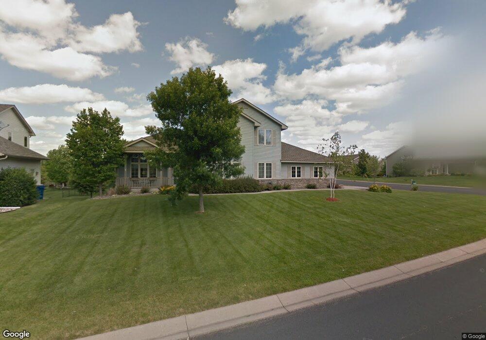
2903 Clary Ct Shakopee, MN 55379
Estimated Value: $511,000 - $556,000
5
Beds
4
Baths
2,268
Sq Ft
$237/Sq Ft
Est. Value
About This Home
This home is located at 2903 Clary Ct, Shakopee, MN 55379 and is currently estimated at $536,999, approximately $236 per square foot. 2903 Clary Ct is a home located in Scott County with nearby schools including Jackson Elementary School, East Middle School, and Shakopee Senior High School.
Ownership History
Date
Name
Owned For
Owner Type
Purchase Details
Closed on
Jul 28, 2017
Sold by
Piper Michael R and Piper Jessica L
Bought by
Mcginn Matthew J and Mcginn Krystal A
Current Estimated Value
Home Financials for this Owner
Home Financials are based on the most recent Mortgage that was taken out on this home.
Original Mortgage
$304,000
Interest Rate
3.93%
Mortgage Type
New Conventional
Purchase Details
Closed on
Mar 29, 2007
Sold by
Jewett Lori B
Bought by
Peper Michael R and Peper Jessica L
Purchase Details
Closed on
Jul 17, 2003
Sold by
Knoblauch Builders L L C
Bought by
Jewett Lori B
Create a Home Valuation Report for This Property
The Home Valuation Report is an in-depth analysis detailing your home's value as well as a comparison with similar homes in the area
Home Values in the Area
Average Home Value in this Area
Purchase History
| Date | Buyer | Sale Price | Title Company |
|---|---|---|---|
| Mcginn Matthew J | $394,000 | Edina Realty Title Inc | |
| Peper Michael R | $369,900 | -- | |
| Jewett Lori B | $325,000 | -- |
Source: Public Records
Mortgage History
| Date | Status | Borrower | Loan Amount |
|---|---|---|---|
| Previous Owner | Mcginn Matthew J | $304,000 |
Source: Public Records
Tax History Compared to Growth
Tax History
| Year | Tax Paid | Tax Assessment Tax Assessment Total Assessment is a certain percentage of the fair market value that is determined by local assessors to be the total taxable value of land and additions on the property. | Land | Improvement |
|---|---|---|---|---|
| 2025 | $4,876 | $487,300 | $143,300 | $344,000 |
| 2024 | $4,806 | $466,100 | $139,400 | $326,700 |
| 2023 | $5,050 | $448,600 | $134,000 | $314,600 |
| 2022 | $4,866 | $462,900 | $152,300 | $310,600 |
| 2021 | $4,116 | $383,900 | $121,700 | $262,200 |
| 2020 | $4,510 | $356,500 | $116,700 | $239,800 |
| 2019 | $4,800 | $343,500 | $103,700 | $239,800 |
| 2018 | $4,438 | $0 | $0 | $0 |
| 2016 | $4,158 | $0 | $0 | $0 |
| 2014 | -- | $0 | $0 | $0 |
Source: Public Records
Map
Nearby Homes
- 2777 Pampas Ct
- 2960 Molina St
- 1895 Omega Dr
- 2113 Sandhill Dr
- 2518 Green Ash Ave
- 2529 Green Ash Ave
- Berkley Plan at Arbor Bluff - Venture Collection
- 2551 Aspen Ct
- Clark Plan at Arbor Bluff - Venture Collection
- 2548 Aspen Ct
- Itasca Plan at Arbor Bluff - Landmark Collection
- Sequoia Plan at Arbor Bluff - Venture Collection
- Markham Plan at Arbor Bluff - Venture Collection
- 2340 Rock Elm Rd
- Lewis Plan at Arbor Bluff - Landmark Collection
- McKinley Plan at Arbor Bluff - Landmark Collection
- 2584 Aspen Ct
- 2606 Green Ash Ave
- Marquette Plan at Arbor Bluff - Venture Collection
- 2689 Aspen Dr