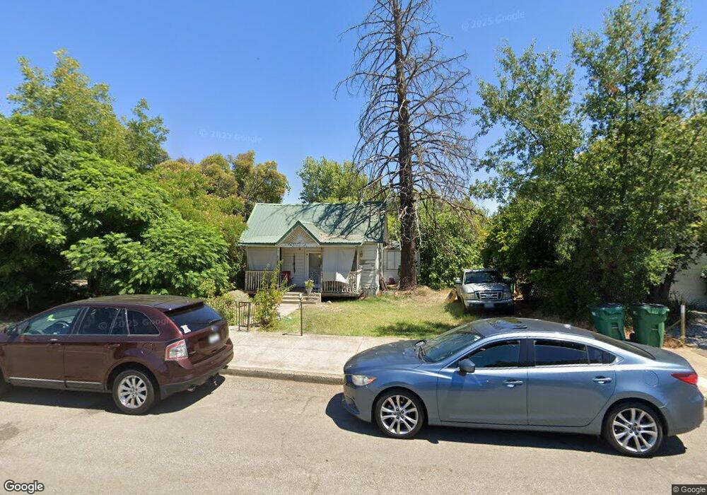
2905 East St Anderson, CA 96007
Riverside Avenue NeighborhoodEstimated Value: $177,000 - $200,023
2
Beds
1
Bath
860
Sq Ft
$220/Sq Ft
Est. Value
About This Home
This home is located at 2905 East St, Anderson, CA 96007 and is currently estimated at $189,256, approximately $220 per square foot. 2905 East St is a home located in Shasta County with nearby schools including Meadow Lane Elementary School, Anderson Heights Elementary School, and Anderson Middle School.
Ownership History
Date
Name
Owned For
Owner Type
Purchase Details
Closed on
Feb 5, 2009
Sold by
Hackland Robert Allen
Bought by
Stelle Mary Carolyn
Current Estimated Value
Home Financials for this Owner
Home Financials are based on the most recent Mortgage that was taken out on this home.
Original Mortgage
$50,000
Outstanding Balance
$31,504
Interest Rate
5.04%
Mortgage Type
Seller Take Back
Estimated Equity
$157,752
Create a Home Valuation Report for This Property
The Home Valuation Report is an in-depth analysis detailing your home's value as well as a comparison with similar homes in the area
Home Values in the Area
Average Home Value in this Area
Purchase History
| Date | Buyer | Sale Price | Title Company |
|---|---|---|---|
| Stelle Mary Carolyn | $75,000 | First American Title Company |
Source: Public Records
Mortgage History
| Date | Status | Borrower | Loan Amount |
|---|---|---|---|
| Open | Stelle Mary Carolyn | $50,000 |
Source: Public Records
Tax History Compared to Growth
Tax History
| Year | Tax Paid | Tax Assessment Tax Assessment Total Assessment is a certain percentage of the fair market value that is determined by local assessors to be the total taxable value of land and additions on the property. | Land | Improvement |
|---|---|---|---|---|
| 2025 | $1,361 | $96,564 | $45,062 | $51,502 |
| 2024 | $1,786 | $94,672 | $44,179 | $50,493 |
| 2023 | $1,786 | $92,816 | $43,313 | $49,503 |
| 2022 | $1,416 | $90,997 | $42,464 | $48,533 |
| 2021 | $1,398 | $89,214 | $41,632 | $47,582 |
| 2020 | $1,395 | $88,301 | $41,206 | $47,095 |
| 2019 | $1,586 | $86,571 | $40,399 | $46,172 |
| 2018 | $1,220 | $84,874 | $39,607 | $45,267 |
| 2017 | $1,214 | $83,211 | $38,831 | $44,380 |
| 2016 | $1,150 | $81,580 | $38,070 | $43,510 |
| 2015 | $1,183 | $80,356 | $37,499 | $42,857 |
| 2014 | $1,110 | $78,783 | $36,765 | $42,018 |
Source: Public Records
Map
Nearby Homes
- 2325 North St
- 0000 Frontier Trail
- 2904 Silver St
- 3065 Silver St
- 2648 Tremonto Rd
- 1715 School St
- 3394 Josh Dr
- 2616 W Hillside Dr
- 2576 W Hillside Dr
- 1745 Diamond St
- 2345 Shenandoah Dr
- 3473 Nathan Dr
- 3509 Humbug Dr
- 2867 Pinto Ln
- 3244 Sharon Ave
- 3502 Humbug Dr
- 3504 Humbug Dr
- 3508 Humbug Dr
- 3150 Franklin St
- 3520 Humbug Dr