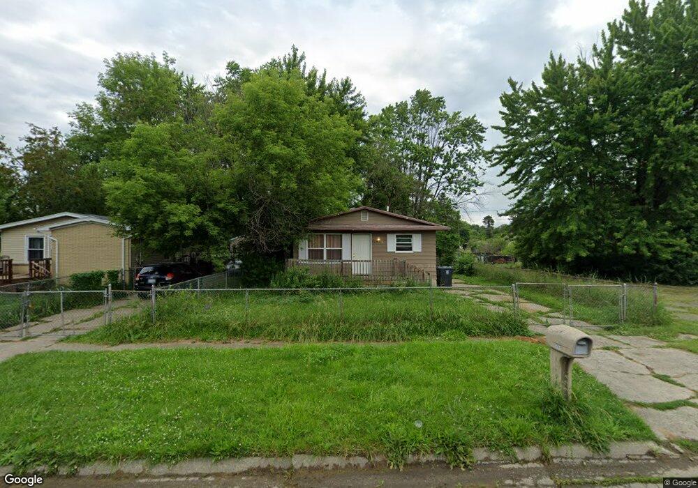
2907 Maryland Ave Unit Bldg-Unit Flint, MI 48506
Potter Longway NeighborhoodEstimated Value: $26,000 - $67,000
3
Beds
1
Bath
870
Sq Ft
$60/Sq Ft
Est. Value
About This Home
This home is located at 2907 Maryland Ave Unit Bldg-Unit, Flint, MI 48506 and is currently estimated at $52,404, approximately $60 per square foot. 2907 Maryland Ave Unit Bldg-Unit is a home located in Genesee County with nearby schools including Potter School, Richfield Public School Academy, and Richfield Early Learning Center.
Ownership History
Date
Name
Owned For
Owner Type
Purchase Details
Closed on
Dec 28, 2017
Sold by
The Secreotry Of Housing And Urban Devel
Bought by
Nationwide Property Partners Inc
Current Estimated Value
Purchase Details
Closed on
May 18, 2017
Sold by
Caliber Home Loans Inc
Bought by
The Secretary Of Housing And Urban Devel
Purchase Details
Closed on
Mar 15, 2017
Sold by
Yost Matthew S and Yost Sarah L
Bought by
Caliber Home Loans Inc
Purchase Details
Closed on
Nov 22, 2004
Sold by
Michaelou Michael A and Michaelou Olivia
Bought by
Yost Matthew S and Yost Sarah L
Create a Home Valuation Report for This Property
The Home Valuation Report is an in-depth analysis detailing your home's value as well as a comparison with similar homes in the area
Home Values in the Area
Average Home Value in this Area
Purchase History
| Date | Buyer | Sale Price | Title Company |
|---|---|---|---|
| Nationwide Property Partners Inc | -- | Title Partners Llc | |
| The Secretary Of Housing And Urban Devel | -- | None Available | |
| Caliber Home Loans Inc | $9,375 | None Available | |
| Yost Matthew S | $55,500 | Metropolitan Title Company |
Source: Public Records
Tax History Compared to Growth
Tax History
| Year | Tax Paid | Tax Assessment Tax Assessment Total Assessment is a certain percentage of the fair market value that is determined by local assessors to be the total taxable value of land and additions on the property. | Land | Improvement |
|---|---|---|---|---|
| 2025 | $1,048 | $23,800 | $0 | $0 |
| 2024 | $973 | $22,200 | $0 | $0 |
| 2023 | $953 | $16,800 | $0 | $0 |
| 2022 | $0 | $13,200 | $0 | $0 |
| 2021 | $965 | $12,500 | $0 | $0 |
| 2020 | $890 | $10,600 | $0 | $0 |
| 2019 | $871 | $10,800 | $0 | $0 |
| 2018 | $857 | $9,100 | $0 | $0 |
| 2017 | $626 | $0 | $0 | $0 |
| 2016 | $623 | $0 | $0 | $0 |
| 2015 | -- | $0 | $0 | $0 |
| 2014 | -- | $0 | $0 | $0 |
| 2012 | -- | $10,800 | $0 | $0 |
Source: Public Records
Map
Nearby Homes
- 2719 Branch Rd
- 3116 Beechwood Ave
- 3010 Wyoming Ave
- 3214 Maryland Ave
- 2426 Hoff St
- 3149 Whittier Ave
- 2211 Torrance St
- 3702 Branch Rd
- 3226 Mcclure Ave
- 3710 Branch Rd
- 3205 Holly Ave
- 2506 Arlington Ave
- 3602 Dakota Ave
- 3232 Dale Ave
- 3514 Whittier Ave
- 2225 Arlington Ave
- 2935 Richfield Rd
- 3713 Risedorph Ave
- 4127 Coggins Ave
- 3401 Davison Rd
- 2907 Maryland Ave
- 2901 Maryland Ave
- 2915 Maryland Ave
- 2918 Dakota Ave
- 2922 Dakota Ave
- 2919 Maryland Ave
- 2910 Dakota Ave
- 2934 Dakota Ave
- 2906 Maryland Ave
- 3002 Dakota Ave
- 2902 Dakota Ave
- 3005 Maryland Ave
- 3002 Maryland Ave
- 3006 Dakota Ave
- 3009 Maryland Ave
- 3006 Maryland Ave
- 2925 Dakota Ave
- 3010 Dakota Ave
- 2921 Dakota Ave
- 2929 Dakota Ave