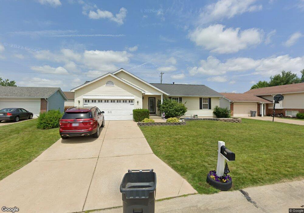
2909 White Stable Dr O Fallon, MO 63368
Estimated Value: $320,000 - $376,000
3
Beds
3
Baths
1,372
Sq Ft
$253/Sq Ft
Est. Value
About This Home
This home is located at 2909 White Stable Dr, O Fallon, MO 63368 and is currently estimated at $346,876, approximately $252 per square foot. 2909 White Stable Dr is a home located in St. Charles County with nearby schools including Pheasant Point Elementary School, Fort Zumwalt South Middle School, and Fort Zumwalt South High School.
Ownership History
Date
Name
Owned For
Owner Type
Purchase Details
Closed on
Jan 15, 2009
Sold by
Remick Edward D and Remick Tonya M
Bought by
Pryor Torey D and Pryor Katherine B
Current Estimated Value
Home Financials for this Owner
Home Financials are based on the most recent Mortgage that was taken out on this home.
Original Mortgage
$167,785
Outstanding Balance
$106,947
Interest Rate
5.42%
Mortgage Type
FHA
Estimated Equity
$239,929
Purchase Details
Closed on
Jul 8, 2003
Sold by
Remick Edward D and Remick Tonya M
Bought by
Remick Edward D and Remick Tonya M
Home Financials for this Owner
Home Financials are based on the most recent Mortgage that was taken out on this home.
Original Mortgage
$116,500
Interest Rate
5.19%
Mortgage Type
Purchase Money Mortgage
Create a Home Valuation Report for This Property
The Home Valuation Report is an in-depth analysis detailing your home's value as well as a comparison with similar homes in the area
Home Values in the Area
Average Home Value in this Area
Purchase History
| Date | Buyer | Sale Price | Title Company |
|---|---|---|---|
| Pryor Torey D | $170,000 | Ust | |
| Remick Edward D | -- | Nations Title Agency Inc |
Source: Public Records
Mortgage History
| Date | Status | Borrower | Loan Amount |
|---|---|---|---|
| Open | Pryor Torey D | $167,785 | |
| Previous Owner | Remick Edward D | $116,500 |
Source: Public Records
Tax History
| Year | Tax Paid | Tax Assessment Tax Assessment Total Assessment is a certain percentage of the fair market value that is determined by local assessors to be the total taxable value of land and additions on the property. | Land | Improvement |
|---|---|---|---|---|
| 2025 | $3,573 | $61,958 | -- | -- |
| 2023 | $3,577 | $54,222 | -- | -- |
| 2022 | $3,054 | $43,105 | $0 | $0 |
| 2021 | $3,061 | $43,105 | $0 | $0 |
| 2020 | $3,002 | $40,678 | $0 | $0 |
| 2019 | $3,009 | $40,678 | $0 | $0 |
| 2018 | $2,849 | $36,842 | $0 | $0 |
| 2017 | $2,804 | $36,842 | $0 | $0 |
| 2016 | $2,638 | $33,299 | $0 | $0 |
| 2015 | $2,459 | $33,299 | $0 | $0 |
| 2014 | $2,085 | $27,833 | $0 | $0 |
Source: Public Records
Map
Nearby Homes
- 249 Dardenne Farms Dr
- 26 Dalton Valley Dr
- 178 Christina Marie Dr
- 661 Clifton Hill Dr
- 67 Simeon Ct
- 93 Arapahoe Basin Ct
- 3 Royallbend Ct
- 2628 Breckenridge Cir
- 367 Shamrock St
- 361 Shamrock St
- 2726 Brook Meadow Ln
- 14 Sea Pines Ct
- 1319 Commons Cir
- 1313 Commons Cir
- 83 Foxgate Ct
- 2136 Farnsworth Dr Unit D
- 211 Butternut Stage Dr
- 44 Pheasant Ring Dr
- 10 Muir Trail Ct
- 6025 Mo-N Unit # 1
- 2913 White Stable Dr
- 2905 White Stable Dr
- 1054 Golden Orchard Dr
- 1056 Golden Orchard Dr
- 1052 Golden Orchard Dr
- 2917 White Stable Dr
- 3 White Stable Ct
- 2901 White Stable Dr
- 1050 Golden Orchard Dr
- 1058 Golden Orchard Dr
- 2902 White Stable Dr
- 2921 White Stable Dr
- 2 White Stable Ct
- 5 White Stable Ct
- 1048 Golden Orchard Dr
- 2909 Wheatfield Farms Dr
- 2925 White Stable Dr
- 1053 Golden Orchard Dr
- 1055 Golden Orchard Dr
- 1051 Golden Orchard Dr
Your Personal Tour Guide
Ask me questions while you tour the home.