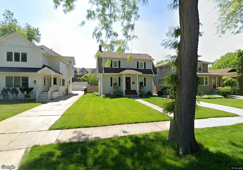
291 Herrick Rd Riverside, IL 60546
Estimated Value: $421,000 - $539,000
3
Beds
2
Baths
1,570
Sq Ft
$307/Sq Ft
Est. Value
About This Home
This home is located at 291 Herrick Rd, Riverside, IL 60546 and is currently estimated at $481,825, approximately $306 per square foot. 291 Herrick Rd is a home located in Cook County with nearby schools including Central Elementary School, L J Hauser Jr High School, and Riverside Brookfield High School.
Ownership History
Date
Name
Owned For
Owner Type
Purchase Details
Closed on
Jun 21, 2021
Sold by
Michka Joan Ann
Bought by
Minchuk John A and Minchuk Ciara V
Current Estimated Value
Home Financials for this Owner
Home Financials are based on the most recent Mortgage that was taken out on this home.
Original Mortgage
$248,000
Outstanding Balance
$223,864
Interest Rate
3.12%
Mortgage Type
New Conventional
Estimated Equity
$257,961
Purchase Details
Closed on
May 23, 1997
Sold by
Michka Walter Max
Bought by
Michka Joan Ann
Home Financials for this Owner
Home Financials are based on the most recent Mortgage that was taken out on this home.
Original Mortgage
$95,000
Interest Rate
8.27%
Create a Home Valuation Report for This Property
The Home Valuation Report is an in-depth analysis detailing your home's value as well as a comparison with similar homes in the area
Home Values in the Area
Average Home Value in this Area
Purchase History
| Date | Buyer | Sale Price | Title Company |
|---|---|---|---|
| Minchuk John A | $310,000 | Chicago Title | |
| Michka Joan Ann | -- | -- |
Source: Public Records
Mortgage History
| Date | Status | Borrower | Loan Amount |
|---|---|---|---|
| Open | Minchuk John A | $248,000 | |
| Previous Owner | Michka Joan Ann | $95,000 |
Source: Public Records
Tax History
| Year | Tax Paid | Tax Assessment Tax Assessment Total Assessment is a certain percentage of the fair market value that is determined by local assessors to be the total taxable value of land and additions on the property. | Land | Improvement |
|---|---|---|---|---|
| 2025 | $12,376 | $39,907 | $8,350 | $31,557 |
| 2024 | $12,376 | $42,000 | $8,350 | $33,650 |
| 2023 | $10,827 | $42,000 | $8,350 | $33,650 |
| 2022 | $10,827 | $31,689 | $7,306 | $24,383 |
| 2021 | $10,437 | $31,688 | $7,306 | $24,382 |
| 2020 | $12,460 | $38,104 | $7,306 | $30,798 |
| 2019 | $10,881 | $34,346 | $6,680 | $27,666 |
| 2018 | $10,560 | $34,346 | $6,680 | $27,666 |
| 2017 | $10,237 | $34,346 | $6,680 | $27,666 |
| 2016 | $11,021 | $33,793 | $5,845 | $27,948 |
| 2015 | $10,726 | $33,793 | $5,845 | $27,948 |
| 2014 | $10,560 | $33,793 | $5,845 | $27,948 |
| 2013 | $10,440 | $36,094 | $5,845 | $30,249 |
Source: Public Records
Map
Nearby Homes
- 269 Shenstone Rd
- 369 Addison Rd
- 280 Blackhawk Rd
- 475 Shenstone Rd Unit 104
- 475 Shenstone Rd Unit 304
- 475 Shenstone Rd Unit 303
- 484 Shenstone Rd
- 176 Riverside Rd
- 303 Lionel Rd
- 262 Lionel Rd
- 7048 35th St
- 10 E Burlington St Unit 2C
- 10 E Burlington St Unit 2B
- 231 Bartram Rd
- 478 Kent Rd
- 3111 Wenonah Ave
- 7336 39th St
- 7330 39th St
- 3548 Clinton Ave
- 78 Pine Ave
- 295 Herrick Rd
- 287 Herrick Rd
- 299 Herrick Rd
- 285 Herrick Rd
- 21 N Herbert Rd
- 21 N Herbert Rd
- 21 N Herbert Rd Unit C
- 21 N Herbert Rd Unit F
- 21 N Herbert Rd Unit G
- 21 N Herbert Rd Unit I
- 248 E Burlington St Unit 248
- 246 E Burlington St
- 242 E Burlington St Unit 242
- 240 E Burlington St Unit 240-250
- 240 E Burlington St Unit 240
- 303 Herrick Rd
- 234 E Burlington St Unit 234
- 307 Herrick Rd
- 230 E Burlington St Unit 230
- 244 E Burlington St Unit 244
Your Personal Tour Guide
Ask me questions while you tour the home.