Estimated Value: $340,000 - $362,000
4
Beds
2
Baths
1,381
Sq Ft
$256/Sq Ft
Est. Value
About This Home
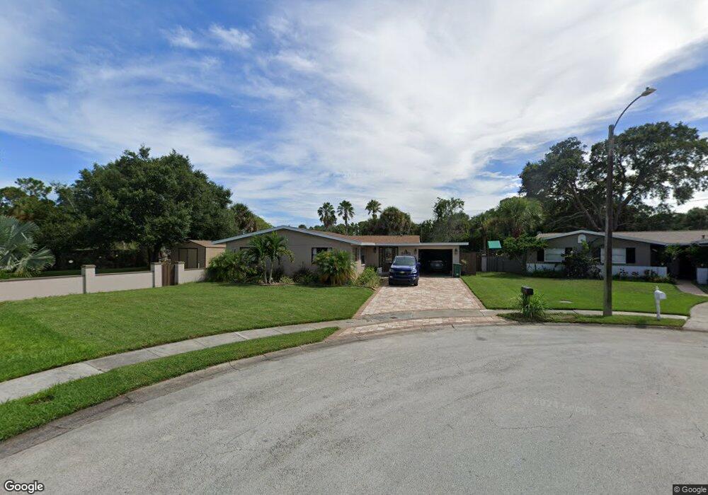
This home is located at 2910 Colchester Rd, Cocoa, FL 32926 and is currently estimated at $354,156, approximately $256 per square foot. 2910 Colchester Rd is a home located in Brevard County with nearby schools including Cocoa High School, Saturn Elementary School, and Space Coast Christian Academy.
Ownership History
Date
Name
Owned For
Owner Type
Purchase Details
Closed on
Jul 2, 2019
Sold by
Fl In Properties Llc
Bought by
Altman Jonathan M and Altman Lisa M
Current Estimated Value
Home Financials for this Owner
Home Financials are based on the most recent Mortgage that was taken out on this home.
Original Mortgage
$199,750
Outstanding Balance
$175,641
Interest Rate
4%
Mortgage Type
New Conventional
Estimated Equity
$178,515
Purchase Details
Closed on
Apr 4, 2018
Sold by
Farmfr Laura A and Mooniy Laura A
Bought by
Fl In Properties Llc
Purchase Details
Closed on
Feb 15, 1994
Sold by
Mooney Laura A and Farmer Laura A
Bought by
Farmer Laura A and Farmer Douglas Joel
Create a Home Valuation Report for This Property
The Home Valuation Report is an in-depth analysis detailing your home's value as well as a comparison with similar homes in the area
Home Values in the Area
Average Home Value in this Area
Purchase History
| Date | Buyer | Sale Price | Title Company |
|---|---|---|---|
| Altman Jonathan M | $235,000 | Supreme Title Closings Llc | |
| Fl In Properties Llc | $92,600 | None Available | |
| Farmer Laura A | -- | -- |
Source: Public Records
Mortgage History
| Date | Status | Borrower | Loan Amount |
|---|---|---|---|
| Open | Altman Jonathan M | $199,750 |
Source: Public Records
Tax History Compared to Growth
Tax History
| Year | Tax Paid | Tax Assessment Tax Assessment Total Assessment is a certain percentage of the fair market value that is determined by local assessors to be the total taxable value of land and additions on the property. | Land | Improvement |
|---|---|---|---|---|
| 2025 | $3,341 | $206,240 | -- | -- |
| 2024 | $3,263 | $200,430 | -- | -- |
| 2023 | $3,263 | $194,600 | $0 | $0 |
| 2022 | $2,976 | $188,940 | $0 | $0 |
| 2021 | $2,977 | $183,440 | $0 | $0 |
| 2020 | $2,794 | $175,230 | $68,000 | $107,230 |
| 2019 | $3,497 | $172,310 | $68,000 | $104,310 |
| 2018 | $2,911 | $157,990 | $59,500 | $98,490 |
| 2017 | $2,682 | $134,750 | $46,750 | $88,000 |
| 2016 | $2,517 | $121,140 | $34,000 | $87,140 |
| 2015 | $2,359 | $105,830 | $34,000 | $71,830 |
| 2014 | $2,106 | $96,210 | $25,500 | $70,710 |
Source: Public Records
Map
Nearby Homes
- 2713 Winchester Dr
- 3004 Winchester Dr
- 3303 Echo Ridge Place
- 3120 Winchester Dr
- 3116 Winchester Dr
- 2211 Longbow Rd
- 3104 Winchester Dr
- 3311 Craggy Bluff Place
- 3424 Lost Canyon Place
- 3485 Lost Canyon Place
- 2101 Lance Blvd
- 3728 W Malory Ct
- 3733 Crossbow Dr
- 3835 Dutchess Place
- 00 N Unknown
- 0000 Unknown
- 00000 Unknown
- 2111 Otterbein Ave
- 3816 Parapet Dr
- 2575 Cox Rd
- 2911 Colchester Rd
- 2918 Colchester Rd
- 2915 Colchester Rd
- 2922 Colchester Rd
- 2919 Colchester Rd
- 2926 Colchester Rd
- 2923 Colchester Rd
- 2927 Colchester Rd
- 0000 No St
- 2930 Colchester Rd
- 2948 Denham Rd
- 2825 Dunhill Dr
- 2821 Dunhill Dr
- 2829 Dunhill Dr
- 2952 Denham Rd
- 2831 Dunhill Dr
- 2819 Dunhill Dr
- 2817 Dunhill Dr
- 2956 Denham Rd
- 2944 Denham Rd