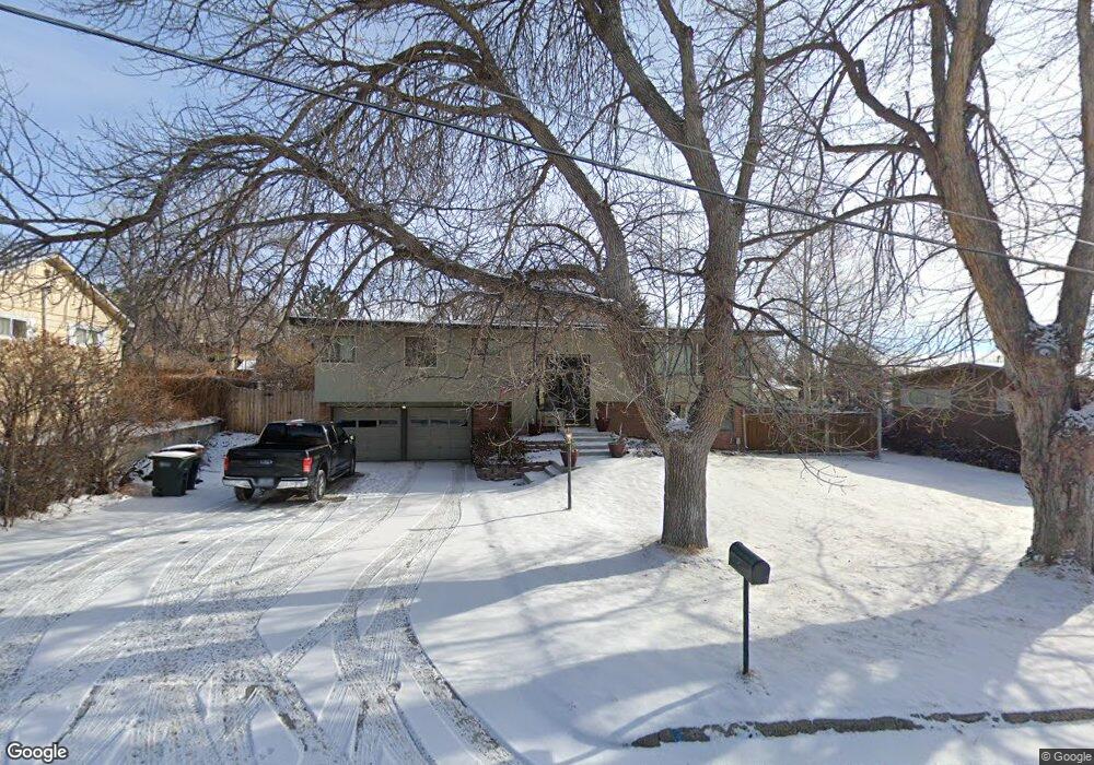
2911 Placer Dr Billings, MT 59102
North Central Billings NeighborhoodEstimated Value: $426,000 - $455,000
3
Beds
3
Baths
2,535
Sq Ft
$174/Sq Ft
Est. Value
About This Home
This home is located at 2911 Placer Dr, Billings, MT 59102 and is currently estimated at $440,339, approximately $173 per square foot. 2911 Placer Dr is a home located in Yellowstone County with nearby schools including Rose Park School, Lewis & Clark Junior High School, and Billings Senior High School.
Ownership History
Date
Name
Owned For
Owner Type
Purchase Details
Closed on
Dec 1, 2021
Sold by
Undes Bekir and Fageratrom Ashley R
Bought by
Thompson Shane D and Thompson Viviane C
Current Estimated Value
Home Financials for this Owner
Home Financials are based on the most recent Mortgage that was taken out on this home.
Original Mortgage
$353,479
Outstanding Balance
$325,021
Interest Rate
3.09%
Mortgage Type
FHA
Estimated Equity
$115,318
Purchase Details
Closed on
Nov 17, 2011
Sold by
Helmer Warren H and Helmer Tana M
Bought by
Undes Bekir and Fagerstrom Ashley R
Home Financials for this Owner
Home Financials are based on the most recent Mortgage that was taken out on this home.
Original Mortgage
$241,225
Interest Rate
3.75%
Mortgage Type
FHA
Create a Home Valuation Report for This Property
The Home Valuation Report is an in-depth analysis detailing your home's value as well as a comparison with similar homes in the area
Home Values in the Area
Average Home Value in this Area
Purchase History
| Date | Buyer | Sale Price | Title Company |
|---|---|---|---|
| Thompson Shane D | -- | First Montana Title Co | |
| Undes Bekir | -- | St |
Source: Public Records
Mortgage History
| Date | Status | Borrower | Loan Amount |
|---|---|---|---|
| Open | Thompson Shane D | $353,479 | |
| Previous Owner | Undes Bekir | $241,225 |
Source: Public Records
Tax History Compared to Growth
Tax History
| Year | Tax Paid | Tax Assessment Tax Assessment Total Assessment is a certain percentage of the fair market value that is determined by local assessors to be the total taxable value of land and additions on the property. | Land | Improvement |
|---|---|---|---|---|
| 2025 | $3,564 | $441,400 | $59,660 | $381,740 |
| 2024 | $3,564 | $348,700 | $56,608 | $292,092 |
| 2023 | $3,571 | $348,700 | $56,608 | $292,092 |
| 2022 | $2,727 | $288,800 | $0 | $0 |
| 2021 | $3,185 | $288,700 | $0 | $0 |
| 2020 | $3,136 | $271,300 | $0 | $0 |
| 2019 | $3,000 | $271,300 | $0 | $0 |
| 2018 | $2,865 | $252,700 | $0 | $0 |
| 2017 | $2,789 | $252,700 | $0 | $0 |
| 2016 | $2,668 | $244,000 | $0 | $0 |
| 2015 | $2,612 | $244,000 | $0 | $0 |
| 2014 | $2,366 | $116,600 | $0 | $0 |
Source: Public Records
Map
Nearby Homes
- 2910 Glacier Dr
- 1440 Granite Ave
- 1323 Granite Ave
- 1233 Yale Ave
- 1214 Linhaven Way
- 1133 Rimrock Rd
- 1400 Poly Dr Unit 4D
- 41 Heatherwood Ln
- 1117 Poly Dr
- 1030 Yale Ave
- 24 Heatherwood Ln Unit 12D
- 1028 Princeton Ave
- 6 Heatherwood Ln
- 1212 O Malley Dr
- 46 Shadow Place Unit 6B
- 1010 Poly Dr
- 2718 Terrace Dr
- 2414 Ivy Ln
- 920 Yale Ave
- 2510 Terrace Dr
- 2917 Placer Dr
- 2905 Placer Dr
- 1333 Rimrock Rd
- 2920 Smokey Ln
- 2922 Smokey Ln
- 1329 Rimrock Rd
- 1402 Cascade Ave
- 3005 Placer Dr
- 2924 Smokey Ln
- 1411 Rimrock Rd
- 1401 Cascade Ave
- 3015 Placer Dr
- 2907 Smokey Ln
- 1412 Cascade Ave
- 3006 Smokey Ln
- 0 Placer Dr
- 2915 Smokey Ln
- 1411 Cascade Ave
- 2923 Smokey Ln
- 1419 Rimrock Rd