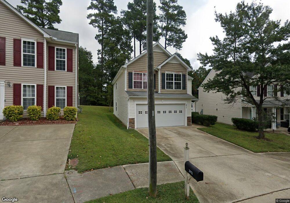
2912 Forrestal Dr Durham, NC 27703
Eastern Durham NeighborhoodEstimated Value: $327,000 - $379,831
3
Beds
3
Baths
1,672
Sq Ft
$210/Sq Ft
Est. Value
About This Home
This home is located at 2912 Forrestal Dr, Durham, NC 27703 and is currently estimated at $351,708, approximately $210 per square foot. 2912 Forrestal Dr is a home located in Durham County with nearby schools including Bethesda Elementary School, John W Neal Middle School, and Southern School of Energy & Sustainability.
Ownership History
Date
Name
Owned For
Owner Type
Purchase Details
Closed on
Jan 9, 2012
Sold by
Wells Fargo Bank National Association
Bought by
Tarpley Mike
Current Estimated Value
Home Financials for this Owner
Home Financials are based on the most recent Mortgage that was taken out on this home.
Original Mortgage
$108,100
Outstanding Balance
$74,075
Interest Rate
3.97%
Mortgage Type
New Conventional
Estimated Equity
$277,633
Purchase Details
Closed on
Aug 9, 2011
Sold by
Cannady Lee
Bought by
Wells Fargo Bank National Association
Purchase Details
Closed on
Apr 1, 2005
Sold by
Anderson Homes Inc
Bought by
Cannady Lee
Home Financials for this Owner
Home Financials are based on the most recent Mortgage that was taken out on this home.
Original Mortgage
$137,663
Interest Rate
8.25%
Mortgage Type
Fannie Mae Freddie Mac
Create a Home Valuation Report for This Property
The Home Valuation Report is an in-depth analysis detailing your home's value as well as a comparison with similar homes in the area
Home Values in the Area
Average Home Value in this Area
Purchase History
| Date | Buyer | Sale Price | Title Company |
|---|---|---|---|
| Tarpley Mike | $108,000 | None Available | |
| Wells Fargo Bank National Association | $146,000 | None Available | |
| Cannady Lee | $153,000 | -- |
Source: Public Records
Mortgage History
| Date | Status | Borrower | Loan Amount |
|---|---|---|---|
| Open | Tarpley Mike | $108,100 | |
| Previous Owner | Cannady Lee | $137,663 | |
| Closed | Cannady Lee | $7,647 |
Source: Public Records
Tax History Compared to Growth
Tax History
| Year | Tax Paid | Tax Assessment Tax Assessment Total Assessment is a certain percentage of the fair market value that is determined by local assessors to be the total taxable value of land and additions on the property. | Land | Improvement |
|---|---|---|---|---|
| 2025 | $3,586 | $361,718 | $77,000 | $284,718 |
| 2024 | $2,693 | $193,062 | $41,400 | $151,662 |
| 2023 | $2,529 | $193,062 | $41,400 | $151,662 |
| 2022 | $2,471 | $193,062 | $41,400 | $151,662 |
| 2021 | $2,459 | $193,062 | $41,400 | $151,662 |
| 2020 | $2,402 | $193,062 | $41,400 | $151,662 |
| 2019 | $2,402 | $193,062 | $41,400 | $151,662 |
| 2018 | $2,226 | $164,128 | $24,840 | $139,288 |
| 2017 | $2,210 | $164,128 | $24,840 | $139,288 |
| 2016 | $2,135 | $164,128 | $24,840 | $139,288 |
| 2015 | $2,314 | $167,176 | $19,242 | $147,934 |
| 2014 | $2,314 | $167,176 | $19,242 | $147,934 |
Source: Public Records
Map
Nearby Homes
- 3211 Ivey Wood Ln
- 1218 Kendall Dr
- 806 Kendall Dr
- 806 Lindley Dr
- 3330 Nantuckett Ave
- 3533 Gibson Rd
- 3323 Nantuckett Ave
- 335 Pleasant Dr
- 519 Pleasant Dr
- 1006 Spacious Skies Ln
- 1030 Thoughtful Spot Ln
- 2072 Tanners Mill Dr
- 1015 Sora Way
- 2934 Carolyn Dr
- 3503 Grimes Ave
- 2036 October Dr
- 613 Midway Ave
- 304 Spring St
- 428 Walton St
- 1525 S Mineral Springs Rd
- 2914 Forrestal Dr
- 2910 Forrestal Dr
- 2916 Forrestal Dr
- 3308 Oriskony Way
- 2909 Forrestal Dr
- 3306 Oriskony Way
- 3304 Oriskony Way
- 2918 Forrestal Dr
- 2911 Forrestal Dr
- 3302 Oriskony Way
- 3206 Oriskony Way
- 3310 Oriskony Way
- 2920 Forrestal Dr
- 2913 Forrestal Dr
- 3204 Oriskony Way
- 2905 Forrestal Dr
- 2922 Forrestal Dr
- 2907 Forrestal Dr
- 2901 Forrestal Dr
- 2915 Forrestal Dr