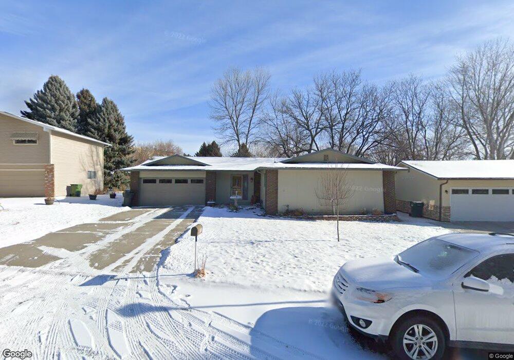
2913 Morledge St Billings, MT 59102
North Central Billings NeighborhoodEstimated Value: $350,000 - $475,000
4
Beds
3
Baths
1,304
Sq Ft
$313/Sq Ft
Est. Value
About This Home
This home is located at 2913 Morledge St, Billings, MT 59102 and is currently estimated at $408,800, approximately $313 per square foot. 2913 Morledge St is a home located in Yellowstone County with nearby schools including Rose Park School, Lewis & Clark Junior High School, and Billings Senior High School.
Ownership History
Date
Name
Owned For
Owner Type
Purchase Details
Closed on
Jun 10, 2014
Sold by
Zygmond Living Trust and Zygmond Marilyn E
Bought by
Swanson Lynette M
Current Estimated Value
Home Financials for this Owner
Home Financials are based on the most recent Mortgage that was taken out on this home.
Original Mortgage
$179,200
Outstanding Balance
$136,662
Interest Rate
4.27%
Mortgage Type
New Conventional
Estimated Equity
$272,138
Create a Home Valuation Report for This Property
The Home Valuation Report is an in-depth analysis detailing your home's value as well as a comparison with similar homes in the area
Home Values in the Area
Average Home Value in this Area
Purchase History
| Date | Buyer | Sale Price | Title Company |
|---|---|---|---|
| Swanson Lynette M | -- | Sterling Title | |
| Swanson Lynette M | -- | Sterling Title |
Source: Public Records
Mortgage History
| Date | Status | Borrower | Loan Amount |
|---|---|---|---|
| Open | Swanson Lynette M | $179,200 | |
| Closed | Swanson Lynette M | $179,200 |
Source: Public Records
Tax History Compared to Growth
Tax History
| Year | Tax Paid | Tax Assessment Tax Assessment Total Assessment is a certain percentage of the fair market value that is determined by local assessors to be the total taxable value of land and additions on the property. | Land | Improvement |
|---|---|---|---|---|
| 2025 | $3,530 | $388,300 | $60,882 | $327,418 |
| 2024 | $3,530 | $349,200 | $57,739 | $291,461 |
| 2023 | $3,539 | $349,200 | $57,739 | $291,461 |
| 2022 | $2,410 | $255,300 | $0 | $0 |
| 2021 | $2,826 | $255,300 | $0 | $0 |
| 2020 | $2,759 | $237,400 | $0 | $0 |
| 2019 | $2,639 | $237,400 | $0 | $0 |
| 2018 | $2,604 | $230,000 | $0 | $0 |
| 2017 | $2,533 | $230,000 | $0 | $0 |
| 2016 | $2,380 | $218,700 | $0 | $0 |
| 2015 | $2,331 | $218,700 | $0 | $0 |
| 2014 | $2,233 | $111,512 | $0 | $0 |
Source: Public Records
Map
Nearby Homes
- 2718 Terrace Dr
- 2042 Green Terrace Dr
- 2030 Rimrock Rd
- 2510 Terrace Dr
- 9 Stanford Ct
- 3226 Country Club Cir
- 2136 Green Terrace Dr
- 1833 Iris Ln
- 2206 Green Terrace Dr
- 2414 Ivy Ln
- 2618 Sunnyview Ln
- 2124 Dahlia Ln
- 2620 Woody Dr
- 1734 Mariposa Ln
- 2910 Glacier Dr
- 1944 Colton Blvd
- 1440 Granite Ave
- 2411 Granite Ave
- 3450 Masterson Cir
- 2020 Plaza Dr
- 2907 Morledge St
- 2921 Morledge St
- 3009 Morledge St
- 2918 Ramada Dr
- 2901 Morledge St
- 2908 Ramada Dr
- 2910 Morledge St
- 1925 Rimrock Rd
- 3008 Ramada Dr
- 2902 Ramada Dr
- 2902 Morledge St
- 2816 Hoover Ave
- 3014 Morledge St
- 2909 Ramada Dr
- 2812 Hoover Ave
- 2917 Ramada Dr
- 3009 Silverwood St
- 3020 Morledge St
- 2901 Ramada Dr
- 2907 Silverwood St